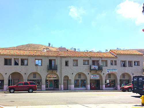
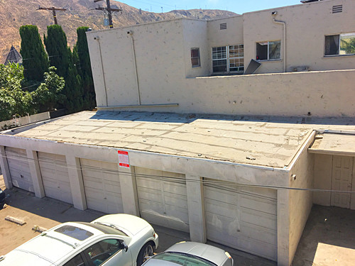
Property Record
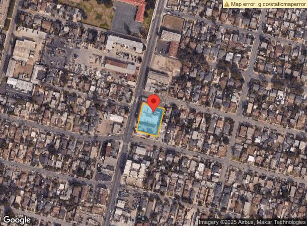
1240 N Ventura Ave, Ventura, CA 93001

NEARBY LISTINGS FOR SALE OR LEASE
Property Detail
1240 N Ventura Ave
069-0-092-205
Crumley Harkey Subdivision #1
Retailwithmorethanonenonretailuse
MAP 20 PG 12 LOT 7-12
X
Ventura
06111C0741F
California
2024
0.68 AC
2024
Ventura
002200
Los Angeles
2,753 SF
Oxnard-Thousand Oaks-Ventura, CA
DEMOGRAPHICS near 1240 N Ventura Ave
1 Mile
3 Mile
5 Mile
2024 Total Population
14,209
35,392
66,343
2029 Population
14,114
35,193
66,302
Pop Growth 2024-2029
(0.67%)
(0.56%)
(0.06%)
Average Age
37
41
42
2024 Total Households
4,833
13,811
26,071
HH Growth 2024-2029
(0.64%)
(0.49%)
(0.02%)
Median Household Inc
$65,625
$78,237
$84,452
Avg Household Size
2.80
2.40
2.40
2024 Avg HH Vehicles
2.00
2.00
2.00
Median Home Value
$573,745
$773,245
$743,691
Median Year Built
1970
1961
1966
Nearby Places
- Restaurants
- Banks
- Shops
- Fitness
- Groceries
PUBLIC TRANSPORTATION
COMMUTER RAIL
Montalvo (Ventura County Line - Southern California Regional Rail Authority (Metrolink))
DRIVE
WALK
Distance
Montalvo (Ventura County Line - Southern California Regional Rail Authority (Metrolink))
14 min
9.7 mi
SALE & LEASE HISTORY
LISTING DATE
SALE/LEASE

Sep 11, 2018
For Sale
Nearby Properties
Address
Land Use
TOTAL SIZE
Lot Size
Zoning
Address
Land Use
TOTAL SIZE
Lot Size
Zoning
4.61 AC
Address
Land Use
TOTAL SIZE
Lot Size
Zoning
4.19 AC
H
Address
Land Use
TOTAL SIZE
Lot Size
Zoning
Address
Land Use
TOTAL SIZE
Lot Size
Zoning
6.81 AC
C-T-O
Address
Land Use
TOTAL SIZE
Lot Size
Zoning
2.89 AC
C-T-O
Address
Land Use
TOTAL SIZE
Lot Size
Zoning
639.79 AC
Address
Land Use
TOTAL SIZE
Lot Size
Zoning
7,993 SF
3.71 AC
C-T-O
Address
Land Use
TOTAL SIZE
Lot Size
Zoning
7,233 SF
7.39 AC
C1
Address
Land Use
TOTAL SIZE
Lot Size
Zoning
Address
Land Use
TOTAL SIZE
Lot Size
Zoning
11,444 SF
6.57 AC
Address
Land Use
TOTAL SIZE
Lot Size
Zoning
42,655 SF
0.94 AC
Address
Land Use
TOTAL SIZE
Lot Size
Zoning
732 SF
0.51 AC
DR
Address
Land Use
TOTAL SIZE
Lot Size
Zoning
0.84 AC
Address
Land Use
TOTAL SIZE
Lot Size
Zoning
56,561 SF
14.56 AC
MPD
Address
Land Use
TOTAL SIZE
Lot Size
Zoning
57,554 SF
0.58 AC
Address
Land Use
TOTAL SIZE
Lot Size
Zoning
1,512 SF
0.79 AC
C1
Address
Land Use
TOTAL SIZE
Lot Size
Zoning
0.82 AC
POD
Address
Land Use
TOTAL SIZE
Lot Size
Zoning
43,498 SF
1.67 AC
R33
Address
Land Use
TOTAL SIZE
Lot Size
Zoning
19,709 SF
0.14 AC
DC
Address
Land Use
TOTAL SIZE
Lot Size
Zoning
19,431 SF
0.59 AC
DR
Address
Land Use
TOTAL SIZE
Lot Size
Zoning
38,456 SF
1.49 AC
R33
Address
Land Use
TOTAL SIZE
Lot Size
Zoning
1.33 AC
DC
Address
Land Use
TOTAL SIZE
Lot Size
Zoning
29,058 SF
1.18 AC
C2
Address
Land Use
TOTAL SIZE
Lot Size
Zoning
3,596 SF
1.19 AC
Address
Land Use
TOTAL SIZE
Lot Size
Zoning
29,798 SF
0.57 AC
C1
Address
Land Use
TOTAL SIZE
Lot Size
Zoning
3.60 AC
8
Address
Land Use
TOTAL SIZE
Lot Size
Zoning
1.40 AC
7
Address
Land Use
TOTAL SIZE
Lot Size
Zoning
5.10 AC
Address
Land Use
TOTAL SIZE
Lot Size
Zoning
1.54 AC
The World's #1 Commercial Real Estate Marketplace
Connect with us
© 2025 CoStar Group
The information above has been obtained from sources believed reliable. While we do not doubt its accuracy we have not verified it and make no guarantee, warranty or representation about it. It is your responsibility to independently confirm its accuracy and completeness. Any projections, opinions, assumptions, or estimates used are for example only and do not represent the current or future performance of the property. The value of this transaction to you depends on tax and other factors which should be evaluated by your tax, financial, and legal advisors. You and your advisors should conduct a careful, independent investigation of the property to determine to your satisfaction the suitability of the property for your needs.