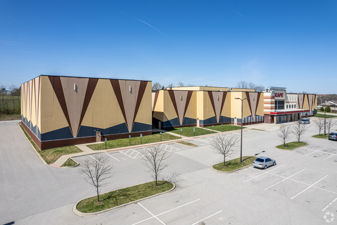
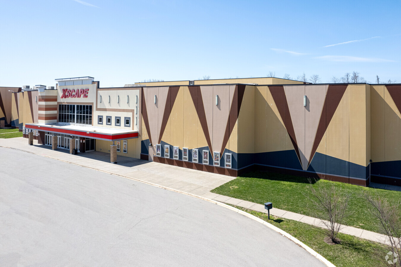
Property Record
12400 Sycamore Station Pl, Louisville, KY 40299
NEARBY LISTINGS FOR SALE OR LEASE
Property Detail
12400 Sycamore Station Pl
Louisville-Jefferson County, KY-IN
Minor Plat
003910860000
7.26 AC LOT 9 MINOR PLAT DB 10289 PG 481 NS SYCAMORE STATION PLACE
Recreationalentertainmentgeneral
Jefferson
X
Kentucky
21111C0048F
9
2024
7.26 AC
2024
Southeast
011518
Louisville
570 SF
DEMOGRAPHICS near 12400 Sycamore Station Pl
1 Mile
3 Mile
5 Mile
2024 Total Population
4,845
49,479
131,040
2029 Population
4,829
48,805
129,394
Pop Growth 2024-2029
(0.33%)
(1.36%)
(1.26%)
Average Age
43
42
42
2024 Total Households
2,209
21,353
55,667
HH Growth 2024-2029
(0.41%)
(1.41%)
(1.26%)
Median Household Inc
$75,173
$86,261
$87,096
Avg Household Size
2.20
2.30
2.30
2024 Avg HH Vehicles
2.00
2.00
2.00
Median Home Value
$305,452
$307,119
$285,040
Median Year Built
2000
1986
1986
Nearby Places
- Restaurants
- Banks
- Shops
- Fitness
- Groceries
PUBLIC TRANSPORTATION
AIRPORT
Louisville Muhammad Ali International
DRIVE
WALK
Distance
Louisville Muhammad Ali International
28 min
14.6 mi
Freight Ports
Port of Toledo
DRIVE
WALK
Distance
Port of Toledo
354 min
303.0 mi
Nearby Properties
Address
Land Use
TOTAL SIZE
Lot Size
Zoning
Address
Land Use
TOTAL SIZE
Lot Size
Zoning
115.43 AC
R4-RESIDEN
Address
Land Use
TOTAL SIZE
Lot Size
Zoning
2,776 SF
34.17 AC
R4-RESIDEN
Address
Land Use
TOTAL SIZE
Lot Size
Zoning
1,194 SF
38.74 AC
R4-RESIDEN
Address
Land Use
TOTAL SIZE
Lot Size
Zoning
1,334 SF
24.71 AC
R4-RESIDEN
Address
Land Use
TOTAL SIZE
Lot Size
Zoning
8.47 AC
R1-RESIDEN
Address
Land Use
TOTAL SIZE
Lot Size
Zoning
45.92 AC
Address
Land Use
TOTAL SIZE
Lot Size
Zoning
19.57 AC
Address
Land Use
TOTAL SIZE
Lot Size
Zoning
202,557 SF
6.06 AC
C2-COMMERC
Address
Land Use
TOTAL SIZE
Lot Size
Zoning
175,971 SF
18.54 AC
PEC-PLANNE
Address
Land Use
TOTAL SIZE
Lot Size
Zoning
18,784 SF
16.80 AC
R6-RESIDEN
Address
Land Use
TOTAL SIZE
Lot Size
Zoning
9,844 SF
15.11 AC
R6-RESIDEN
Address
Land Use
TOTAL SIZE
Lot Size
Zoning
28.91 AC
R4-RESIDEN
Address
Land Use
TOTAL SIZE
Lot Size
Zoning
31,968 SF
15.34 AC
R4-RESIDEN
Address
Land Use
TOTAL SIZE
Lot Size
Zoning
Address
Land Use
TOTAL SIZE
Lot Size
Zoning
9,560 SF
20.31 AC
C1-COMMERC
Address
Land Use
TOTAL SIZE
Lot Size
Zoning
159,847 SF
5.23 AC
PEC-PLANNE
Address
Land Use
TOTAL SIZE
Lot Size
Zoning
110,088 SF
8.69 AC
PEC-PLANNE
Address
Land Use
TOTAL SIZE
Lot Size
Zoning
30.45 AC
Address
Land Use
TOTAL SIZE
Lot Size
Zoning
19.91 AC
Address
Land Use
TOTAL SIZE
Lot Size
Zoning
17,648 SF
8.96 AC
R6-RESIDEN
Address
Land Use
TOTAL SIZE
Lot Size
Zoning
48,000 SF
29.85 AC
PEC-PLANNE
Address
Land Use
TOTAL SIZE
Lot Size
Zoning
98,442 SF
21.16 AC
C2-COMMERC
Address
Land Use
TOTAL SIZE
Lot Size
Zoning
6,846 SF
18.36 AC
R4-RESIDEN
Address
Land Use
TOTAL SIZE
Lot Size
Zoning
51,076 SF
9.77 AC
OR3-OFFICE
Address
Land Use
TOTAL SIZE
Lot Size
Zoning
103,520 SF
24.91 AC
Address
Land Use
TOTAL SIZE
Lot Size
Zoning
335,400 SF
18.84 AC
PEC-PLANNE
Address
Land Use
TOTAL SIZE
Lot Size
Zoning
16.42 AC
PEC-PLANNE
Address
Land Use
TOTAL SIZE
Lot Size
Zoning
10.72 AC
Address
Land Use
TOTAL SIZE
Lot Size
Zoning
170,236 SF
16.35 AC
C1-COMMERC
Address
Land Use
TOTAL SIZE
Lot Size
Zoning
207,825 SF
10.86 AC
PEC-PLANNE
The World's #1 Commercial Real Estate Marketplace
Connect with us
© 2025 CoStar Group
The information above has been obtained from sources believed reliable. While we do not doubt its accuracy we have not verified it and make no guarantee, warranty or representation about it. It is your responsibility to independently confirm its accuracy and completeness. Any projections, opinions, assumptions, or estimates used are for example only and do not represent the current or future performance of the property. The value of this transaction to you depends on tax and other factors which should be evaluated by your tax, financial, and legal advisors. You and your advisors should conduct a careful, independent investigation of the property to determine to your satisfaction the suitability of the property for your needs.