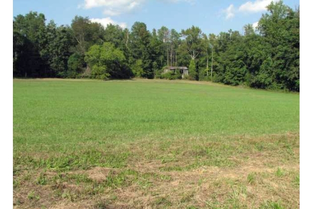
Property Record
12445 Second Branch Rd, Chesterfield, VA 23838
NEARBY LISTINGS FOR SALE OR LEASE
-
-
View all Chesterfield listings for sale on LoopNet.com
Property Detail
12445 Second Branch Rd
Richmond, VA
E Of Second Branch Rd Parcel 2
737-64-38-67-200-000
N/L RIVER ROAD PARCEL 2
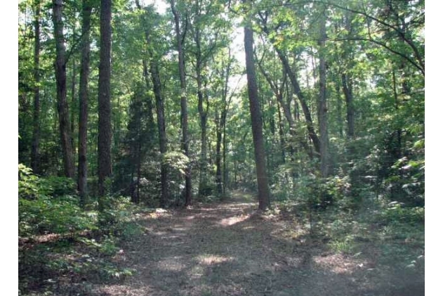
Agriculturalland
Chesterfield
X
Virginia
51041C0305E
135.85 AC
2024
Outlying Chesterfield
2024
Richmond VA
100705
DEMOGRAPHICS near 12445 Second Branch Rd
1 Mile
3 Mile
5 Mile
2024 Total Population
227
5,096
26,591
2029 Population
246
5,547
29,135
Pop Growth 2024-2029
+ 8.37%
+ 8.85%
+ 9.57%
Average Age
45
43
43
2024 Total Households
85
1,804
9,403
HH Growth 2024-2029
+ 8.24%
+ 8.92%
+ 9.65%
Median Household Inc
$72,272
$101,312
$116,298
Avg Household Size
2.60
2.80
2.80
2024 Avg HH Vehicles
3.00
3.00
3.00
Median Home Value
$344,827
$357,904
$358,965
Median Year Built
1980
1992
1997
Nearby Places
- Restaurants
- Banks
- Shops
- Fitness
- Groceries
PUBLIC TRANSPORTATION
AIRPORT
Richmond International
DRIVE
WALK
Distance
Richmond International
48 min
28.2 mi
Freight Ports
Virginia Port Authority - Richmond
DRIVE
WALK
Distance
Virginia Port Authority - Richmond
38 min
20.8 mi
Nearby Properties
Address
Land Use
TOTAL SIZE
Lot Size
Zoning
Address
Land Use
TOTAL SIZE
Lot Size
Zoning
11,484 SF
3.32 AC
A - AGRICU
Address
Land Use
TOTAL SIZE
Lot Size
Zoning
12,265 SF
4.68 AC
A - AGRICU
Address
Land Use
TOTAL SIZE
Lot Size
Zoning
584.87 AC
R88 - SING
Address
Land Use
TOTAL SIZE
Lot Size
Zoning
3,568 SF
19.62 AC
A - AGRICU
Address
Land Use
TOTAL SIZE
Lot Size
Zoning
2,751 SF
3.33 AC
A - AGRICU
Address
Land Use
TOTAL SIZE
Lot Size
Zoning
58.95 AC
A - AGRICU
Address
Land Use
TOTAL SIZE
Lot Size
Zoning
4,573 SF
20 AC
A - AGRICU
Address
Land Use
TOTAL SIZE
Lot Size
Zoning
5,696 SF
3.11 AC
A - AGRICU
Address
Land Use
TOTAL SIZE
Lot Size
Zoning
85.10 AC
A - AGRICU
Address
Land Use
TOTAL SIZE
Lot Size
Zoning
109.66 AC
R88 - SING
Address
Land Use
TOTAL SIZE
Lot Size
Zoning
64.89 AC
A - AGRICU
Address
Land Use
TOTAL SIZE
Lot Size
Zoning
193 AC
A - AGRICU
Address
Land Use
TOTAL SIZE
Lot Size
Zoning
5,984 SF
2.22 AC
A - AGRICU
Address
Land Use
TOTAL SIZE
Lot Size
Zoning
20 AC
A - AGRICU
Address
Land Use
TOTAL SIZE
Lot Size
Zoning
36.81 AC
R25 - SING
Address
Land Use
TOTAL SIZE
Lot Size
Zoning
54.92 AC
A - AGRICU
Address
Land Use
TOTAL SIZE
Lot Size
Zoning
154.58 AC
A - AGRICU
Address
Land Use
TOTAL SIZE
Lot Size
Zoning
875 SF
51.30 AC
R25 - SING
Address
Land Use
TOTAL SIZE
Lot Size
Zoning
63.10 AC
A - AGRICU
Address
Land Use
TOTAL SIZE
Lot Size
Zoning
155 AC
A - AGRICU
Address
Land Use
TOTAL SIZE
Lot Size
Zoning
676.35 AC
A - AGRICU
Address
Land Use
TOTAL SIZE
Lot Size
Zoning
675.70 AC
A - AGRICU
Address
Land Use
TOTAL SIZE
Lot Size
Zoning
53.74 AC
R25 - SING
Address
Land Use
TOTAL SIZE
Lot Size
Zoning
320 AC
A - AGRICU
Address
Land Use
TOTAL SIZE
Lot Size
Zoning
50.69 AC
A - AGRICU
Address
Land Use
TOTAL SIZE
Lot Size
Zoning
55.03 AC
A - AGRICU
Address
Land Use
TOTAL SIZE
Lot Size
Zoning
1,624 SF
4.03 AC
A - AGRICU
Address
Land Use
TOTAL SIZE
Lot Size
Zoning
0.23 AC
A - AGRICU
Address
Land Use
TOTAL SIZE
Lot Size
Zoning
46.49 AC
A - AGRICU
Address
Land Use
TOTAL SIZE
Lot Size
Zoning
3,322 SF
0.50 AC
A - AGRICU
The World's #1 Commercial Real Estate Marketplace
Connect with us
© 2025 CoStar Group
The information above has been obtained from sources believed reliable. While we do not doubt its accuracy we have not verified it and make no guarantee, warranty or representation about it. It is your responsibility to independently confirm its accuracy and completeness. Any projections, opinions, assumptions, or estimates used are for example only and do not represent the current or future performance of the property. The value of this transaction to you depends on tax and other factors which should be evaluated by your tax, financial, and legal advisors. You and your advisors should conduct a careful, independent investigation of the property to determine to your satisfaction the suitability of the property for your needs.