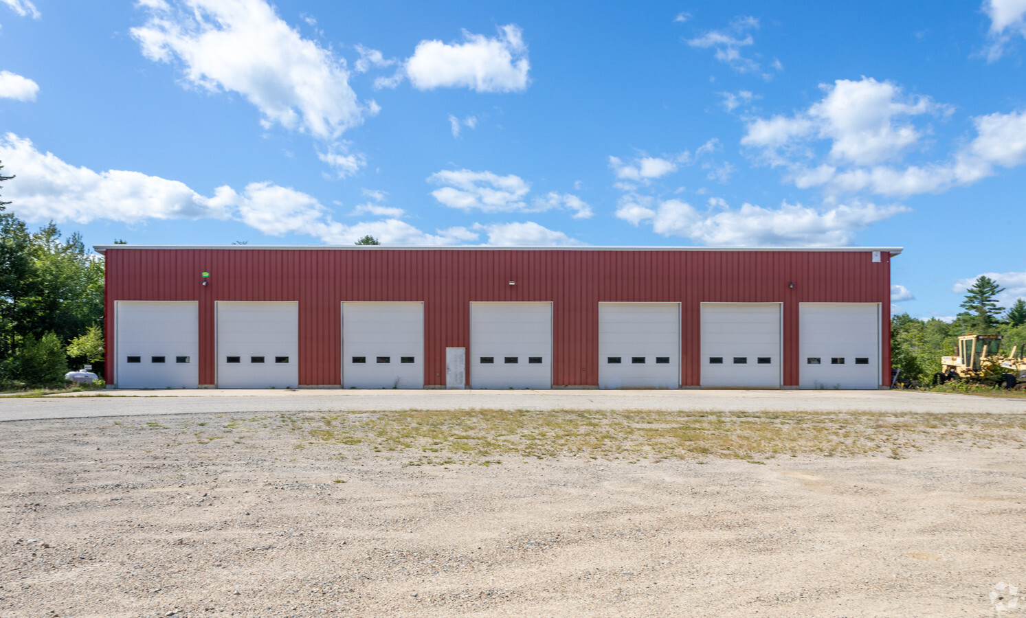
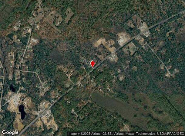
Property Record
1247 Carl Broggi Hwy, Lebanon, ME 04027
NEARBY LISTINGS FOR SALE OR LEASE
Property Detail
1247 Carl Broggi Hwy
Portland-South Portland, ME
York
LBNN-000003R-000000-000012-E000000
Maine
Commercialnec
12-e
2024
32 AC
2024
York County
031000
Portland/South Portland
DEMOGRAPHICS near 1247 Carl Broggi Hwy
1 Mile
3 Mile
5 Mile
2024 Total Population
506
4,904
20,066
2029 Population
527
5,092
20,931
Pop Growth 2024-2029
+ 4.15%
+ 3.83%
+ 4.31%
Average Age
41
41
43
2024 Total Households
189
1,909
8,234
HH Growth 2024-2029
+ 3.70%
+ 3.77%
+ 4.31%
Median Household Inc
$71,785
$72,737
$85,694
Avg Household Size
2.60
2.50
2.40
2024 Avg HH Vehicles
2.00
2.00
2.00
Median Home Value
$251,807
$246,280
$239,559
Median Year Built
1984
1982
1982
Nearby Places
- Restaurants
- Banks
- Shops
- Fitness
- Groceries
PUBLIC TRANSPORTATION
AIRPORT
Portsmouth International at Pease
DRIVE
WALK
Distance
Portsmouth International at Pease
40 min
24.6 mi
Freight Ports
Portland, ME
DRIVE
WALK
Distance
Portland, ME
60 min
44.8 mi
SALE & LEASE HISTORY
LISTING DATE
SALE/LEASE

Oct 22, 2019
For Sale
Nearby Properties
Address
Land Use
TOTAL SIZE
Lot Size
Zoning
Address
Land Use
TOTAL SIZE
Lot Size
Zoning
22.33 AC
RA
Address
Land Use
TOTAL SIZE
Lot Size
Zoning
53,517 SF
30 AC
A
Address
Land Use
TOTAL SIZE
Lot Size
Zoning
30 AC
RA
Address
Land Use
TOTAL SIZE
Lot Size
Zoning
1,968 SF
53 AC
RA
Address
Land Use
TOTAL SIZE
Lot Size
Zoning
2.60 AC
RA
Address
Land Use
TOTAL SIZE
Lot Size
Zoning
17,355 SF
2.60 AC
R2
Address
Land Use
TOTAL SIZE
Lot Size
Zoning
37,884 SF
3.49 AC
R2
Address
Land Use
TOTAL SIZE
Lot Size
Zoning
16,080 SF
6.41 AC
IND
Address
Land Use
TOTAL SIZE
Lot Size
Zoning
516 SF
23.09 AC
IND
Address
Land Use
TOTAL SIZE
Lot Size
Zoning
15.40 AC
RA
Address
Land Use
TOTAL SIZE
Lot Size
Zoning
1,668 SF
2 AC
RA
Address
Land Use
TOTAL SIZE
Lot Size
Zoning
112,089 SF
16.33 AC
IND
Address
Land Use
TOTAL SIZE
Lot Size
Zoning
2,279 SF
40 AC
RA
Address
Land Use
TOTAL SIZE
Lot Size
Zoning
4.59 AC
RA
Address
Land Use
TOTAL SIZE
Lot Size
Zoning
16 AC
RA
Address
Land Use
TOTAL SIZE
Lot Size
Zoning
6.67 AC
RA
Address
Land Use
TOTAL SIZE
Lot Size
Zoning
13.74 AC
RA
Address
Land Use
TOTAL SIZE
Lot Size
Zoning
1,848 SF
16 AC
RA
Address
Land Use
TOTAL SIZE
Lot Size
Zoning
5.40 AC
RA
Address
Land Use
TOTAL SIZE
Lot Size
Zoning
10,504 SF
12.37 AC
NMU
Address
Land Use
TOTAL SIZE
Lot Size
Zoning
6.70 AC
RA
Address
Land Use
TOTAL SIZE
Lot Size
Zoning
12,020 SF
1.88 AC
HC
Address
Land Use
TOTAL SIZE
Lot Size
Zoning
4,620 SF
0.13 AC
RA
Address
Land Use
TOTAL SIZE
Lot Size
Zoning
4.28 AC
RA
Address
Land Use
TOTAL SIZE
Lot Size
Zoning
2,346 SF
8.70 AC
NMU
Address
Land Use
TOTAL SIZE
Lot Size
Zoning
9.34 AC
RA
Address
Land Use
TOTAL SIZE
Lot Size
Zoning
12,420 SF
2.24 AC
IND
Address
Land Use
TOTAL SIZE
Lot Size
Zoning
822 SF
0.56 AC
RA
Address
Land Use
TOTAL SIZE
Lot Size
Zoning
7,338 SF
0.45 AC
R2
The World's #1 Commercial Real Estate Marketplace
Connect with us
© 2025 CoStar Group
The information above has been obtained from sources believed reliable. While we do not doubt its accuracy we have not verified it and make no guarantee, warranty or representation about it. It is your responsibility to independently confirm its accuracy and completeness. Any projections, opinions, assumptions, or estimates used are for example only and do not represent the current or future performance of the property. The value of this transaction to you depends on tax and other factors which should be evaluated by your tax, financial, and legal advisors. You and your advisors should conduct a careful, independent investigation of the property to determine to your satisfaction the suitability of the property for your needs.