Property Record
125 Macarthur Ct, Nicholasville, KY 40356


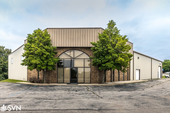
Property Detail
125 Macarthur Ct
Lexington-Fayette, KY
PARCEL 1-2
067-00-00-056.00
Jessamine
Multipleuses
Kentucky
B and X Area of moderate flood hazard, usually the area between the limits of the 100-year and 500-year floods.
1-2
2025
1.04 AC
2025
Jessamine County
060200
Lexington/Fayette
13,036 SF
NEARBY LISTINGS FOR SALE OR LEASE
DEMOGRAPHICS near 125 Macarthur Ct
1 mile
3 mile
5 mile
2025 Total Population
1,261
30,640
126,518
2030 Population
1,430
31,695
130,822
Pop Growth 2025-2030
+ 13.40%
+ 3.44%
+ 3.40%
Average Age
43
39
39
2025 Total Households
453
12,198
52,750
HH Growth 2025-2030
+ 13.47%
+ 3.59%
+ 3.52%
Median Household Inc
$68,135
$93,696
$73,256
Avg Household Size
2.60
2.50
2.30
2025 Avg HH Vehicles
3.00
2.00
2.00
Median Home Value
$360,614
$330,406
$300,145
Median Year Built
1999
1997
1986
Nearby Places
Map Layers
Map Styles
 Street
 Aerial
Layers
 Traffic
 Biking
Places
Listings with unknown addresses are not visible on the map
- Restaurants
- Banks
- Shops
- Fitness
- Groceries
PUBLIC TRANSPORTATION
AIRPORT
Blue Grass
Drive
Walk
Distance
Blue Grass
23 min
12.7 mi
SALE & LEASE HISTORY
LISTING DATE
SALE/LEASE

Sep 24, 2016
For Sale
Mar 30, 2017
For Sale
Nearby Properties
Address
Land Use
TOTAL SIZE
Lot Size
Zoning
Address
Land Use
TOTAL SIZE
Lot Size
Zoning
8,001 SF
32.59 AC
MU-3
Address
Land Use
TOTAL SIZE
Lot Size
Zoning
5,650 SF
22.46 AC
R-3
Address
Land Use
TOTAL SIZE
Lot Size
Zoning
22.10 AC
R-3
Address
Land Use
TOTAL SIZE
Lot Size
Zoning
41,040 SF
14.77 AC
R-4
Address
Land Use
TOTAL SIZE
Lot Size
Zoning
184,756 SF
4.43 AC
MU-3
Address
Land Use
TOTAL SIZE
Lot Size
Zoning
41,132 SF
19 AC
Address
Land Use
TOTAL SIZE
Lot Size
Zoning
6.25 AC
A-U
Address
Land Use
TOTAL SIZE
Lot Size
Zoning
219,320 SF
8.35 AC
R-4
Address
Land Use
TOTAL SIZE
Lot Size
Zoning
4,992 SF
32.12 AC
Address
Land Use
TOTAL SIZE
Lot Size
Zoning
118,794 SF
16.05 AC
B-6P
Address
Land Use
TOTAL SIZE
Lot Size
Zoning
444,063 SF
26.02 AC
Address
Land Use
TOTAL SIZE
Lot Size
Zoning
74,908 SF
15.06 AC
A-U
Address
Land Use
TOTAL SIZE
Lot Size
Zoning
19,536 SF
19.48 AC
R-4
Address
Land Use
TOTAL SIZE
Lot Size
Zoning
Address
Land Use
TOTAL SIZE
Lot Size
Zoning
4,142 SF
19.94 AC
Address
Land Use
TOTAL SIZE
Lot Size
Zoning
44,298 SF
11 AC
Address
Land Use
TOTAL SIZE
Lot Size
Zoning
39,277 SF
15 AC
Address
Land Use
TOTAL SIZE
Lot Size
Zoning
13,686 SF
2 AC
Address
Land Use
TOTAL SIZE
Lot Size
Zoning
196,147 SF
20.02 AC
B-3
Address
Land Use
TOTAL SIZE
Lot Size
Zoning
60,990 SF
4.29 AC
Address
Land Use
TOTAL SIZE
Lot Size
Zoning
82,436 SF
4.24 AC
R-4
Address
Land Use
TOTAL SIZE
Lot Size
Zoning
Address
Land Use
TOTAL SIZE
Lot Size
Zoning
52,283 SF
4.89 AC
A-U
Address
Land Use
TOTAL SIZE
Lot Size
Zoning
1,920 SF
99.41 AC
A-U
Address
Land Use
TOTAL SIZE
Lot Size
Zoning
29,690 SF
255 AC
Address
Land Use
TOTAL SIZE
Lot Size
Zoning
52,480 SF
9 AC
Address
Land Use
TOTAL SIZE
Lot Size
Zoning
46,722 SF
MU-3
Address
Land Use
TOTAL SIZE
Lot Size
Zoning
44,958 SF
MU-3
Address
Land Use
TOTAL SIZE
Lot Size
Zoning
200,857 SF
22.84 AC
The World's #1 Commercial Real Estate Marketplace
Connect with us
© 2026 CoStar Group
The information above has been obtained from sources believed reliable. While we do not doubt its accuracy we have not verified it and make no guarantee, warranty or representation about it. It is your responsibility to independently confirm its accuracy and completeness. Any projections, opinions, assumptions, or estimates used are for example only and do not represent the current or future performance of the property. The value of this transaction to you depends on tax and other factors which should be evaluated by your tax, financial, and legal advisors. You and your advisors should conduct a careful, independent investigation of the property to determine to your satisfaction the suitability of the property for your needs.