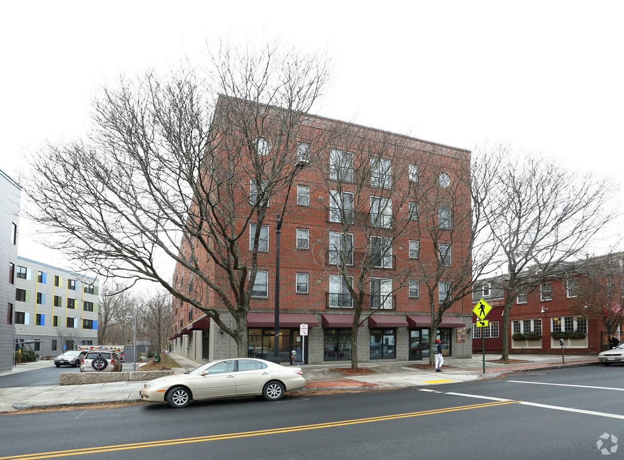
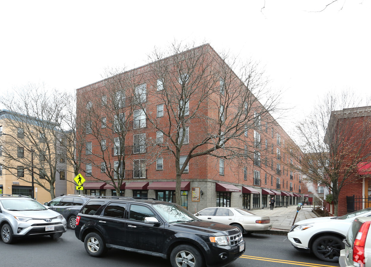
Property Record
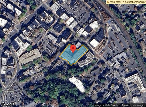
125 Pleasant St, Northampton, MA 01060
NEARBY LISTINGS FOR SALE OR LEASE
Property Detail
125 Pleasant St
Springfield, MA
Hampshire
NHAM-000032C-000057-000001
Massachusetts
Commercialofficeresidentialmixeduse
1
2024
1.03 AC
2024
Hampshire County
821903
Hartford
98,482 SF
DEMOGRAPHICS near 125 Pleasant St
1 Mile
3 Mile
5 Mile
2024 Total Population
10,449
23,967
46,086
2029 Population
8,569
19,214
36,679
Pop Growth 2024-2029
(17.99%)
(19.83%)
(20.41%)
Average Age
37
42
44
2024 Total Households
4,352
10,471
20,367
HH Growth 2024-2029
(21.76%)
(21.92%)
(21.85%)
Median Household Inc
$68,581
$72,824
$72,963
Avg Household Size
1.90
2.00
2.10
2024 Avg HH Vehicles
1.00
2.00
2.00
Median Home Value
$405,573
$392,617
$368,981
Median Year Built
1947
1950
1956
Nearby Places
- Restaurants
- Banks
- Shops
- Fitness
- Groceries
PUBLIC TRANSPORTATION
COMMUTER RAIL
Northampton (Valley Flyer - Amtrak, Vermonter - Amtrak)
DRIVE
WALK
Distance
Northampton (Valley Flyer - Amtrak, Vermonter - Amtrak)
0 min
3 min
0.1 mi
AIRPORT
Bradley International
DRIVE
WALK
Distance
Bradley International
52 min
29.6 mi
Freight Ports
Albany, NY Port
DRIVE
WALK
Distance
Albany, NY Port
112 min
91.6 mi
SALE & LEASE HISTORY
LISTING DATE
SALE/LEASE

Sep 28, 2016
For Lease
Nearby Properties
Address
Land Use
TOTAL SIZE
Lot Size
Zoning
Address
Land Use
TOTAL SIZE
Lot Size
Zoning
29.13 AC
RR
Address
Land Use
TOTAL SIZE
Lot Size
Zoning
5.65 AC
URC
Address
Land Use
TOTAL SIZE
Lot Size
Zoning
18.04 AC
URB
Address
Land Use
TOTAL SIZE
Lot Size
Zoning
17.40 AC
SC
Address
Land Use
TOTAL SIZE
Lot Size
Zoning
150,256 SF
13.58 AC
Address
Land Use
TOTAL SIZE
Lot Size
Zoning
243,012 SF
24.96 AC
URB
Address
Land Use
TOTAL SIZE
Lot Size
Zoning
26.50 AC
URB
Address
Land Use
TOTAL SIZE
Lot Size
Zoning
12.23 AC
HB
Address
Land Use
TOTAL SIZE
Lot Size
Zoning
61,650 SF
12.37 AC
B
Address
Land Use
TOTAL SIZE
Lot Size
Zoning
0.12 AC
URC
Address
Land Use
TOTAL SIZE
Lot Size
Zoning
63.16 AC
URB
Address
Land Use
TOTAL SIZE
Lot Size
Zoning
55,964 SF
0.36 AC
URC
Address
Land Use
TOTAL SIZE
Lot Size
Zoning
7.58 AC
HB
Address
Land Use
TOTAL SIZE
Lot Size
Zoning
66,138 SF
5 AC
GB
Address
Land Use
TOTAL SIZE
Lot Size
Zoning
10.37 AC
HB
Address
Land Use
TOTAL SIZE
Lot Size
Zoning
21.77 AC
GI
Address
Land Use
TOTAL SIZE
Lot Size
Zoning
85,816 SF
6.80 AC
URB
Address
Land Use
TOTAL SIZE
Lot Size
Zoning
2.69 AC
URC
Address
Land Use
TOTAL SIZE
Lot Size
Zoning
131.99 AC
HB
Address
Land Use
TOTAL SIZE
Lot Size
Zoning
30.42 AC
URB
Address
Land Use
TOTAL SIZE
Lot Size
Zoning
88,144 SF
0.35 AC
CB
Address
Land Use
TOTAL SIZE
Lot Size
Zoning
1.77 AC
URC
Address
Land Use
TOTAL SIZE
Lot Size
Zoning
42,070 SF
4.38 AC
URA
Address
Land Use
TOTAL SIZE
Lot Size
Zoning
0.32 AC
URC
Address
Land Use
TOTAL SIZE
Lot Size
Zoning
15,130 SF
2.60 AC
B
Address
Land Use
TOTAL SIZE
Lot Size
Zoning
5.84 AC
URC
Address
Land Use
TOTAL SIZE
Lot Size
Zoning
4.19 AC
HB
Address
Land Use
TOTAL SIZE
Lot Size
Zoning
0.14 AC
URC
Address
Land Use
TOTAL SIZE
Lot Size
Zoning
5.06 AC
URC
The World's #1 Commercial Real Estate Marketplace
Connect with us
© 2025 CoStar Group
The information above has been obtained from sources believed reliable. While we do not doubt its accuracy we have not verified it and make no guarantee, warranty or representation about it. It is your responsibility to independently confirm its accuracy and completeness. Any projections, opinions, assumptions, or estimates used are for example only and do not represent the current or future performance of the property. The value of this transaction to you depends on tax and other factors which should be evaluated by your tax, financial, and legal advisors. You and your advisors should conduct a careful, independent investigation of the property to determine to your satisfaction the suitability of the property for your needs.