Property Record
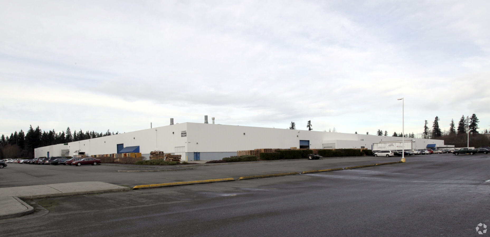
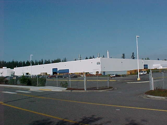
12521 Harbour Reach Dr, Mukilteo, WA 98275
NEARBY LISTINGS FOR SALE OR LEASE
Property Detail
12521 Harbour Reach Dr
Seattle-Tacoma-Bellevue, WA
Rev Bsp For Harbour Pointe
280427-002-049-00
SECTION 27 TOWNSHIP 28 RANGE 04 QUARTER SW-NW & SECTION 28 TOWNSHIP 28 RANGE 04 QUARTER SE-NE TRS B & C (WETLAND), D, E, F (WETLAND), G, H (PUMP HOUSE) & I (NGPA) OF REV BSP FOR HARBOUR POINTE SECTOR 20 REC UND AFN 200505235191 BEING A REV BSP REC UN
Miningfacilityoilgasmineralpreciousmetals
Snohomish
X
Washington
53061C1020F
50
2024
24.38 AC
2025
S Everett/Harbor Pt
475,490 SF
Seattle/Puget Sound
DEMOGRAPHICS near 12521 Harbour Reach Dr
1 Mile
3 Mile
5 Mile
2024 Total Population
11,456
124,988
275,031
2029 Population
12,080
131,341
288,485
Pop Growth 2024-2029
+ 5.45%
+ 5.08%
+ 4.89%
Average Age
39
38
39
2024 Total Households
4,134
47,355
105,564
HH Growth 2024-2029
+ 5.52%
+ 5.18%
+ 5.01%
Median Household Inc
$98,882
$90,169
$91,385
Avg Household Size
2.70
2.60
2.50
2024 Avg HH Vehicles
2.00
2.00
2.00
Median Home Value
$687,974
$647,152
$662,049
Median Year Built
1998
1994
1990
Nearby Places
- Restaurants
- Banks
- Shops
- Fitness
- Groceries
PUBLIC TRANSPORTATION
COMMUTER RAIL
Mukilteo Station (Sounder South Line - Central Puget Sound Regional Transit Authority Rail (Link Light Rail/Sounder))
DRIVE
WALK
Distance
Mukilteo Station (Sounder South Line - Central Puget Sound Regional Transit Authority Rail (Link Light Rail/Sounder))
14 min
6.2 mi
Edmonds Station (Sounder South Line - Central Puget Sound Regional Transit Authority Rail (Link Light Rail/Sounder))
DRIVE
WALK
Distance
Edmonds Station (Sounder South Line - Central Puget Sound Regional Transit Authority Rail (Link Light Rail/Sounder))
22 min
9.4 mi
AIRPORT
Seattle Paine Field International
DRIVE
WALK
Distance
Seattle Paine Field International
10 min
3.7 mi
Freight Ports
Port of Everett
DRIVE
WALK
Distance
Port of Everett
22 min
9.9 mi
Nearby Properties
Address
Land Use
TOTAL SIZE
Lot Size
Zoning
Address
Land Use
TOTAL SIZE
Lot Size
Zoning
413,101 SF
27.85 AC
MR-22
Address
Land Use
TOTAL SIZE
Lot Size
Zoning
547,136 SF
4.07 AC
UC
Address
Land Use
TOTAL SIZE
Lot Size
Zoning
426,238 SF
9.84 AC
UC
Address
Land Use
TOTAL SIZE
Lot Size
Zoning
435,716 SF
19.29 AC
MR
Address
Land Use
TOTAL SIZE
Lot Size
Zoning
619,673 SF
0.34 AC
UC
Address
Land Use
TOTAL SIZE
Lot Size
Zoning
329,693 SF
6.04 AC
MU
Address
Land Use
TOTAL SIZE
Lot Size
Zoning
287,132 SF
16.70 AC
MR-22
Address
Land Use
TOTAL SIZE
Lot Size
Zoning
326,128 SF
12.96 AC
UR4
Address
Land Use
TOTAL SIZE
Lot Size
Zoning
296,011 SF
15.89 AC
MR
Address
Land Use
TOTAL SIZE
Lot Size
Zoning
316,519 SF
16.81 AC
MR
Address
Land Use
TOTAL SIZE
Lot Size
Zoning
575,730 SF
151.35 AC
LI
Address
Land Use
TOTAL SIZE
Lot Size
Zoning
306,096 SF
14.40 AC
UR3
Address
Land Use
TOTAL SIZE
Lot Size
Zoning
306,149 SF
8.93 AC
MR
Address
Land Use
TOTAL SIZE
Lot Size
Zoning
33.37 AC
R-7,200
Address
Land Use
TOTAL SIZE
Lot Size
Zoning
232,411 SF
18.56 AC
MR
Address
Land Use
TOTAL SIZE
Lot Size
Zoning
175,410 SF
12.15 AC
PCB(S)
Address
Land Use
TOTAL SIZE
Lot Size
Zoning
282,880 SF
12.35 AC
B
Address
Land Use
TOTAL SIZE
Lot Size
Zoning
386,535 SF
2.21 AC
UC
Address
Land Use
TOTAL SIZE
Lot Size
Zoning
288,726 SF
15.63 AC
MR
Address
Land Use
TOTAL SIZE
Lot Size
Zoning
250,741 SF
15.61 AC
UC
Address
Land Use
TOTAL SIZE
Lot Size
Zoning
244,082 SF
13.45 AC
MR
Address
Land Use
TOTAL SIZE
Lot Size
Zoning
520,582 SF
1.11 AC
UC
Address
Land Use
TOTAL SIZE
Lot Size
Zoning
106,481 SF
27.94 AC
R-7,200
Address
Land Use
TOTAL SIZE
Lot Size
Zoning
49.26 AC
R-1
Address
Land Use
TOTAL SIZE
Lot Size
Zoning
356,576 SF
8.79 AC
UC
Address
Land Use
TOTAL SIZE
Lot Size
Zoning
180,947 SF
8.24 AC
MR
Address
Land Use
TOTAL SIZE
Lot Size
Zoning
173,464 SF
6.41 AC
PCB(S)
Address
Land Use
TOTAL SIZE
Lot Size
Zoning
195,366 SF
10.66 AC
MR
Address
Land Use
TOTAL SIZE
Lot Size
Zoning
196,628 SF
12.64 AC
MR
Address
Land Use
TOTAL SIZE
Lot Size
Zoning
225,964 SF
11.73 AC
MR
The World's #1 Commercial Real Estate Marketplace
Connect with us
© 2025 CoStar Group
The information above has been obtained from sources believed reliable. While we do not doubt its accuracy we have not verified it and make no guarantee, warranty or representation about it. It is your responsibility to independently confirm its accuracy and completeness. Any projections, opinions, assumptions, or estimates used are for example only and do not represent the current or future performance of the property. The value of this transaction to you depends on tax and other factors which should be evaluated by your tax, financial, and legal advisors. You and your advisors should conduct a careful, independent investigation of the property to determine to your satisfaction the suitability of the property for your needs.