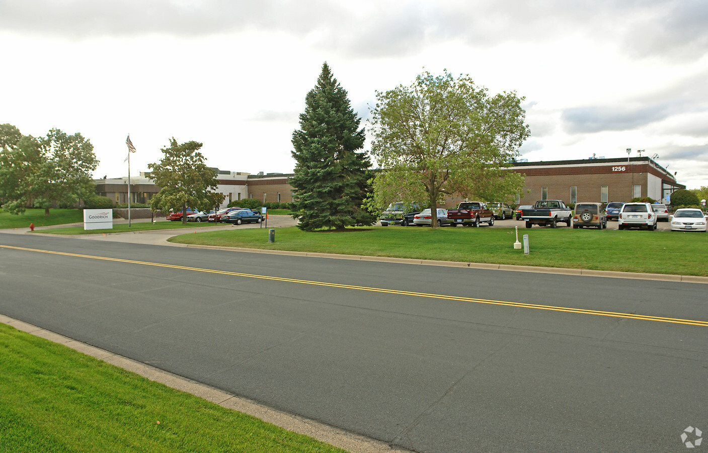
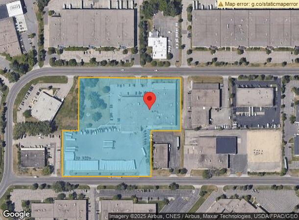
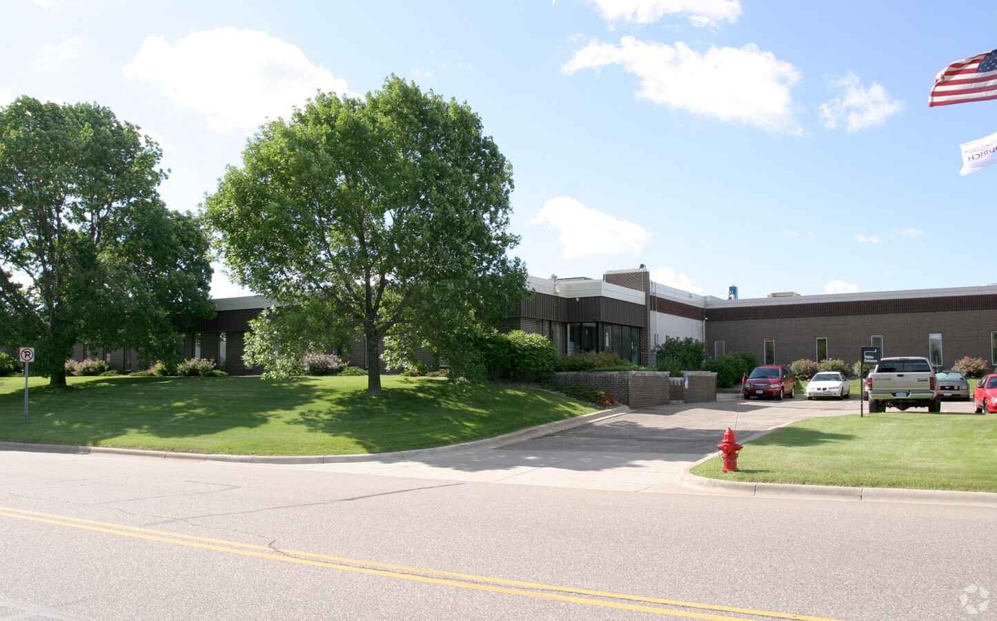
Property Record
1256 Trapp Rd, Saint Paul, MN 55121
NEARBY LISTINGS FOR SALE OR LEASE
Property Detail
1256 Trapp Rd
Minneapolis-St. Paul-Bloomington, MN-WI
Fleetpark Addition
10-26880-01-010
FLEETPARK ADDITION 1 1
Industrialgeneral
Dakota
X
Minnesota
27053C0500F
10
2024
7 AC
2023
South Central
060726
Minneapolis/St Paul
64,123 SF
DEMOGRAPHICS near 1256 Trapp Rd
1 Mile
3 Mile
5 Mile
2024 Total Population
1,918
35,162
160,042
2029 Population
1,951
35,793
161,204
Pop Growth 2024-2029
+ 1.72%
+ 1.79%
+ 0.73%
Average Age
37
41
41
2024 Total Households
787
15,198
67,924
HH Growth 2024-2029
+ 1.78%
+ 1.70%
+ 0.67%
Median Household Inc
$71,920
$88,639
$84,650
Avg Household Size
2.40
2.30
2.30
2024 Avg HH Vehicles
2.00
2.00
2.00
Median Home Value
$374,324
$404,762
$349,675
Median Year Built
1988
1986
1978
Nearby Places
- Restaurants
- Banks
- Shops
- Fitness
- Groceries
PUBLIC TRANSPORTATION
COMMUTER RAIL
St. Paul-Minneapolis (Empire Builder - Amtrak)
DRIVE
WALK
Distance
St. Paul-Minneapolis (Empire Builder - Amtrak)
15 min
10.0 mi
AIRPORT
Minneapolis-St Paul International/Wold-Chamberlain
DRIVE
WALK
Distance
Minneapolis-St Paul International/Wold-Chamberlain
11 min
5.3 mi
Freight Ports
Port Milwaukee
DRIVE
WALK
Distance
Port Milwaukee
372 min
336.2 mi
SALE & LEASE HISTORY
LISTING DATE
SALE/LEASE

Sep 24, 2016
For Sale
Nearby Properties
Address
Land Use
TOTAL SIZE
Lot Size
Zoning
Address
Land Use
TOTAL SIZE
Lot Size
Zoning
657,358 SF
17.12 AC
Address
Land Use
TOTAL SIZE
Lot Size
Zoning
378,880 SF
3.42 AC
Address
Land Use
TOTAL SIZE
Lot Size
Zoning
264,370 SF
36.39 AC
Address
Land Use
TOTAL SIZE
Lot Size
Zoning
247,470 SF
2.20 AC
Address
Land Use
TOTAL SIZE
Lot Size
Zoning
291,589 SF
6.77 AC
Address
Land Use
TOTAL SIZE
Lot Size
Zoning
1,049,150 SF
87.81 AC
Address
Land Use
TOTAL SIZE
Lot Size
Zoning
300,000 SF
18.44 AC
Address
Land Use
TOTAL SIZE
Lot Size
Zoning
207,621 SF
1.65 AC
Address
Land Use
TOTAL SIZE
Lot Size
Zoning
247,451 SF
9.57 AC
Address
Land Use
TOTAL SIZE
Lot Size
Zoning
34,152 SF
6.11 AC
Address
Land Use
TOTAL SIZE
Lot Size
Zoning
185,851 SF
2.55 AC
Address
Land Use
TOTAL SIZE
Lot Size
Zoning
159,341 SF
2.82 AC
Address
Land Use
TOTAL SIZE
Lot Size
Zoning
180,746 SF
1.93 AC
Address
Land Use
TOTAL SIZE
Lot Size
Zoning
541,075 SF
88.93 AC
Address
Land Use
TOTAL SIZE
Lot Size
Zoning
278,025 SF
9.12 AC
Address
Land Use
TOTAL SIZE
Lot Size
Zoning
436,701 SF
19.58 AC
Address
Land Use
TOTAL SIZE
Lot Size
Zoning
227,200 SF
14.78 AC
Address
Land Use
TOTAL SIZE
Lot Size
Zoning
168,846 SF
7.30 AC
Address
Land Use
TOTAL SIZE
Lot Size
Zoning
217,832 SF
15.13 AC
Address
Land Use
TOTAL SIZE
Lot Size
Zoning
205,920 SF
16.68 AC
Address
Land Use
TOTAL SIZE
Lot Size
Zoning
451,103 SF
25.24 AC
Address
Land Use
TOTAL SIZE
Lot Size
Zoning
185,086 SF
3.30 AC
Address
Land Use
TOTAL SIZE
Lot Size
Zoning
208,276 SF
10 AC
Address
Land Use
TOTAL SIZE
Lot Size
Zoning
147,269 SF
1.43 AC
Address
Land Use
TOTAL SIZE
Lot Size
Zoning
545,596 SF
16.99 AC
Address
Land Use
TOTAL SIZE
Lot Size
Zoning
99,170 SF
1.50 AC
Address
Land Use
TOTAL SIZE
Lot Size
Zoning
224,000 SF
18.81 AC
Address
Land Use
TOTAL SIZE
Lot Size
Zoning
2,000 SF
50.50 AC
Address
Land Use
TOTAL SIZE
Lot Size
Zoning
238,639 SF
10.01 AC
Address
Land Use
TOTAL SIZE
Lot Size
Zoning
140,375 SF
25.37 AC
The World's #1 Commercial Real Estate Marketplace
Connect with us
© 2025 CoStar Group
The information above has been obtained from sources believed reliable. While we do not doubt its accuracy we have not verified it and make no guarantee, warranty or representation about it. It is your responsibility to independently confirm its accuracy and completeness. Any projections, opinions, assumptions, or estimates used are for example only and do not represent the current or future performance of the property. The value of this transaction to you depends on tax and other factors which should be evaluated by your tax, financial, and legal advisors. You and your advisors should conduct a careful, independent investigation of the property to determine to your satisfaction the suitability of the property for your needs.