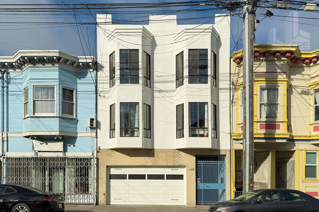
Property Record
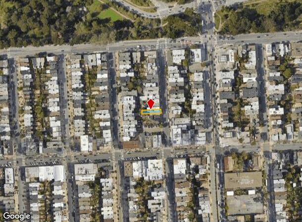
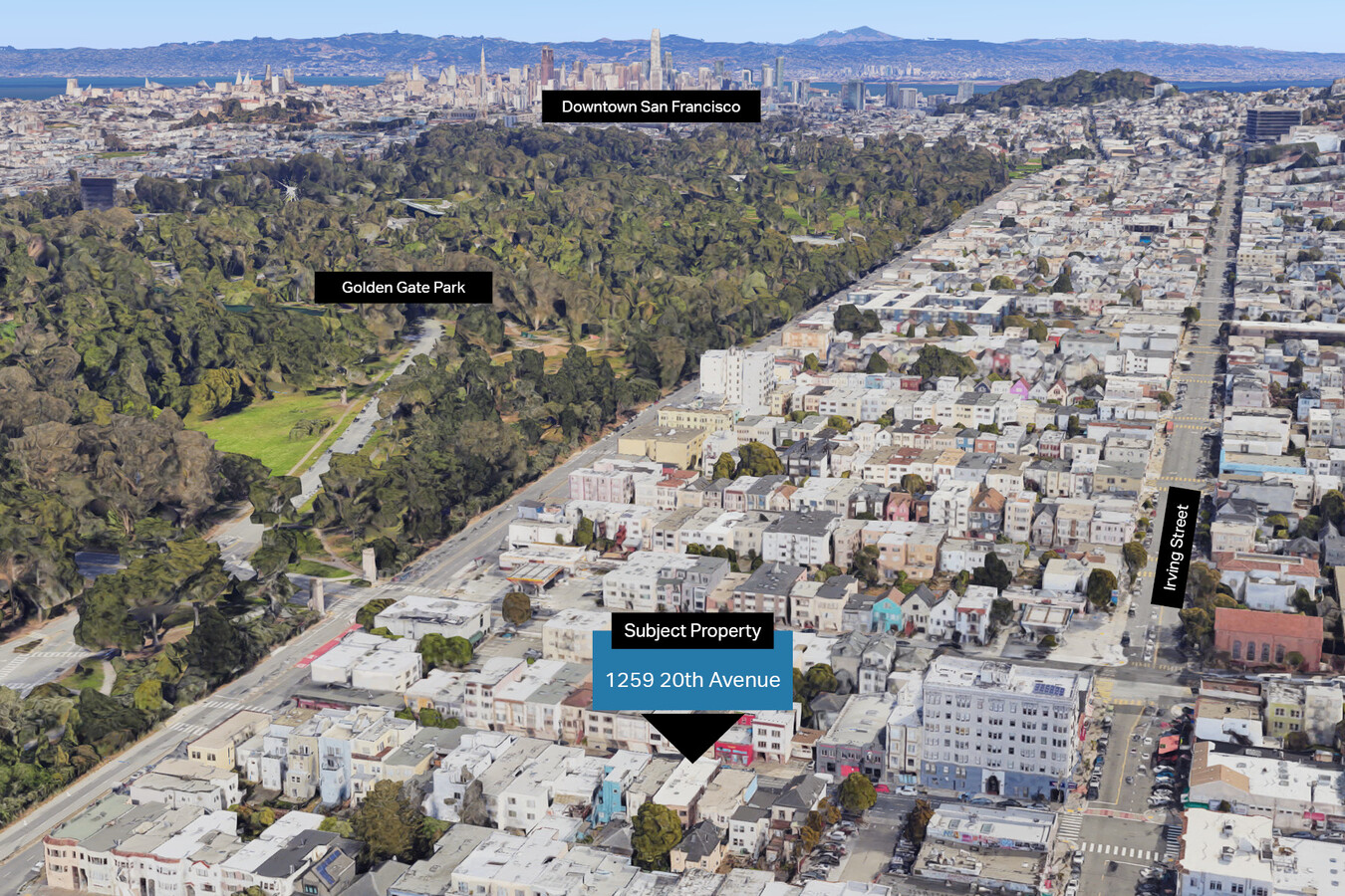
1259 20Th Ave, San Francisco, CA 94122
NEARBY LISTINGS FOR SALE OR LEASE
Property Detail
1259 20Th Ave
San Francisco-Redwood City-South San Francisco, CA
BLK 653
1730-012
San Francisco
Apartment
California
2023
12
2023
0.07 AC
032601
Central Sunset
4,686 SF
San Francisco
DEMOGRAPHICS near 1259 20Th Ave
1 Mile
3 Mile
5 Mile
2024 Total Population
48,399
321,853
780,255
2029 Population
44,771
297,188
722,512
Pop Growth 2024-2029
(7.50%)
(7.66%)
(7.40%)
Average Age
43
43
43
2024 Total Households
19,165
134,635
331,636
HH Growth 2024-2029
(7.99%)
(8.14%)
(7.76%)
Median Household Inc
$132,656
$145,538
$125,982
Avg Household Size
2.40
2.30
2.20
2024 Avg HH Vehicles
1.00
1.00
1.00
Median Home Value
$1,128,102
$1,119,013
$1,099,520
Median Year Built
1947
1947
1949
Nearby Places
- Restaurants
- Banks
- Shops
- Fitness
- Groceries
PUBLIC TRANSPORTATION
TRANSIT/SUBWAY
Judah And 19Th Avenue (N Judah - San Francisco Municipal Railway (MUNI Metro))
DRIVE
WALK
Distance
Judah And 19Th Avenue (N Judah - San Francisco Municipal Railway (MUNI Metro))
2 min
4 min
0.2 mi
Judah And 22Nd Avenue (N Judah - San Francisco Municipal Railway (MUNI Metro))
DRIVE
WALK
Distance
Judah And 22Nd Avenue (N Judah - San Francisco Municipal Railway (MUNI Metro))
1 min
5 min
0.3 mi
Judah St & 23Rd Ave (N Judah - San Francisco Municipal Railway (MUNI Metro))
DRIVE
WALK
Distance
Judah St & 23Rd Ave (N Judah - San Francisco Municipal Railway (MUNI Metro))
2 min
6 min
0.4 mi
Judah And 25Th Avenue (N Judah - San Francisco Municipal Railway (MUNI Metro))
DRIVE
WALK
Distance
Judah And 25Th Avenue (N Judah - San Francisco Municipal Railway (MUNI Metro))
1 min
9 min
0.5 mi
Judah And 15Th Avenue (N Judah - San Francisco Municipal Railway (MUNI Metro))
DRIVE
WALK
Distance
Judah And 15Th Avenue (N Judah - San Francisco Municipal Railway (MUNI Metro))
2 min
9 min
0.5 mi
COMMUTER RAIL
San Francisco 4Th & King (Caltrain - Caltrain (Caltrain))
DRIVE
WALK
Distance
San Francisco 4Th & King (Caltrain - Caltrain (Caltrain))
12 min
5.2 mi
22Nd Street (Caltrain - Caltrain (Caltrain))
DRIVE
WALK
Distance
22Nd Street (Caltrain - Caltrain (Caltrain))
13 min
5.8 mi
AIRPORT
San Francisco International
DRIVE
WALK
Distance
San Francisco International
26 min
14.2 mi
Metro Oakland International
DRIVE
WALK
Distance
Metro Oakland International
40 min
24.1 mi
Freight Ports
Port of San Francisco
DRIVE
WALK
Distance
Port of San Francisco
15 min
6.1 mi
SALE & LEASE HISTORY
LISTING DATE
SALE/LEASE

Nov 04, 2024
For Sale
Nearby Properties
Address
Land Use
TOTAL SIZE
Lot Size
Zoning
Address
Land Use
TOTAL SIZE
Lot Size
Zoning
718 SF
18.55 AC
RH2
Address
Land Use
TOTAL SIZE
Lot Size
Zoning
411,904 SF
21.74 AC
C2
Address
Land Use
TOTAL SIZE
Lot Size
Zoning
4.41 AC
RH-3/RM-2
Address
Land Use
TOTAL SIZE
Lot Size
Zoning
409,895 SF
7.20 AC
RH3
Address
Land Use
TOTAL SIZE
Lot Size
Zoning
419,790 SF
3 AC
M1
Address
Land Use
TOTAL SIZE
Lot Size
Zoning
2.40 AC
NC3
Address
Land Use
TOTAL SIZE
Lot Size
Zoning
250,843 SF
6.62 AC
NC3
Address
Land Use
TOTAL SIZE
Lot Size
Zoning
2.03 AC
C2
Address
Land Use
TOTAL SIZE
Lot Size
Zoning
17.91 AC
RH-2
Address
Land Use
TOTAL SIZE
Lot Size
Zoning
420,000 SF
0.79 AC
NC-3
Address
Land Use
TOTAL SIZE
Lot Size
Zoning
905,491 SF
10.27 AC
RM1
Address
Land Use
TOTAL SIZE
Lot Size
Zoning
230,310 SF
0.65 AC
NC3
Address
Land Use
TOTAL SIZE
Lot Size
Zoning
88,900 SF
5.37 AC
NCS
Address
Land Use
TOTAL SIZE
Lot Size
Zoning
2.24 AC
RM3
Address
Land Use
TOTAL SIZE
Lot Size
Zoning
75,989 SF
0.72 AC
Address
Land Use
TOTAL SIZE
Lot Size
Zoning
90,539 SF
2.28 AC
RH2
Address
Land Use
TOTAL SIZE
Lot Size
Zoning
176,000 SF
1.64 AC
C2
Address
Land Use
TOTAL SIZE
Lot Size
Zoning
73,491 SF
4.48 AC
C2
Address
Land Use
TOTAL SIZE
Lot Size
Zoning
146,036 SF
0.49 AC
RH3
Address
Land Use
TOTAL SIZE
Lot Size
Zoning
195,791 SF
0.80 AC
NC3
Address
Land Use
TOTAL SIZE
Lot Size
Zoning
70,563 SF
0.42 AC
Address
Land Use
TOTAL SIZE
Lot Size
Zoning
127,189 SF
0.74 AC
RM2
Address
Land Use
TOTAL SIZE
Lot Size
Zoning
76,000 SF
1.48 AC
RM4
Address
Land Use
TOTAL SIZE
Lot Size
Zoning
54,131 SF
1.75 AC
C2
Address
Land Use
TOTAL SIZE
Lot Size
Zoning
50,461 SF
0.42 AC
UPMKT
Address
Land Use
TOTAL SIZE
Lot Size
Zoning
70,120 SF
6.35 AC
RM2
Address
Land Use
TOTAL SIZE
Lot Size
Zoning
1.20 AC
RM1
Address
Land Use
TOTAL SIZE
Lot Size
Zoning
67,500 SF
0.51 AC
Address
Land Use
TOTAL SIZE
Lot Size
Zoning
2.99 AC
NC3
Address
Land Use
TOTAL SIZE
Lot Size
Zoning
194,477 SF
11.37 AC
RH1
The World's #1 Commercial Real Estate Marketplace
Connect with us
© 2025 CoStar Group
The information above has been obtained from sources believed reliable. While we do not doubt its accuracy we have not verified it and make no guarantee, warranty or representation about it. It is your responsibility to independently confirm its accuracy and completeness. Any projections, opinions, assumptions, or estimates used are for example only and do not represent the current or future performance of the property. The value of this transaction to you depends on tax and other factors which should be evaluated by your tax, financial, and legal advisors. You and your advisors should conduct a careful, independent investigation of the property to determine to your satisfaction the suitability of the property for your needs.