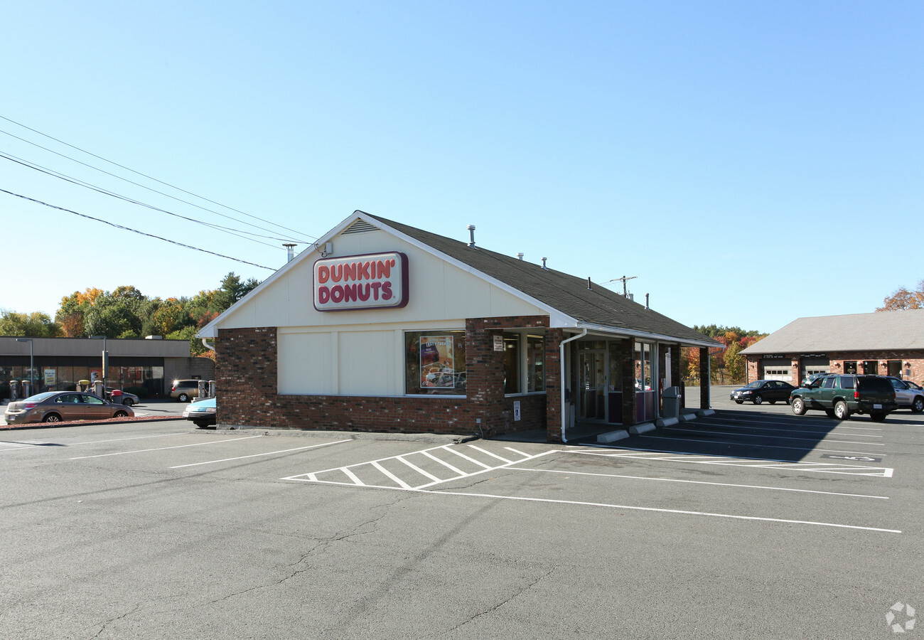
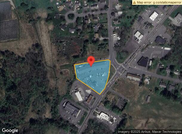
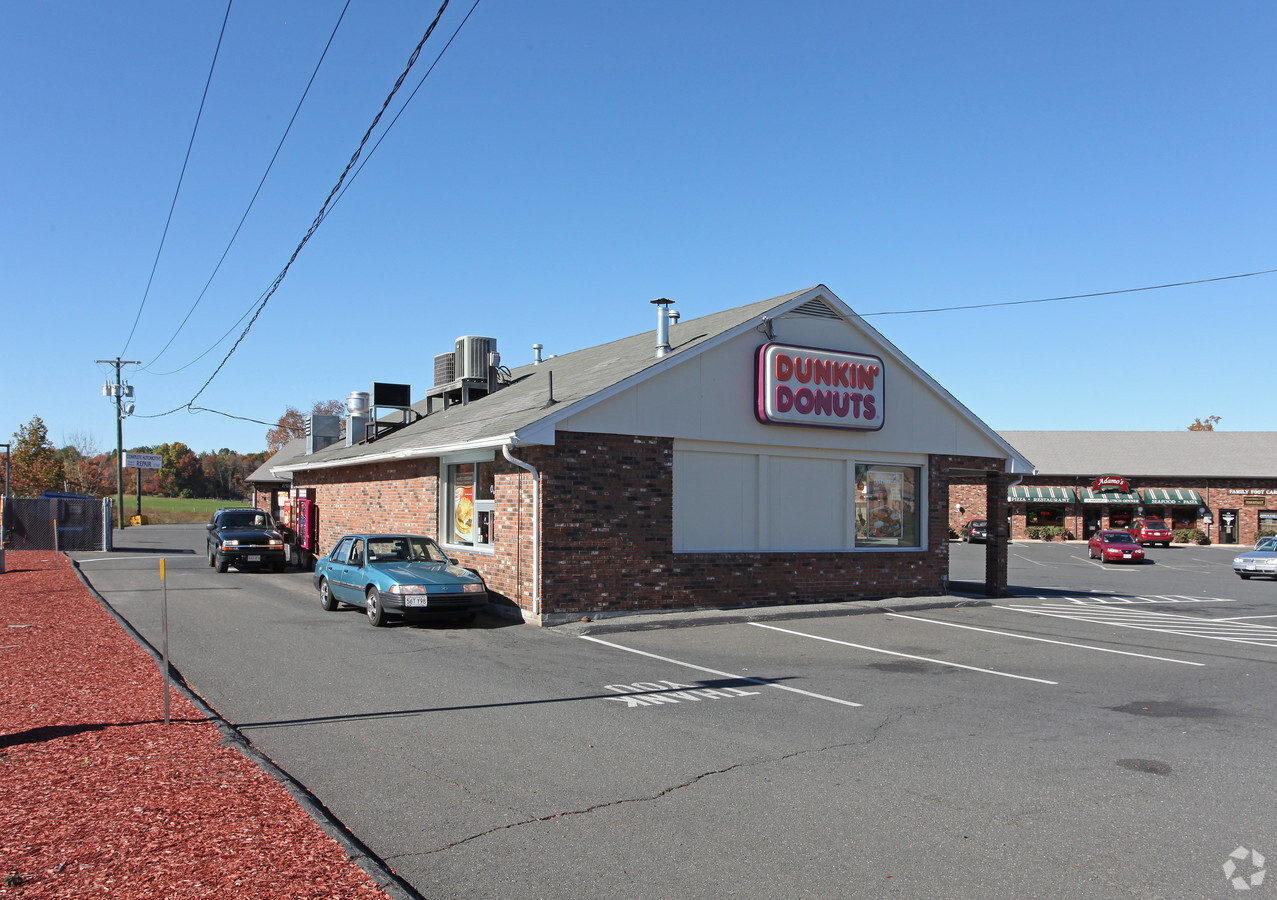
Property Record
126 Northampton St, Easthampton, MA 01027
NEARBY LISTINGS FOR SALE OR LEASE
Property Detail
126 Northampton St
EHAM-000128-000096
Hampshire
Departmentstore
Massachusetts
2024
1.76 AC
2024
Hampshire County
822402
Hartford
13,490 SF
Springfield, MA
DEMOGRAPHICS near 126 Northampton St
1 Mile
3 Mile
5 Mile
2024 Total Population
3,429
20,852
51,426
2029 Population
2,693
16,510
41,814
Pop Growth 2024-2029
(21.46%)
(20.82%)
(18.69%)
Average Age
43
44
44
2024 Total Households
1,742
9,397
22,538
HH Growth 2024-2029
(21.47%)
(21.84%)
(20.08%)
Median Household Inc
$52,636
$67,790
$73,968
Avg Household Size
1.90
2.10
2.10
2024 Avg HH Vehicles
2.00
2.00
2.00
Median Home Value
$279,536
$349,262
$358,608
Median Year Built
1948
1961
1960
Nearby Places
- Restaurants
- Banks
- Shops
- Fitness
- Groceries
PUBLIC TRANSPORTATION
COMMUTER RAIL
Northampton (Valley Flyer - Amtrak, Vermonter - Amtrak)
DRIVE
WALK
Distance
Northampton (Valley Flyer - Amtrak, Vermonter - Amtrak)
7 min
3.8 mi
Holyoke Amtrak (Valley Flyer - Amtrak, Vermonter - Amtrak)
DRIVE
WALK
Distance
Holyoke Amtrak (Valley Flyer - Amtrak, Vermonter - Amtrak)
14 min
7.6 mi
AIRPORT
Bradley International
DRIVE
WALK
Distance
Bradley International
52 min
27.0 mi
Freight Ports
Albany, NY Port
DRIVE
WALK
Distance
Albany, NY Port
107 min
85.3 mi
Nearby Properties
Address
Land Use
TOTAL SIZE
Lot Size
Zoning
Address
Land Use
TOTAL SIZE
Lot Size
Zoning
29.13 AC
RR
Address
Land Use
TOTAL SIZE
Lot Size
Zoning
42,416 SF
17.58 AC
R10
Address
Land Use
TOTAL SIZE
Lot Size
Zoning
126,515 SF
183.24 AC
R40
Address
Land Use
TOTAL SIZE
Lot Size
Zoning
150,256 SF
13.58 AC
Address
Land Use
TOTAL SIZE
Lot Size
Zoning
5,272 SF
16.12 AC
R10
Address
Land Use
TOTAL SIZE
Lot Size
Zoning
4,114 SF
125.44 AC
R35
Address
Land Use
TOTAL SIZE
Lot Size
Zoning
66,138 SF
5 AC
GB
Address
Land Use
TOTAL SIZE
Lot Size
Zoning
84,509 SF
7.53 AC
R10
Address
Land Use
TOTAL SIZE
Lot Size
Zoning
5.84 AC
URC
Address
Land Use
TOTAL SIZE
Lot Size
Zoning
48,626 SF
4.25 AC
DB
Address
Land Use
TOTAL SIZE
Lot Size
Zoning
45,480 SF
3.48 AC
GB
Address
Land Use
TOTAL SIZE
Lot Size
Zoning
32,187 SF
3.16 AC
HB
Address
Land Use
TOTAL SIZE
Lot Size
Zoning
8.13 AC
BP
Address
Land Use
TOTAL SIZE
Lot Size
Zoning
16,720 SF
5.74 AC
HB
Address
Land Use
TOTAL SIZE
Lot Size
Zoning
39,110 SF
3.62 AC
GB
Address
Land Use
TOTAL SIZE
Lot Size
Zoning
156,709 SF
1.47 AC
Address
Land Use
TOTAL SIZE
Lot Size
Zoning
1.37 AC
URC
Address
Land Use
TOTAL SIZE
Lot Size
Zoning
29,946 SF
6.36 AC
HB
Address
Land Use
TOTAL SIZE
Lot Size
Zoning
5.87 AC
SR
Address
Land Use
TOTAL SIZE
Lot Size
Zoning
30,210 SF
1.58 AC
HB
Address
Land Use
TOTAL SIZE
Lot Size
Zoning
211,382 SF
17.15 AC
I
Address
Land Use
TOTAL SIZE
Lot Size
Zoning
480,770 SF
7.61 AC
MI
Address
Land Use
TOTAL SIZE
Lot Size
Zoning
3,792 SF
7.27 AC
R15
Address
Land Use
TOTAL SIZE
Lot Size
Zoning
13,608 SF
11 AC
RR
Address
Land Use
TOTAL SIZE
Lot Size
Zoning
Address
Land Use
TOTAL SIZE
Lot Size
Zoning
1,280.42 AC
RA
Address
Land Use
TOTAL SIZE
Lot Size
Zoning
14.80 AC
Address
Land Use
TOTAL SIZE
Lot Size
Zoning
27,040 SF
14.60 AC
I
Address
Land Use
TOTAL SIZE
Lot Size
Zoning
1.29 AC
URC
Address
Land Use
TOTAL SIZE
Lot Size
Zoning
43,286 SF
0.71 AC
R5
The World's #1 Commercial Real Estate Marketplace
Connect with us
© 2025 CoStar Group
The information above has been obtained from sources believed reliable. While we do not doubt its accuracy we have not verified it and make no guarantee, warranty or representation about it. It is your responsibility to independently confirm its accuracy and completeness. Any projections, opinions, assumptions, or estimates used are for example only and do not represent the current or future performance of the property. The value of this transaction to you depends on tax and other factors which should be evaluated by your tax, financial, and legal advisors. You and your advisors should conduct a careful, independent investigation of the property to determine to your satisfaction the suitability of the property for your needs.