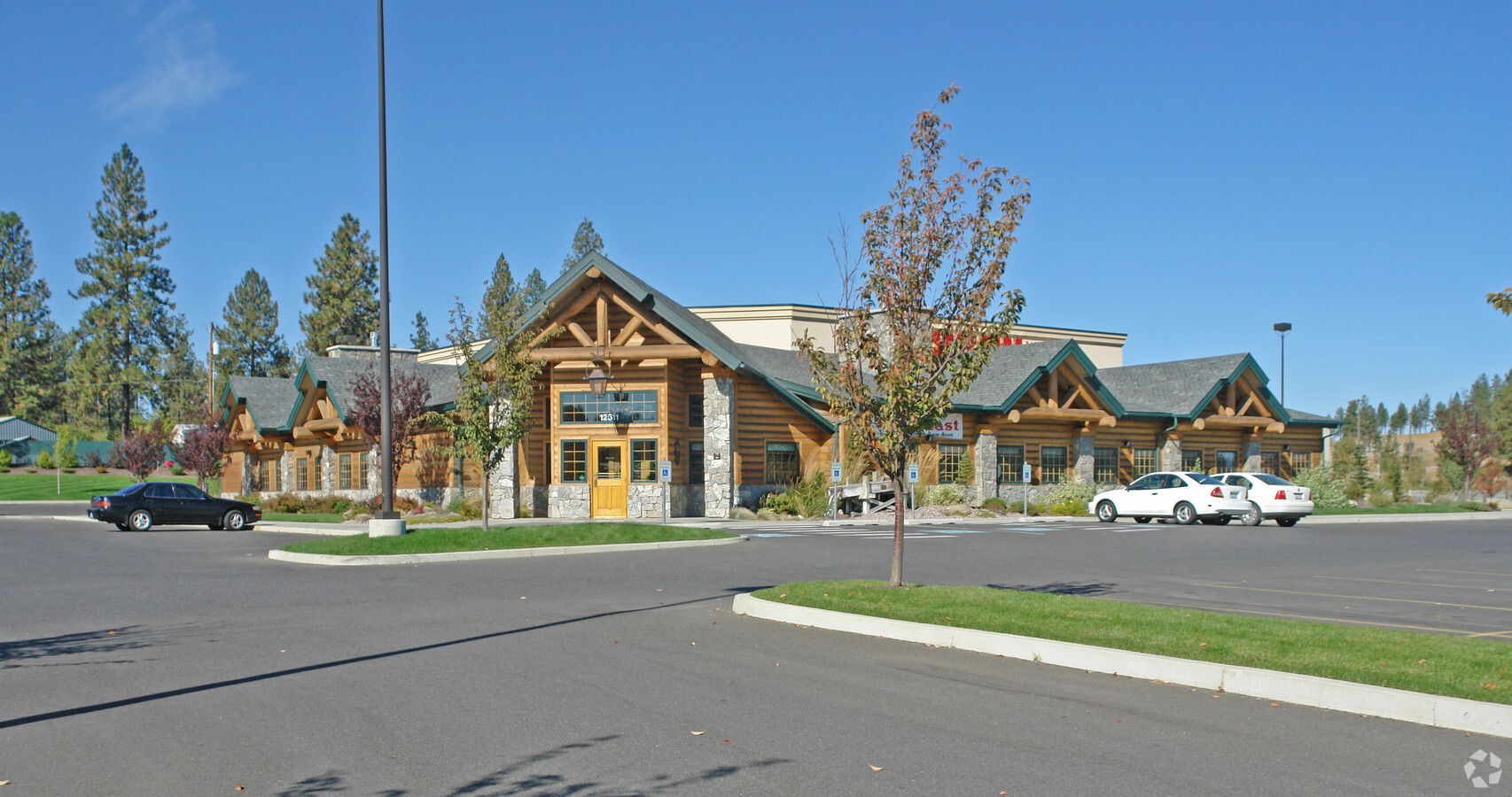
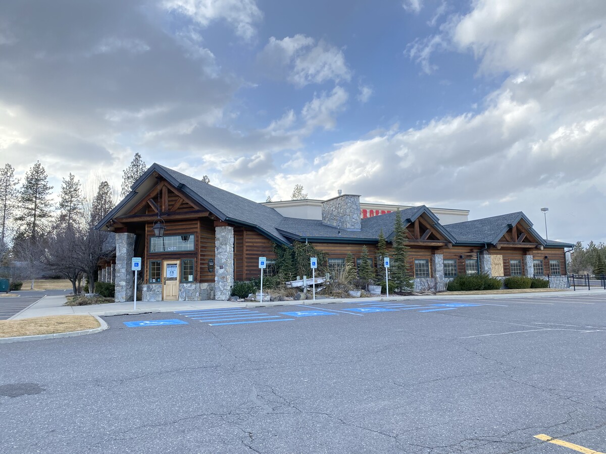
Property Record
12611 N Sr 395 Hwy, Spokane, WA 99218

NEARBY LISTINGS FOR SALE OR LEASE
Property Detail
12611 N Sr 395 Hwy
Spokane-Spokane Valley, WA
Ely Of Holms Acre Tracts 1St Add
36082.0801
08-26-43 LOT A BSP 2005-94 (AFN# 5203680) LYG ELY OF HOLMS ACRE TRACTS 1ST ADD & WLY OF SR 395
Storebuilding
Spokane
X
Washington
53063C0369D
a
2024
3.27 AC
2024
NW North Metro
010902
Spokane
11,879 SF
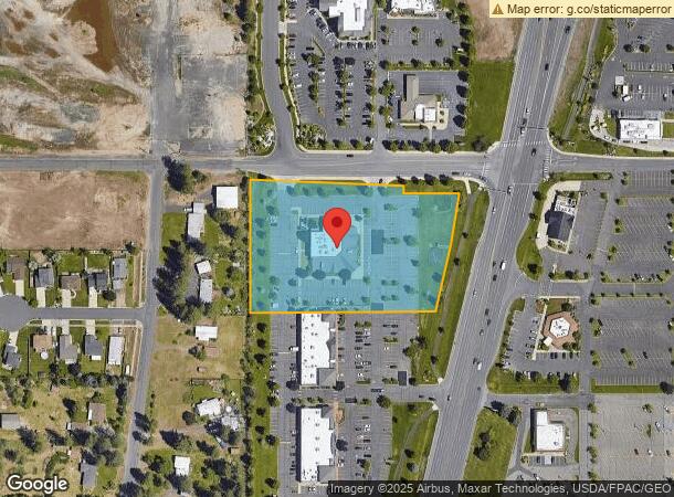
DEMOGRAPHICS near 12611 N Sr 395 Hwy
1 Mile
3 Mile
5 Mile
2024 Total Population
9,214
40,939
111,627
2029 Population
9,713
43,388
118,349
Pop Growth 2024-2029
+ 5.42%
+ 5.98%
+ 6.02%
Average Age
43
39
40
2024 Total Households
3,488
15,043
42,989
HH Growth 2024-2029
+ 5.45%
+ 6.17%
+ 6.19%
Median Household Inc
$78,496
$74,090
$68,589
Avg Household Size
2.50
2.60
2.50
2024 Avg HH Vehicles
2.00
2.00
2.00
Median Home Value
$414,647
$389,564
$359,725
Median Year Built
1991
1988
1980
Nearby Places
- Restaurants
- Banks
- Shops
- Fitness
- Groceries
PUBLIC TRANSPORTATION
COMMUTER RAIL
Spokane (Empire Builder - Amtrak)
DRIVE
WALK
Distance
Spokane (Empire Builder - Amtrak)
19 min
8.3 mi
AIRPORT
Spokane International
DRIVE
WALK
Distance
Spokane International
29 min
14.8 mi
Freight Ports
Port of Everett
DRIVE
WALK
Distance
Port of Everett
357 min
310.4 mi
SALE & LEASE HISTORY
LISTING DATE
SALE/LEASE

Jan 24, 2022
For Lease
Nearby Properties
Address
Land Use
TOTAL SIZE
Lot Size
Zoning
Address
Land Use
TOTAL SIZE
Lot Size
Zoning
523,081 SF
92.96 AC
LDR
Address
Land Use
TOTAL SIZE
Lot Size
Zoning
278,777 SF
5.47 AC
HDR
Address
Land Use
TOTAL SIZE
Lot Size
Zoning
317,476 SF
31.10 AC
GC
Address
Land Use
TOTAL SIZE
Lot Size
Zoning
78,497 SF
9.19 AC
MU
Address
Land Use
TOTAL SIZE
Lot Size
Zoning
215,573 SF
11.30 AC
HDR
Address
Land Use
TOTAL SIZE
Lot Size
Zoning
172,525 SF
8.18 AC
HDR
Address
Land Use
TOTAL SIZE
Lot Size
Zoning
73,593 SF
7.24 AC
RMF
Address
Land Use
TOTAL SIZE
Lot Size
Zoning
116,772 SF
8.56 AC
MU
Address
Land Use
TOTAL SIZE
Lot Size
Zoning
76,224 SF
12.67 AC
RMF
Address
Land Use
TOTAL SIZE
Lot Size
Zoning
150,061 SF
5.01 AC
GC
Address
Land Use
TOTAL SIZE
Lot Size
Zoning
76,224 SF
13.94 AC
RMF
Address
Land Use
TOTAL SIZE
Lot Size
Zoning
166,390 SF
19.33 AC
MU
Address
Land Use
TOTAL SIZE
Lot Size
Zoning
107,246 SF
6.63 AC
GC
Address
Land Use
TOTAL SIZE
Lot Size
Zoning
67,094 SF
9.33 AC
RSF
Address
Land Use
TOTAL SIZE
Lot Size
Zoning
230,295 SF
22.41 AC
GC
Address
Land Use
TOTAL SIZE
Lot Size
Zoning
35,343 SF
5.31 AC
GC
Address
Land Use
TOTAL SIZE
Lot Size
Zoning
59,303 SF
5.52 AC
HDR
Address
Land Use
TOTAL SIZE
Lot Size
Zoning
156,212 SF
11.31 AC
MU
Address
Land Use
TOTAL SIZE
Lot Size
Zoning
209,047 SF
41.68 AC
HI
Address
Land Use
TOTAL SIZE
Lot Size
Zoning
121,519 SF
6.26 AC
HDR
Address
Land Use
TOTAL SIZE
Lot Size
Zoning
183,152 SF
38.47 AC
LDR
Address
Land Use
TOTAL SIZE
Lot Size
Zoning
64,558 SF
11.91 AC
LDR
Address
Land Use
TOTAL SIZE
Lot Size
Zoning
165,390 SF
15.18 AC
RC
Address
Land Use
TOTAL SIZE
Lot Size
Zoning
317,375 SF
36.25 AC
LDR
Address
Land Use
TOTAL SIZE
Lot Size
Zoning
71,200 SF
7.15 AC
RMF
Address
Land Use
TOTAL SIZE
Lot Size
Zoning
79,576 SF
12.71 AC
GC
Address
Land Use
TOTAL SIZE
Lot Size
Zoning
57,420 SF
4.28 AC
GC
Address
Land Use
TOTAL SIZE
Lot Size
Zoning
119,355 SF
22.82 AC
LDR
Address
Land Use
TOTAL SIZE
Lot Size
Zoning
68,670 SF
19.71 AC
UR
Address
Land Use
TOTAL SIZE
Lot Size
Zoning
98,738 SF
6.14 AC
O
The World's #1 Commercial Real Estate Marketplace
Connect with us
© 2025 CoStar Group
The information above has been obtained from sources believed reliable. While we do not doubt its accuracy we have not verified it and make no guarantee, warranty or representation about it. It is your responsibility to independently confirm its accuracy and completeness. Any projections, opinions, assumptions, or estimates used are for example only and do not represent the current or future performance of the property. The value of this transaction to you depends on tax and other factors which should be evaluated by your tax, financial, and legal advisors. You and your advisors should conduct a careful, independent investigation of the property to determine to your satisfaction the suitability of the property for your needs.