Property Record
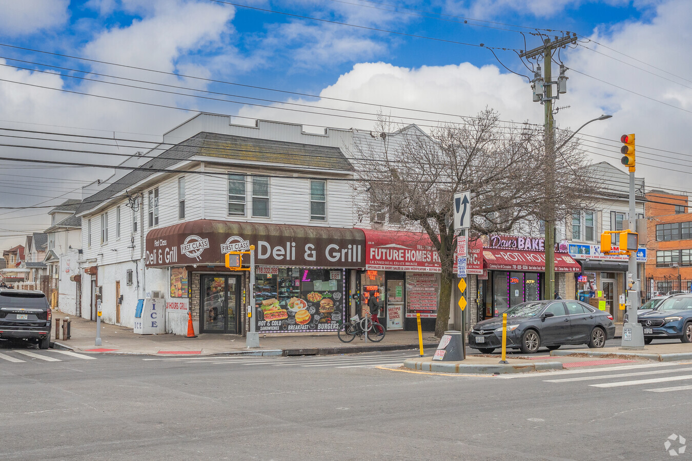
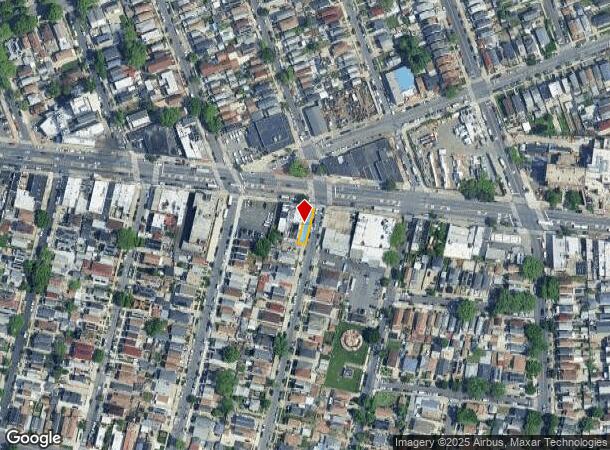
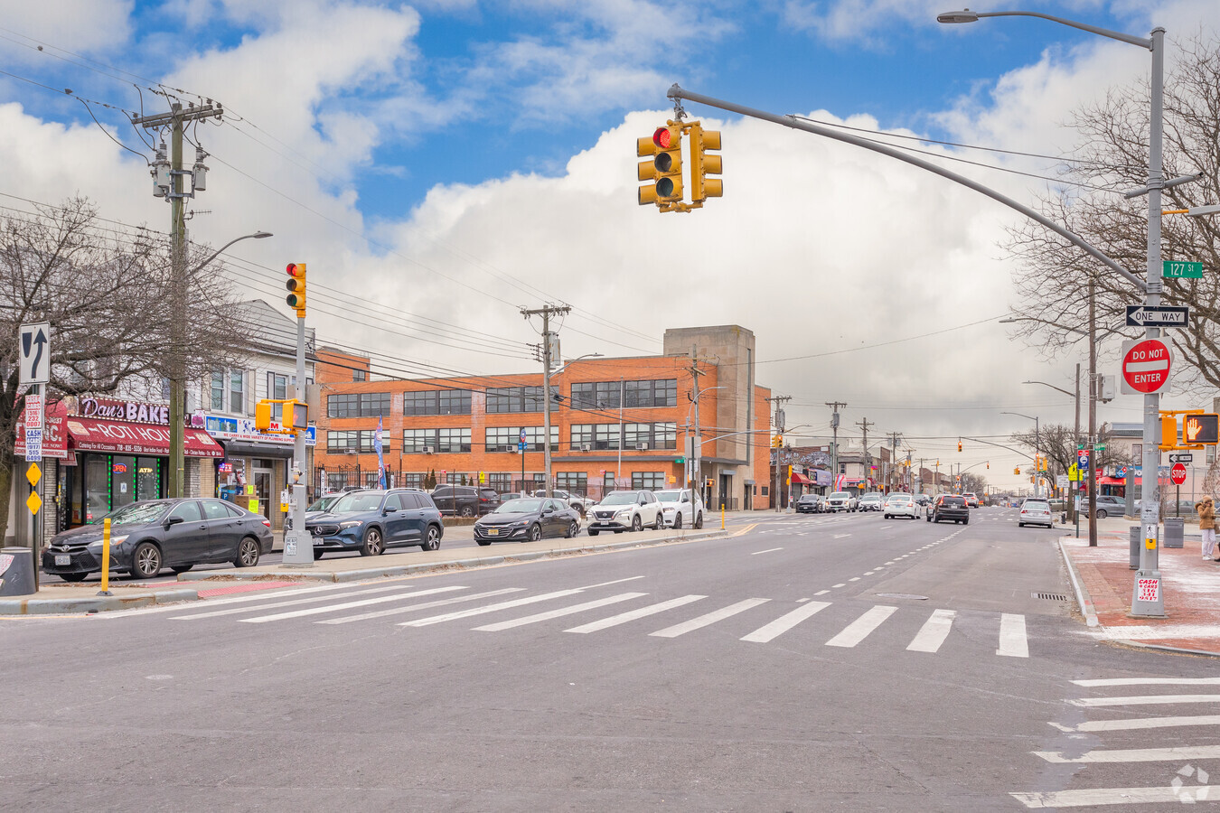
12620 Rockaway Blvd, South Ozone Park, NY 11420
Current Lease Availabilities
NEARBY LISTINGS FOR SALE OR LEASE
Property Detail
12620 Rockaway Blvd
11748-0062
Richmond Hill Arcade 03
Storebuilding
Queens
X
New York
3604970241F
62
2024
0.05 AC
2024
South Queens
084000
Long Island (New York)
3,500 SF
New York-Jersey City-White Plains, NY-NJ
DEMOGRAPHICS near 12620 Rockaway Blvd
1 Mile
3 Mile
5 Mile
2024 Total Population
63,831
495,884
1,198,867
2029 Population
57,585
457,012
1,112,099
Pop Growth 2024-2029
(9.79%)
(7.84%)
(7.24%)
Average Age
41
41
41
2024 Total Households
18,173
158,062
402,611
HH Growth 2024-2029
(10.46%)
(7.97%)
(7.39%)
Median Household Inc
$84,677
$71,532
$72,155
Avg Household Size
3.30
3.00
2.80
2024 Avg HH Vehicles
1.00
1.00
1.00
Median Home Value
$663,727
$635,422
$651,355
Median Year Built
1948
1951
1952
Nearby Places
- Restaurants
- Banks
- Shops
- Fitness
- Groceries
PUBLIC TRANSPORTATION
COMMUTER RAIL
Jamaica Station (Babylon Branch - Long Island Rail Road, Far Rockaway Branch - Long Island Rail Road, Hempstead Branch - Long Island Rail Road, Long Beach Branch - Long Island Rail Road, Montauk Branch - Long Island Rail Road, Oyster Bay Branch - Long Island Rail Road, Port Jefferson Branch - Long Island Rail Road, Ronkonkoma Branch - Long Island Rail Road, West Hempstead Branch - Long Island Rail Road)
DRIVE
WALK
Distance
Jamaica Station (Babylon Branch - Long Island Rail Road, Far Rockaway Branch - Long Island Rail Road, Hempstead Branch - Long Island Rail Road, Long Beach Branch - Long Island Rail Road, Montauk Branch - Long Island Rail Road, Oyster Bay Branch - Long Island Rail Road, Port Jefferson Branch - Long Island Rail Road, Ronkonkoma Branch - Long Island Rail Road, West Hempstead Branch - Long Island Rail Road)
4 min
2.6 mi
Locust Manor Station (Far Rockaway Branch - Long Island Rail Road)
DRIVE
WALK
Distance
Locust Manor Station (Far Rockaway Branch - Long Island Rail Road)
7 min
2.8 mi
AIRPORT
John F Kennedy International
DRIVE
WALK
Distance
John F Kennedy International
6 min
4.0 mi
Laguardia
DRIVE
WALK
Distance
Laguardia
14 min
9.0 mi
Newark Liberty International
DRIVE
WALK
Distance
Newark Liberty International
41 min
28.7 mi
Freight Ports
NY - Red Hook Container Terminal
DRIVE
WALK
Distance
NY - Red Hook Container Terminal
25 min
13.4 mi
Nearby Properties
Address
Land Use
TOTAL SIZE
Lot Size
Zoning
Address
Land Use
TOTAL SIZE
Lot Size
Zoning
14,417,607 SF
4,921.45 AC
M1-1
Address
Land Use
TOTAL SIZE
Lot Size
Zoning
1,845,252 SF
172 AC
C8-1
Address
Land Use
TOTAL SIZE
Lot Size
Zoning
1,069,367 SF
14.65 AC
R4
Address
Land Use
TOTAL SIZE
Lot Size
Zoning
484,470 SF
2.48 AC
R6
Address
Land Use
TOTAL SIZE
Lot Size
Zoning
294.47 AC
PARK
Address
Land Use
TOTAL SIZE
Lot Size
Zoning
731,247 SF
56.09 AC
R3-2
Address
Land Use
TOTAL SIZE
Lot Size
Zoning
126.85 AC
PARK
Address
Land Use
TOTAL SIZE
Lot Size
Zoning
738,000 SF
1.92 AC
C6-3
Address
Land Use
TOTAL SIZE
Lot Size
Zoning
291,589 SF
1.55 AC
C6-3
Address
Land Use
TOTAL SIZE
Lot Size
Zoning
2,193 SF
94.72 AC
PARK
Address
Land Use
TOTAL SIZE
Lot Size
Zoning
234,452 SF
2.99 AC
R4
Address
Land Use
TOTAL SIZE
Lot Size
Zoning
320,535 SF
1.52 AC
C4-4A
Address
Land Use
TOTAL SIZE
Lot Size
Zoning
384,249 SF
5.56 AC
R5
Address
Land Use
TOTAL SIZE
Lot Size
Zoning
364,424 SF
C5-3
Address
Land Use
TOTAL SIZE
Lot Size
Zoning
360,000 SF
8.78 AC
R6
Address
Land Use
TOTAL SIZE
Lot Size
Zoning
230,580 SF
3.40 AC
C8-1
Address
Land Use
TOTAL SIZE
Lot Size
Zoning
535,609 SF
0.82 AC
C6-4
Address
Land Use
TOTAL SIZE
Lot Size
Zoning
497,600 SF
6.79 AC
C4-4
Address
Land Use
TOTAL SIZE
Lot Size
Zoning
208,952 SF
9.03 AC
M1-1
Address
Land Use
TOTAL SIZE
Lot Size
Zoning
107,000 SF
1.84 AC
R6
Address
Land Use
TOTAL SIZE
Lot Size
Zoning
552,216 SF
9.41 AC
R4
Address
Land Use
TOTAL SIZE
Lot Size
Zoning
240,000 SF
14.50 AC
R4
Address
Land Use
TOTAL SIZE
Lot Size
Zoning
183,070 SF
4.47 AC
M1-1
Address
Land Use
TOTAL SIZE
Lot Size
Zoning
1,396,750 SF
12.56 AC
R6
Address
Land Use
TOTAL SIZE
Lot Size
Zoning
295,904 SF
0.63 AC
C6-3
Address
Land Use
TOTAL SIZE
Lot Size
Zoning
240,000 SF
1.90 AC
C6-3
Address
Land Use
TOTAL SIZE
Lot Size
Zoning
400,343 SF
1.54 AC
C4-4
Address
Land Use
TOTAL SIZE
Lot Size
Zoning
471,648 SF
1.46 AC
C6-3
Address
Land Use
TOTAL SIZE
Lot Size
Zoning
4,750 SF
18.41 AC
R5
Address
Land Use
TOTAL SIZE
Lot Size
Zoning
285,170 SF
12.63 AC
R3-1
The World's #1 Commercial Real Estate Marketplace
Connect with us
© 2025 CoStar Group
The information above has been obtained from sources believed reliable. While we do not doubt its accuracy we have not verified it and make no guarantee, warranty or representation about it. It is your responsibility to independently confirm its accuracy and completeness. Any projections, opinions, assumptions, or estimates used are for example only and do not represent the current or future performance of the property. The value of this transaction to you depends on tax and other factors which should be evaluated by your tax, financial, and legal advisors. You and your advisors should conduct a careful, independent investigation of the property to determine to your satisfaction the suitability of the property for your needs.