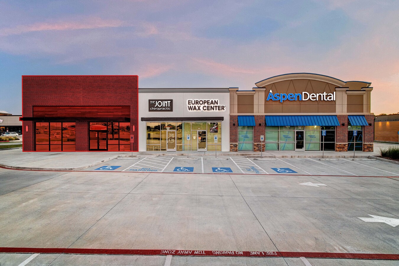
Property Record
12651 State Highway 249 Pkwy, Houston, TX 77086
Current Lease Availabilities
NEARBY LISTINGS FOR SALE OR LEASE
Property Detail
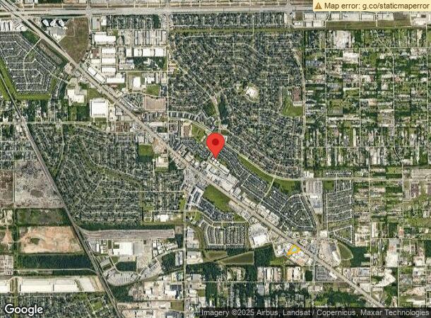
12651 State Highway 249 Pkwy
Houston-The Woodlands-Sugar Land, TX
Marketplace 249 Reserve Sec 1
1415290010006
RES A1-C BLK 1 MARKETPLACE 249 RESERVE SEC 1
Commercialnec
Harris
2023
Texas
2024
1.44 AC
533903
Near Northwest Oaks
8,775 SF
Houston
DEMOGRAPHICS near 12651 State Highway 249 Pkwy
1 Mile
3 Mile
5 Mile
2024 Total Population
9,370
114,059
305,545
2029 Population
9,449
113,490
307,153
Pop Growth 2024-2029
+ 0.84%
(0.50%)
+ 0.53%
Average Age
35
36
36
2024 Total Households
2,764
33,288
98,272
HH Growth 2024-2029
+ 0.76%
(0.69%)
+ 0.47%
Median Household Inc
$58,465
$55,762
$49,512
Avg Household Size
3.30
3.30
3.00
2024 Avg HH Vehicles
2.00
2.00
2.00
Median Home Value
$159,310
$162,059
$174,442
Median Year Built
1989
1983
1984
Nearby Places
- Restaurants
- Banks
- Shops
- Fitness
- Groceries
PUBLIC TRANSPORTATION
AIRPORT
George Bush Intcntl/Houston
DRIVE
WALK
Distance
George Bush Intcntl/Houston
18 min
14.3 mi
William P Hobby
DRIVE
WALK
Distance
William P Hobby
44 min
27.8 mi
Freight Ports
Port of Houston
DRIVE
WALK
Distance
Port of Houston
36 min
23.3 mi
Nearby Properties
Address
Land Use
TOTAL SIZE
Lot Size
Zoning
Address
Land Use
TOTAL SIZE
Lot Size
Zoning
778,140 SF
40.25 AC
Address
Land Use
TOTAL SIZE
Lot Size
Zoning
552,757 SF
32.95 AC
Address
Land Use
TOTAL SIZE
Lot Size
Zoning
397,248 SF
26.37 AC
Address
Land Use
TOTAL SIZE
Lot Size
Zoning
546,420 SF
40.07 AC
Address
Land Use
TOTAL SIZE
Lot Size
Zoning
527,744 SF
35.46 AC
Address
Land Use
TOTAL SIZE
Lot Size
Zoning
365,380 SF
19.17 AC
Address
Land Use
TOTAL SIZE
Lot Size
Zoning
424,122 SF
21.06 AC
Address
Land Use
TOTAL SIZE
Lot Size
Zoning
399,828 SF
20.32 AC
Address
Land Use
TOTAL SIZE
Lot Size
Zoning
361,800 SF
18.20 AC
Address
Land Use
TOTAL SIZE
Lot Size
Zoning
614,712 SF
7.92 AC
Address
Land Use
TOTAL SIZE
Lot Size
Zoning
351,235 SF
20.73 AC
Address
Land Use
TOTAL SIZE
Lot Size
Zoning
357,300 SF
23.38 AC
Address
Land Use
TOTAL SIZE
Lot Size
Zoning
356,656 SF
23.54 AC
Address
Land Use
TOTAL SIZE
Lot Size
Zoning
215,968 SF
17.23 AC
Address
Land Use
TOTAL SIZE
Lot Size
Zoning
299,280 SF
15.71 AC
Address
Land Use
TOTAL SIZE
Lot Size
Zoning
293,280 SF
16.24 AC
Address
Land Use
TOTAL SIZE
Lot Size
Zoning
502,860 SF
40.99 AC
Address
Land Use
TOTAL SIZE
Lot Size
Zoning
272,600 SF
23.27 AC
Address
Land Use
TOTAL SIZE
Lot Size
Zoning
352,680 SF
28.20 AC
Address
Land Use
TOTAL SIZE
Lot Size
Zoning
200,123 SF
14.94 AC
Address
Land Use
TOTAL SIZE
Lot Size
Zoning
240,905 SF
19.98 AC
Address
Land Use
TOTAL SIZE
Lot Size
Zoning
241,946 SF
14.02 AC
Address
Land Use
TOTAL SIZE
Lot Size
Zoning
523,507 SF
38.28 AC
Address
Land Use
TOTAL SIZE
Lot Size
Zoning
172,500 SF
13.15 AC
Address
Land Use
TOTAL SIZE
Lot Size
Zoning
214.58 AC
Address
Land Use
TOTAL SIZE
Lot Size
Zoning
253,369 SF
16.81 AC
Address
Land Use
TOTAL SIZE
Lot Size
Zoning
209,825 SF
11.97 AC
Address
Land Use
TOTAL SIZE
Lot Size
Zoning
264,996 SF
18.94 AC
Address
Land Use
TOTAL SIZE
Lot Size
Zoning
333,286 SF
13.95 AC
Address
Land Use
TOTAL SIZE
Lot Size
Zoning
705,525 SF
167.38 AC
The World's #1 Commercial Real Estate Marketplace
Connect with us
© 2025 CoStar Group
The information above has been obtained from sources believed reliable. While we do not doubt its accuracy we have not verified it and make no guarantee, warranty or representation about it. It is your responsibility to independently confirm its accuracy and completeness. Any projections, opinions, assumptions, or estimates used are for example only and do not represent the current or future performance of the property. The value of this transaction to you depends on tax and other factors which should be evaluated by your tax, financial, and legal advisors. You and your advisors should conduct a careful, independent investigation of the property to determine to your satisfaction the suitability of the property for your needs.