Property Record
127 Blandy Rd Nw, Milledgeville, GA 31061
NEARBY LISTINGS FOR SALE OR LEASE
-
-
View all Milledgeville listings for lease on LoopNet.com
Property Detail
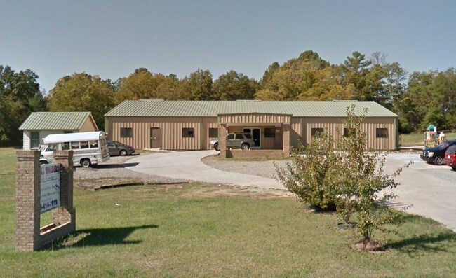
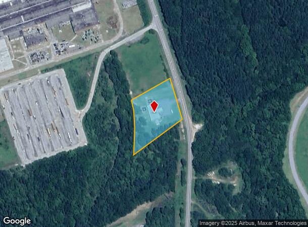
127 Blandy Rd Nw
Milledgeville, GA
Comm-Slandy Cir
068-001H
TRACT B PB 32-1 DB 1346-94
Daycare
Baldwin
X
Georgia
13009C0135D
266
2024
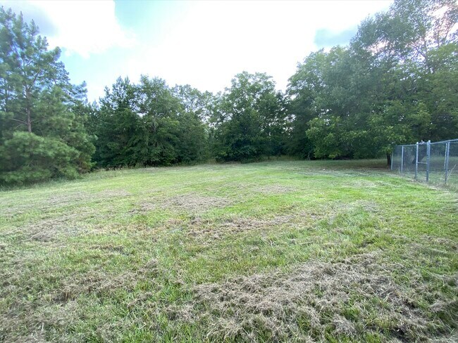
2 AC
2024
Georgia South Area
970502
Other Market Areas
6,000 SF
DEMOGRAPHICS near 127 Blandy Rd Nw
1 Mile
3 Mile
5 Mile
2024 Total Population
218
15,247
26,884
2029 Population
214
15,206
26,857
Pop Growth 2024-2029
(1.83%)
(0.27%)
(0.10%)
Average Age
42
36
38
2024 Total Households
88
6,026
10,568
HH Growth 2024-2029
(2.27%)
(0.33%)
(0.15%)
Median Household Inc
$78,629
$35,605
$39,592
Avg Household Size
2.40
2.20
2.30
2024 Avg HH Vehicles
2.00
2.00
2.00
Median Home Value
$250,000
$164,352
$161,950
Median Year Built
1985
1978
1980
Nearby Places
- Restaurants
- Banks
- Shops
- Fitness
- Groceries
SALE & LEASE HISTORY
LISTING DATE
SALE/LEASE

Oct 24, 2016
For Sale
Aug 05, 2020
For Lease
Nearby Properties
Address
Land Use
TOTAL SIZE
Lot Size
Zoning
Address
Land Use
TOTAL SIZE
Lot Size
Zoning
19.20 AC
RESIDENTIA
Address
Land Use
TOTAL SIZE
Lot Size
Zoning
29.65 AC
RESIDENTIA
Address
Land Use
TOTAL SIZE
Lot Size
Zoning
59,500 SF
44 AC
RESIDENTIA
Address
Land Use
TOTAL SIZE
Lot Size
Zoning
430,556 SF
32.09 AC
RESIDENTIA
Address
Land Use
TOTAL SIZE
Lot Size
Zoning
74,448 SF
49 AC
RESIDENTIA
Address
Land Use
TOTAL SIZE
Lot Size
Zoning
92,400 SF
30 AC
RESIDENTIA
Address
Land Use
TOTAL SIZE
Lot Size
Zoning
2.50 AC
RESIDENTIA
Address
Land Use
TOTAL SIZE
Lot Size
Zoning
49,412 SF
0.26 AC
RESIDENTIA
Address
Land Use
TOTAL SIZE
Lot Size
Zoning
313,804 SF
17.50 AC
RESIDENTIA
Address
Land Use
TOTAL SIZE
Lot Size
Zoning
386,880 SF
17.52 AC
RESIDENTIA
Address
Land Use
TOTAL SIZE
Lot Size
Zoning
67,500 SF
1.70 AC
RESIDENTIA
Address
Land Use
TOTAL SIZE
Lot Size
Zoning
30.05 AC
RESIDENTIA
Address
Land Use
TOTAL SIZE
Lot Size
Zoning
866,082 SF
6.61 AC
RESIDENTIA
Address
Land Use
TOTAL SIZE
Lot Size
Zoning
40,800 SF
0.14 AC
RESIDENTIA
Address
Land Use
TOTAL SIZE
Lot Size
Zoning
12.30 AC
RESIDENTIA
Address
Land Use
TOTAL SIZE
Lot Size
Zoning
66,430 SF
14.93 AC
COMMERCIAL
Address
Land Use
TOTAL SIZE
Lot Size
Zoning
127,410 SF
25.98 AC
RESIDENTIA
Address
Land Use
TOTAL SIZE
Lot Size
Zoning
228,844 SF
3.20 AC
RESIDENTIA
Address
Land Use
TOTAL SIZE
Lot Size
Zoning
554,286 SF
24.17 AC
RESIDENTIA
Address
Land Use
TOTAL SIZE
Lot Size
Zoning
19.50 AC
RESIDENTIA
Address
Land Use
TOTAL SIZE
Lot Size
Zoning
6,318 SF
27.92 AC
RESIDENTIA
Address
Land Use
TOTAL SIZE
Lot Size
Zoning
76,800 SF
0.86 AC
UNZONED UR
Address
Land Use
TOTAL SIZE
Lot Size
Zoning
46,858 SF
2.64 AC
RESIDENTIA
Address
Land Use
TOTAL SIZE
Lot Size
Zoning
50,580 SF
7.61 AC
COMMERCIAL
Address
Land Use
TOTAL SIZE
Lot Size
Zoning
34,953 SF
2.17 AC
RESIDENTIA
Address
Land Use
TOTAL SIZE
Lot Size
Zoning
76,582 SF
3.17 AC
RESIDENTIA
Address
Land Use
TOTAL SIZE
Lot Size
Zoning
37,296 SF
13.50 AC
RESIDENTIA
Address
Land Use
TOTAL SIZE
Lot Size
Zoning
17,980 SF
2.30 AC
COMMERCIAL
Address
Land Use
TOTAL SIZE
Lot Size
Zoning
160,604 SF
8.29 AC
RESIDENTIA
Address
Land Use
TOTAL SIZE
Lot Size
Zoning
7,764 SF
10 AC
UNZONED RU
The World's #1 Commercial Real Estate Marketplace
Connect with us
© 2025 CoStar Group
The information above has been obtained from sources believed reliable. While we do not doubt its accuracy we have not verified it and make no guarantee, warranty or representation about it. It is your responsibility to independently confirm its accuracy and completeness. Any projections, opinions, assumptions, or estimates used are for example only and do not represent the current or future performance of the property. The value of this transaction to you depends on tax and other factors which should be evaluated by your tax, financial, and legal advisors. You and your advisors should conduct a careful, independent investigation of the property to determine to your satisfaction the suitability of the property for your needs.