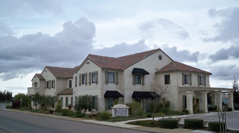
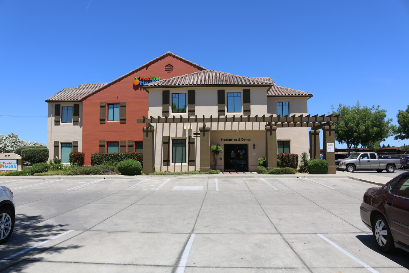
Property Record
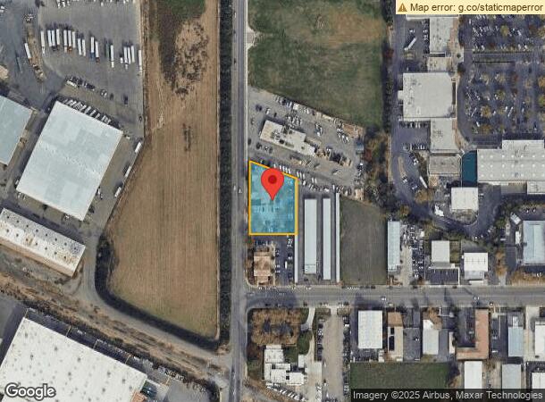
1275 Tharp Rd, Yuba City, CA 95993

NEARBY LISTINGS FOR SALE OR LEASE
Property Detail
1275 Tharp Rd
Sacramento
Map 993
Yuba City, CA
FORMERLY PTN OF 04-391-012 PARCEL 002 OF PARCEL MAP 993, RECORDED 6-6-01 FORMERLY @: 04-391-014 - ADDED 10-08-2002
59-131-014
Sutter
Commercialnec
California
2023
2
2023
0.80 AC
050603
Sutter County
13,410 SF
DEMOGRAPHICS near 1275 Tharp Rd
1 Mile
3 Mile
5 Mile
2024 Total Population
9,125
68,765
101,742
2029 Population
9,017
68,254
103,089
Pop Growth 2024-2029
(1.18%)
(0.74%)
+ 1.32%
Average Age
41
39
39
2024 Total Households
3,320
23,429
34,205
HH Growth 2024-2029
(1.17%)
(0.68%)
+ 1.53%
Median Household Inc
$56,637
$60,739
$59,883
Avg Household Size
2.70
2.90
2.90
2024 Avg HH Vehicles
2.00
2.00
2.00
Median Home Value
$382,394
$354,156
$344,970
Median Year Built
1982
1979
1979
Nearby Places
- Restaurants
- Banks
- Shops
- Fitness
- Groceries
SALE & LEASE HISTORY
LISTING DATE
SALE/LEASE

Sep 24, 2016
For Sale
Sep 04, 2018
For Sale
Nearby Properties
Address
Land Use
TOTAL SIZE
Lot Size
Zoning
Address
Land Use
TOTAL SIZE
Lot Size
Zoning
1,028,560 SF
52.30 AC
M1
Address
Land Use
TOTAL SIZE
Lot Size
Zoning
30,734 SF
1.38 AC
C-3
Address
Land Use
TOTAL SIZE
Lot Size
Zoning
25,580 SF
9.48 AC
C3
Address
Land Use
TOTAL SIZE
Lot Size
Zoning
98,830 SF
0.40 AC
C-3
Address
Land Use
TOTAL SIZE
Lot Size
Zoning
48,348 SF
3.25 AC
Address
Land Use
TOTAL SIZE
Lot Size
Zoning
143,368 SF
11.40 AC
Address
Land Use
TOTAL SIZE
Lot Size
Zoning
92,312 SF
17.04 AC
Address
Land Use
TOTAL SIZE
Lot Size
Zoning
120,622 SF
2.25 AC
Address
Land Use
TOTAL SIZE
Lot Size
Zoning
259,011 SF
14.20 AC
M1
Address
Land Use
TOTAL SIZE
Lot Size
Zoning
55,702 SF
3.16 AC
Address
Land Use
TOTAL SIZE
Lot Size
Zoning
147,546 SF
7.55 AC
R3
Address
Land Use
TOTAL SIZE
Lot Size
Zoning
49,817 SF
2.81 AC
C3
Address
Land Use
TOTAL SIZE
Lot Size
Zoning
176,181 SF
6.99 AC
CM
Address
Land Use
TOTAL SIZE
Lot Size
Zoning
53,600 SF
8.15 AC
Address
Land Use
TOTAL SIZE
Lot Size
Zoning
50,270 SF
4.16 AC
CO
Address
Land Use
TOTAL SIZE
Lot Size
Zoning
105,160 SF
8.99 AC
Address
Land Use
TOTAL SIZE
Lot Size
Zoning
137,178 SF
11.01 AC
C3
Address
Land Use
TOTAL SIZE
Lot Size
Zoning
140,846 SF
12.98 AC
C3
Address
Land Use
TOTAL SIZE
Lot Size
Zoning
48,117 SF
1.81 AC
R1
Address
Land Use
TOTAL SIZE
Lot Size
Zoning
138,490 SF
18.72 AC
C3
Address
Land Use
TOTAL SIZE
Lot Size
Zoning
115,058 SF
13.03 AC
Address
Land Use
TOTAL SIZE
Lot Size
Zoning
41,279 SF
5.18 AC
Address
Land Use
TOTAL SIZE
Lot Size
Zoning
90,130 SF
8.42 AC
Address
Land Use
TOTAL SIZE
Lot Size
Zoning
2.53 AC
Address
Land Use
TOTAL SIZE
Lot Size
Zoning
37,854 SF
6 AC
C3
Address
Land Use
TOTAL SIZE
Lot Size
Zoning
56,257 SF
1.73 AC
Address
Land Use
TOTAL SIZE
Lot Size
Zoning
39,340 SF
6.51 AC
Address
Land Use
TOTAL SIZE
Lot Size
Zoning
203,184 SF
17.82 AC
C3
Address
Land Use
TOTAL SIZE
Lot Size
Zoning
42,986 SF
4.85 AC
C3
Address
Land Use
TOTAL SIZE
Lot Size
Zoning
29,062 SF
1.55 AC
C3
The World's #1 Commercial Real Estate Marketplace
Connect with us
© 2025 CoStar Group
The information above has been obtained from sources believed reliable. While we do not doubt its accuracy we have not verified it and make no guarantee, warranty or representation about it. It is your responsibility to independently confirm its accuracy and completeness. Any projections, opinions, assumptions, or estimates used are for example only and do not represent the current or future performance of the property. The value of this transaction to you depends on tax and other factors which should be evaluated by your tax, financial, and legal advisors. You and your advisors should conduct a careful, independent investigation of the property to determine to your satisfaction the suitability of the property for your needs.