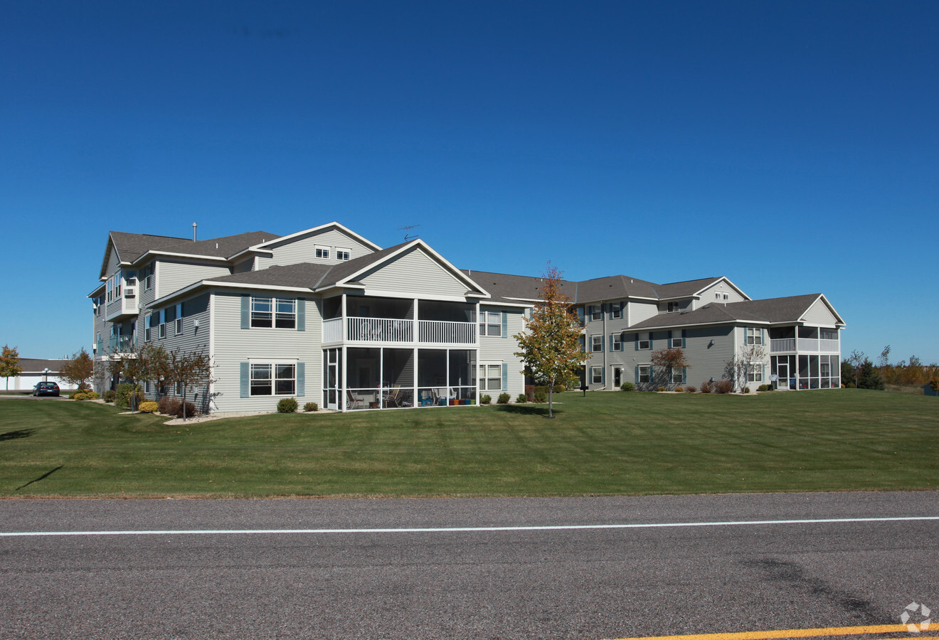
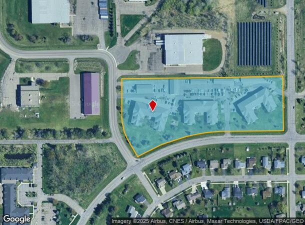
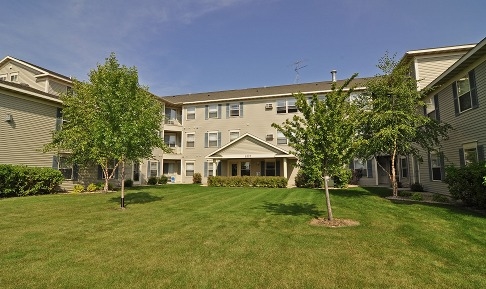
Property Record
1277 15Th St Ne, Sauk Rapids, MN 56379
NEARBY LISTINGS FOR SALE OR LEASE
-
-
View all Sauk Rapids listings for sale on LoopNet.com
Property Detail
1277 15Th St Ne
St. Cloud, MN
City View
19.03515.00
SECT-24 TWP-036 RANGE-031 CITY VIEW LOT-001 BLOCK-001
Multifamilydwelling
Benton
X
Minnesota
27145C0635E
1
2024
6.61 AC
2024
Outlying Benton County
021102
Minneapolis/St Paul
DEMOGRAPHICS near 1277 15Th St Ne
1 Mile
3 Mile
5 Mile
2024 Total Population
3,448
44,737
93,497
2029 Population
3,472
45,820
96,459
Pop Growth 2024-2029
+ 0.70%
+ 2.42%
+ 3.17%
Average Age
36
36
37
2024 Total Households
1,416
17,972
37,009
HH Growth 2024-2029
+ 0.64%
+ 2.52%
+ 3.20%
Median Household Inc
$71,419
$50,222
$54,782
Avg Household Size
2.40
2.30
2.30
2024 Avg HH Vehicles
2.00
2.00
2.00
Median Home Value
$245,454
$173,657
$189,958
Median Year Built
2000
1977
1982
Nearby Places
- Restaurants
- Banks
- Shops
- Fitness
- Groceries
PUBLIC TRANSPORTATION
COMMUTER RAIL
St. Cloud Amtrak Station (Empire Builder - Amtrak)
DRIVE
WALK
Distance
St. Cloud Amtrak Station (Empire Builder - Amtrak)
6 min
2.5 mi
Freight Ports
Port Milwaukee
DRIVE
WALK
Distance
Port Milwaukee
454 min
404.0 mi
Nearby Properties
Address
Land Use
TOTAL SIZE
Lot Size
Zoning
Address
Land Use
TOTAL SIZE
Lot Size
Zoning
16.60 AC
MD
Address
Land Use
TOTAL SIZE
Lot Size
Zoning
362,000 SF
86.20 AC
Address
Land Use
TOTAL SIZE
Lot Size
Zoning
Address
Land Use
TOTAL SIZE
Lot Size
Zoning
281,127 SF
135,381 AC
PUD95
Address
Land Use
TOTAL SIZE
Lot Size
Zoning
252,469 SF
35 AC
Address
Land Use
TOTAL SIZE
Lot Size
Zoning
149,778 SF
7.86 AC
Address
Land Use
TOTAL SIZE
Lot Size
Zoning
Address
Land Use
TOTAL SIZE
Lot Size
Zoning
Address
Land Use
TOTAL SIZE
Lot Size
Zoning
127,460 SF
5 AC
Address
Land Use
TOTAL SIZE
Lot Size
Zoning
183,627 SF
3 AC
R3
Address
Land Use
TOTAL SIZE
Lot Size
Zoning
25,608 SF
6.96 AC
R5
Address
Land Use
TOTAL SIZE
Lot Size
Zoning
36,393 SF
6.28 AC
Address
Land Use
TOTAL SIZE
Lot Size
Zoning
100,024 SF
0.47 AC
Address
Land Use
TOTAL SIZE
Lot Size
Zoning
Address
Land Use
TOTAL SIZE
Lot Size
Zoning
112,300 SF
2.27 AC
R3
Address
Land Use
TOTAL SIZE
Lot Size
Zoning
197,115 SF
18.27 AC
Address
Land Use
TOTAL SIZE
Lot Size
Zoning
29,349 SF
4.83 AC
Address
Land Use
TOTAL SIZE
Lot Size
Zoning
71,940 SF
1.99 AC
Address
Land Use
TOTAL SIZE
Lot Size
Zoning
24,642 SF
5.40 AC
R5
Address
Land Use
TOTAL SIZE
Lot Size
Zoning
161,067 SF
14.06 AC
Address
Land Use
TOTAL SIZE
Lot Size
Zoning
80,100 SF
11.01 AC
Address
Land Use
TOTAL SIZE
Lot Size
Zoning
22,122 SF
14.61 AC
Address
Land Use
TOTAL SIZE
Lot Size
Zoning
104,030 SF
6.49 AC
PUD4
Address
Land Use
TOTAL SIZE
Lot Size
Zoning
4.21 AC
Address
Land Use
TOTAL SIZE
Lot Size
Zoning
13,217 SF
3.38 AC
Address
Land Use
TOTAL SIZE
Lot Size
Zoning
107,428 SF
2.67 AC
R3
Address
Land Use
TOTAL SIZE
Lot Size
Zoning
Address
Land Use
TOTAL SIZE
Lot Size
Zoning
60,532 SF
1.38 AC
C4
Address
Land Use
TOTAL SIZE
Lot Size
Zoning
171,311 SF
1.77 AC
C3
The World's #1 Commercial Real Estate Marketplace
Connect with us
© 2025 CoStar Group
The information above has been obtained from sources believed reliable. While we do not doubt its accuracy we have not verified it and make no guarantee, warranty or representation about it. It is your responsibility to independently confirm its accuracy and completeness. Any projections, opinions, assumptions, or estimates used are for example only and do not represent the current or future performance of the property. The value of this transaction to you depends on tax and other factors which should be evaluated by your tax, financial, and legal advisors. You and your advisors should conduct a careful, independent investigation of the property to determine to your satisfaction the suitability of the property for your needs.