Property Record
12797 Adams Rd, Granger, IN 46530
NEARBY LISTINGS FOR SALE OR LEASE
-
-
View all Granger listings for sale on LoopNet.com
Property Detail
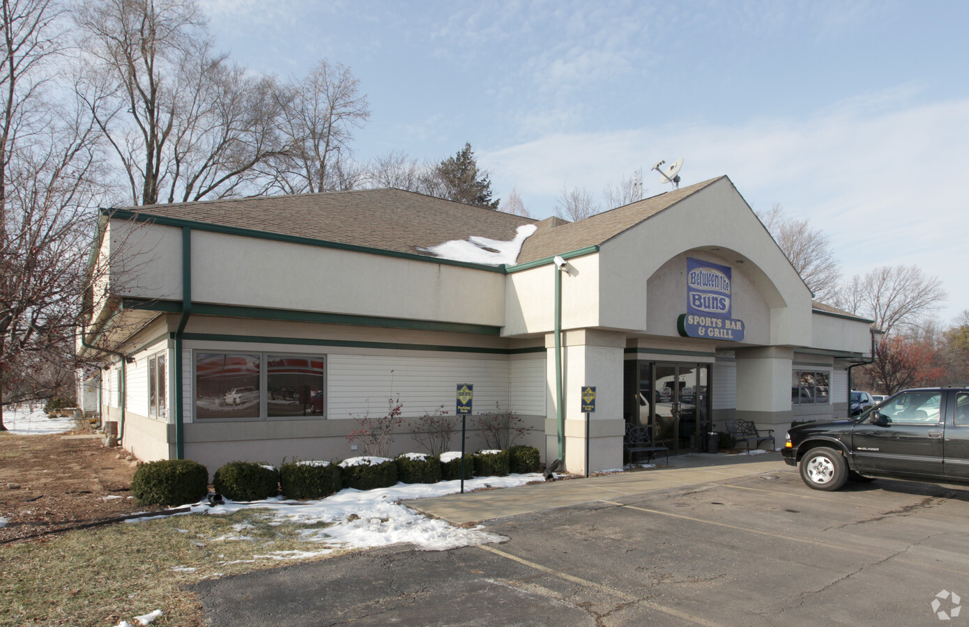
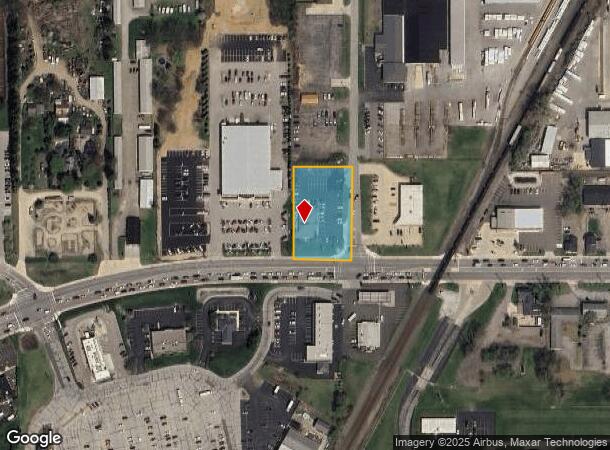
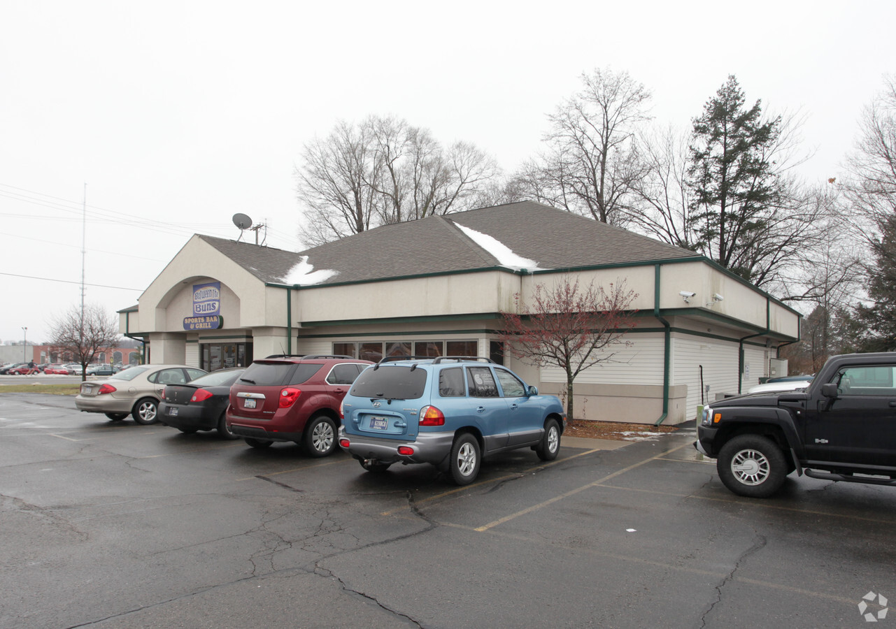
12797 Adams Rd
South Bend-Mishawaka, IN-MI
J & B Replat Of Reynolds Minor Sub
71-05-07-351-012.000-011
LOT BB J & B REPLAT OF REYNOLDS MINOR SUB EX 133 SQ FT SE COR 09/10 SPLIT TO STATE FOR STREET 2660WD 5-28-08
Restaurantbuilding
St Joseph
X
Indiana
18039C0015D
bb
2022
1.03 AC
2023
Outlying St Joseph County
011406
South Bend/Mishawaka
5,912 SF
DEMOGRAPHICS near 12797 Adams Rd
1 Mile
3 Mile
5 Mile
2024 Total Population
2,578
18,637
51,765
2029 Population
2,540
18,363
51,067
Pop Growth 2024-2029
(1.47%)
(1.47%)
(1.35%)
Average Age
39
39
40
2024 Total Households
851
6,155
19,183
HH Growth 2024-2029
(1.65%)
(1.56%)
(1.37%)
Median Household Inc
$109,269
$121,584
$96,171
Avg Household Size
2.90
3.00
2.60
2024 Avg HH Vehicles
2.00
2.00
2.00
Median Home Value
$260,160
$269,473
$247,354
Median Year Built
1989
1989
1987
Nearby Places
- Restaurants
- Banks
- Shops
- Fitness
- Groceries
PUBLIC TRANSPORTATION
AIRPORT
South Bend International
DRIVE
WALK
Distance
South Bend International
33 min
18.6 mi
Freight Ports
Port Milwaukee
DRIVE
WALK
Distance
Port Milwaukee
223 min
186.2 mi
Nearby Properties
Address
Land Use
TOTAL SIZE
Lot Size
Zoning
Address
Land Use
TOTAL SIZE
Lot Size
Zoning
276,540 SF
13.81 AC
Address
Land Use
TOTAL SIZE
Lot Size
Zoning
239,363 SF
8.26 AC
Address
Land Use
TOTAL SIZE
Lot Size
Zoning
146,337 SF
20.82 AC
Address
Land Use
TOTAL SIZE
Lot Size
Zoning
85,367 SF
5.67 AC
Address
Land Use
TOTAL SIZE
Lot Size
Zoning
66,856 SF
16.33 AC
Address
Land Use
TOTAL SIZE
Lot Size
Zoning
67,537 SF
7.74 AC
Address
Land Use
TOTAL SIZE
Lot Size
Zoning
108,400 SF
9.38 AC
Address
Land Use
TOTAL SIZE
Lot Size
Zoning
90,310 SF
9.60 AC
Address
Land Use
TOTAL SIZE
Lot Size
Zoning
36,438 SF
14.61 AC
Address
Land Use
TOTAL SIZE
Lot Size
Zoning
208.06 AC
Address
Land Use
TOTAL SIZE
Lot Size
Zoning
48,005 SF
9.22 AC
Address
Land Use
TOTAL SIZE
Lot Size
Zoning
28,156 SF
4.53 AC
Address
Land Use
TOTAL SIZE
Lot Size
Zoning
30,724 SF
7.55 AC
Address
Land Use
TOTAL SIZE
Lot Size
Zoning
12,096 SF
6.01 AC
Address
Land Use
TOTAL SIZE
Lot Size
Zoning
9.60 AC
Address
Land Use
TOTAL SIZE
Lot Size
Zoning
200,554 SF
24.33 AC
Address
Land Use
TOTAL SIZE
Lot Size
Zoning
17,148 SF
5.24 AC
Address
Land Use
TOTAL SIZE
Lot Size
Zoning
7.07 AC
Address
Land Use
TOTAL SIZE
Lot Size
Zoning
9,840 SF
38.89 AC
Address
Land Use
TOTAL SIZE
Lot Size
Zoning
1.48 AC
Address
Land Use
TOTAL SIZE
Lot Size
Zoning
67,724 SF
40.51 AC
Address
Land Use
TOTAL SIZE
Lot Size
Zoning
8.30 AC
Address
Land Use
TOTAL SIZE
Lot Size
Zoning
31,200 SF
2 AC
Address
Land Use
TOTAL SIZE
Lot Size
Zoning
16,581 SF
1.59 AC
Address
Land Use
TOTAL SIZE
Lot Size
Zoning
12,484 SF
40.98 AC
Address
Land Use
TOTAL SIZE
Lot Size
Zoning
10,456 SF
2.01 AC
Address
Land Use
TOTAL SIZE
Lot Size
Zoning
47.67 AC
Address
Land Use
TOTAL SIZE
Lot Size
Zoning
14,666 SF
2.34 AC
Address
Land Use
TOTAL SIZE
Lot Size
Zoning
14,859 SF
2.11 AC
Address
Land Use
TOTAL SIZE
Lot Size
Zoning
20,528 SF
1.46 AC
The World's #1 Commercial Real Estate Marketplace
Connect with us
© 2025 CoStar Group
The information above has been obtained from sources believed reliable. While we do not doubt its accuracy we have not verified it and make no guarantee, warranty or representation about it. It is your responsibility to independently confirm its accuracy and completeness. Any projections, opinions, assumptions, or estimates used are for example only and do not represent the current or future performance of the property. The value of this transaction to you depends on tax and other factors which should be evaluated by your tax, financial, and legal advisors. You and your advisors should conduct a careful, independent investigation of the property to determine to your satisfaction the suitability of the property for your needs.