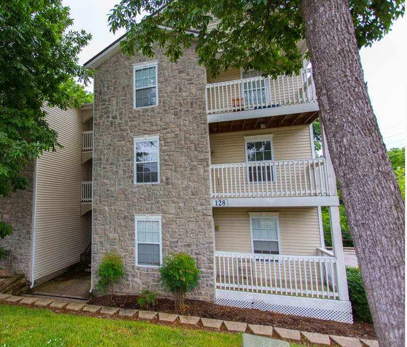
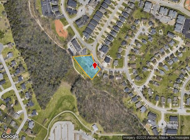
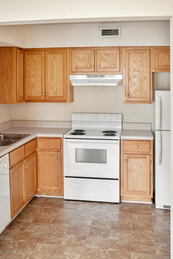
Property Record
128 River Tanmer Way, Bowling Green, KY 42101
NEARBY LISTINGS FOR SALE OR LEASE
Property Detail
128 River Tanmer Way
040A-29-082
Stonehenge
Multifamilydwelling
Warren
AE
Kentucky
21227C0301E
0.77 AC
2024
Bowling Green Area
2024
Other Market Areas
011002
Bowling Green, KY
6,990 SF
DEMOGRAPHICS near 128 River Tanmer Way
1 Mile
3 Mile
5 Mile
2024 Total Population
10,376
47,484
84,922
2029 Population
11,452
51,819
93,295
Pop Growth 2024-2029
+ 10.37%
+ 9.13%
+ 9.86%
Average Age
32
33
35
2024 Total Households
3,831
17,489
32,792
HH Growth 2024-2029
+ 10.73%
+ 9.89%
+ 10.54%
Median Household Inc
$45,791
$39,478
$48,879
Avg Household Size
2.60
2.30
2.40
2024 Avg HH Vehicles
2.00
2.00
2.00
Median Home Value
$145,599
$162,459
$220,365
Median Year Built
1996
1985
1989
Nearby Places
- Restaurants
- Banks
- Shops
- Fitness
- Groceries
SALE & LEASE HISTORY
LISTING DATE
SALE/LEASE

Oct 12, 2022
For Sale
Nearby Properties
Address
Land Use
TOTAL SIZE
Lot Size
Zoning
Address
Land Use
TOTAL SIZE
Lot Size
Zoning
117,551 SF
5.06 AC
Address
Land Use
TOTAL SIZE
Lot Size
Zoning
150,327 SF
2.54 AC
Address
Land Use
TOTAL SIZE
Lot Size
Zoning
39,504 SF
19.74 AC
Address
Land Use
TOTAL SIZE
Lot Size
Zoning
36,984 SF
6.88 AC
Address
Land Use
TOTAL SIZE
Lot Size
Zoning
49,434 SF
43.95 AC
Address
Land Use
TOTAL SIZE
Lot Size
Zoning
418,117 SF
44.30 AC
Address
Land Use
TOTAL SIZE
Lot Size
Zoning
214,273 SF
26.97 AC
Address
Land Use
TOTAL SIZE
Lot Size
Zoning
2,946 SF
3.59 AC
Address
Land Use
TOTAL SIZE
Lot Size
Zoning
82,675 SF
5.02 AC
Address
Land Use
TOTAL SIZE
Lot Size
Zoning
283,545 SF
38.28 AC
Address
Land Use
TOTAL SIZE
Lot Size
Zoning
38,782 SF
4.05 AC
Address
Land Use
TOTAL SIZE
Lot Size
Zoning
1,101 SF
16.07 AC
Address
Land Use
TOTAL SIZE
Lot Size
Zoning
3,200 SF
8.61 AC
Address
Land Use
TOTAL SIZE
Lot Size
Zoning
245,774 SF
39.12 AC
Address
Land Use
TOTAL SIZE
Lot Size
Zoning
241,486 SF
23.20 AC
Address
Land Use
TOTAL SIZE
Lot Size
Zoning
13,277 SF
1.21 AC
Address
Land Use
TOTAL SIZE
Lot Size
Zoning
168,353 SF
37.76 AC
Address
Land Use
TOTAL SIZE
Lot Size
Zoning
13,661 SF
6.25 AC
Address
Land Use
TOTAL SIZE
Lot Size
Zoning
43,663 SF
8.77 AC
Address
Land Use
TOTAL SIZE
Lot Size
Zoning
17,010 SF
9.64 AC
Address
Land Use
TOTAL SIZE
Lot Size
Zoning
11,568 SF
2.30 AC
Address
Land Use
TOTAL SIZE
Lot Size
Zoning
17,280 SF
8.89 AC
Address
Land Use
TOTAL SIZE
Lot Size
Zoning
63,584 SF
6.43 AC
Address
Land Use
TOTAL SIZE
Lot Size
Zoning
44,800 SF
8.99 AC
Address
Land Use
TOTAL SIZE
Lot Size
Zoning
8,458 SF
2.81 AC
Address
Land Use
TOTAL SIZE
Lot Size
Zoning
24,027 SF
2.27 AC
Address
Land Use
TOTAL SIZE
Lot Size
Zoning
27,100 SF
4.43 AC
Address
Land Use
TOTAL SIZE
Lot Size
Zoning
4,608 SF
8 AC
Address
Land Use
TOTAL SIZE
Lot Size
Zoning
468,214 SF
50.34 AC
Address
Land Use
TOTAL SIZE
Lot Size
Zoning
208,988 SF
13.64 AC
The World's #1 Commercial Real Estate Marketplace
Connect with us
© 2025 CoStar Group
The information above has been obtained from sources believed reliable. While we do not doubt its accuracy we have not verified it and make no guarantee, warranty or representation about it. It is your responsibility to independently confirm its accuracy and completeness. Any projections, opinions, assumptions, or estimates used are for example only and do not represent the current or future performance of the property. The value of this transaction to you depends on tax and other factors which should be evaluated by your tax, financial, and legal advisors. You and your advisors should conduct a careful, independent investigation of the property to determine to your satisfaction the suitability of the property for your needs.