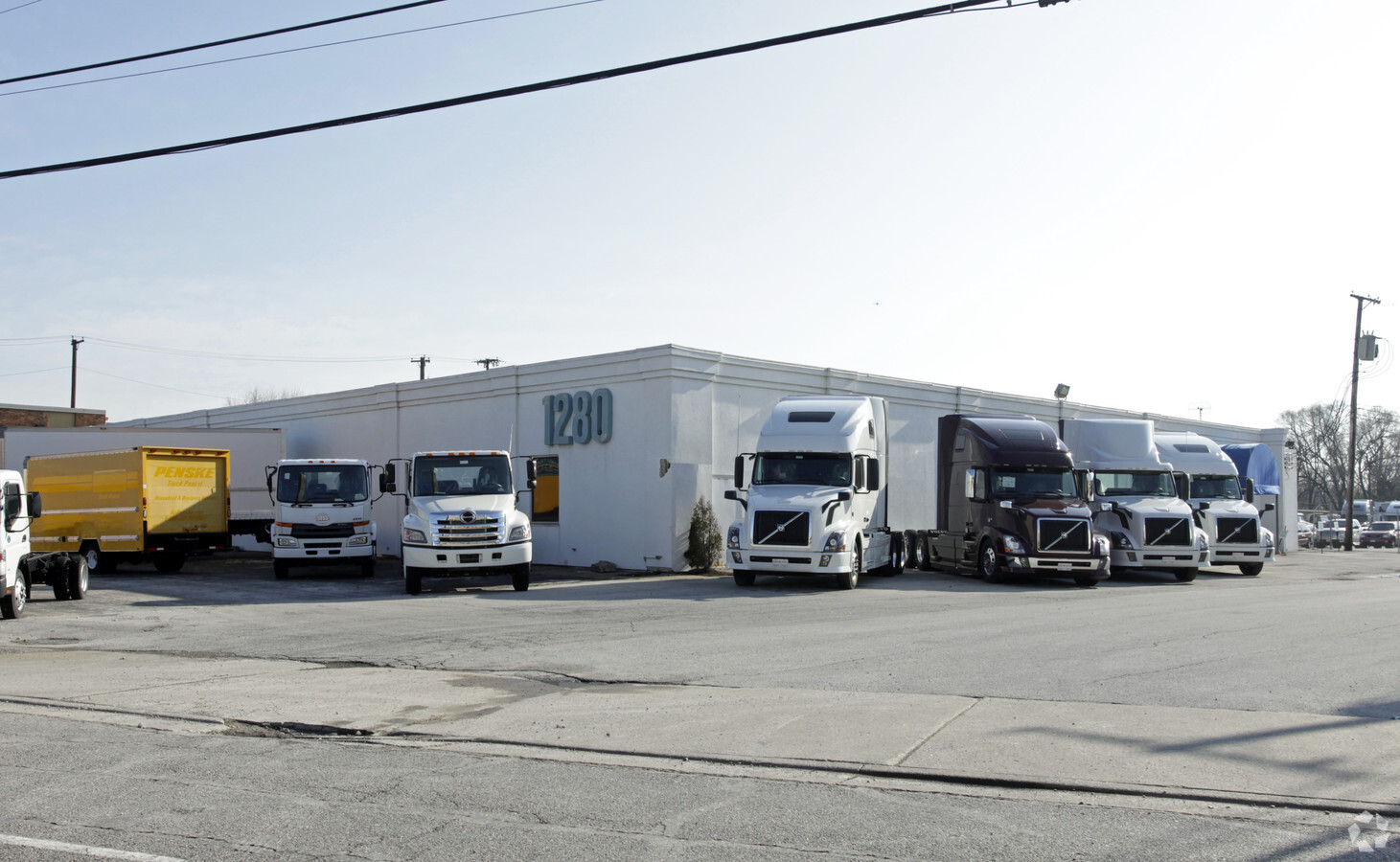
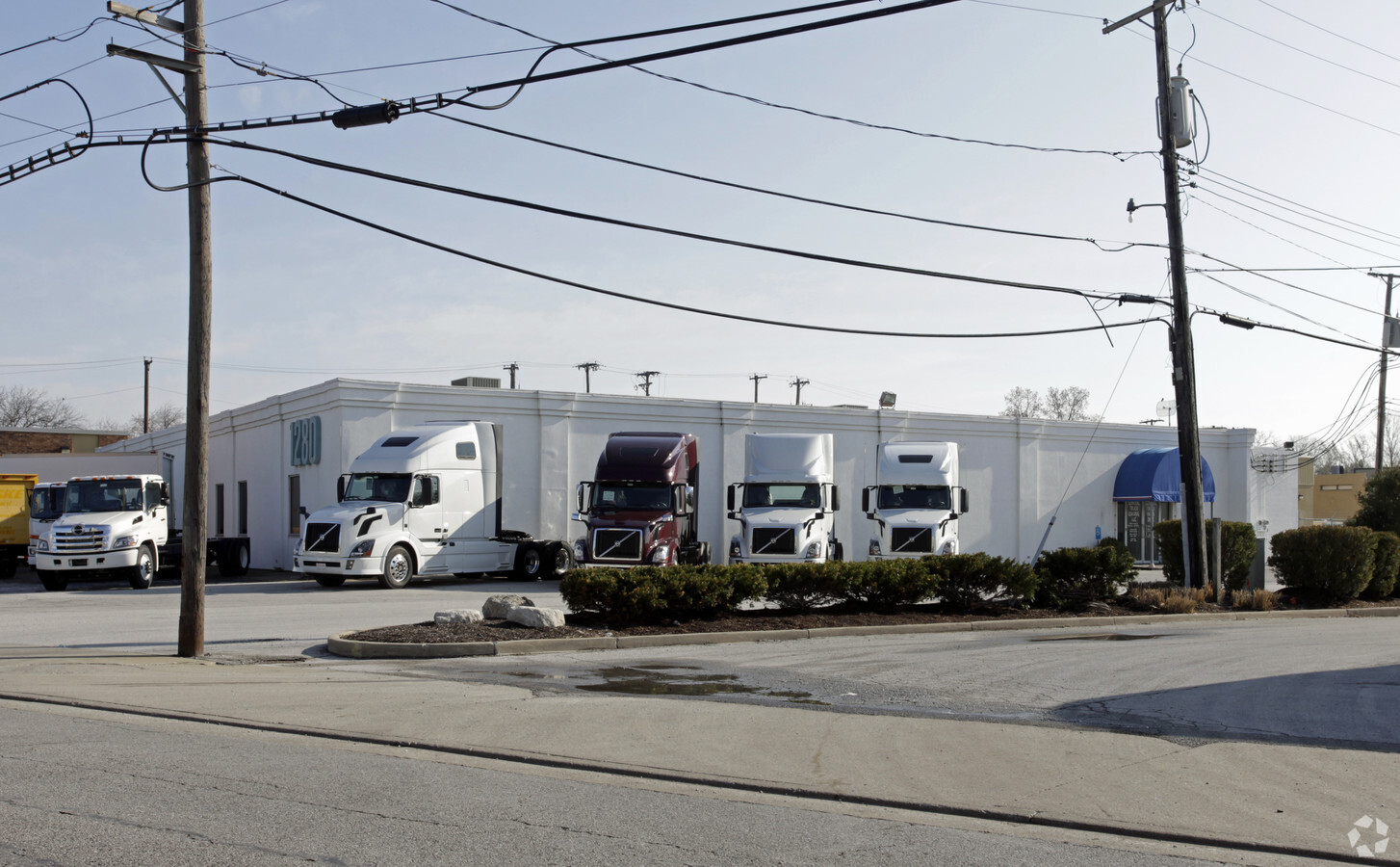
Property Record
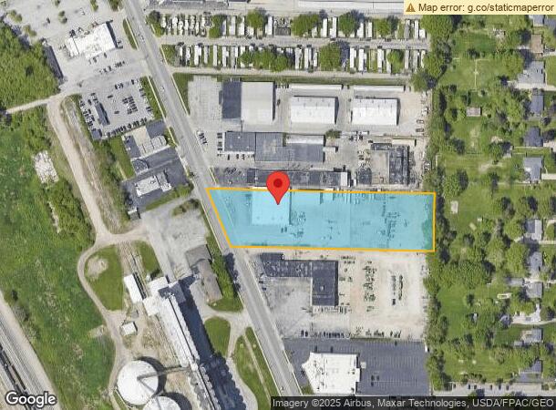
1280 Conant St, Maumee, OH 43537
Current Lease Availabilities
NEARBY LISTINGS FOR SALE OR LEASE
Property Detail
1280 Conant St
Toledo, OH
United States Reserve
36-01654
2 36 PT LOT 43 IRREG 2.366 AC PCE MEAS 206.29 FT CEN LINECONANT ST 584.81 FT
Storebuilding
Lucas
X
Ohio
39173C0010D
43
2023
2.36 AC
2023
South/Southwest
007104
Toledo
18,200 SF
DEMOGRAPHICS near 1280 Conant St
1 Mile
3 Mile
5 Mile
2024 Total Population
6,373
53,795
127,091
2029 Population
6,224
53,042
125,918
Pop Growth 2024-2029
(2.34%)
(1.40%)
(0.92%)
Average Age
42
42
41
2024 Total Households
2,878
23,723
55,040
HH Growth 2024-2029
(2.26%)
(1.52%)
(1.01%)
Median Household Inc
$80,007
$71,134
$65,935
Avg Household Size
2.20
2.20
2.20
2024 Avg HH Vehicles
2.00
2.00
2.00
Median Home Value
$166,309
$187,496
$194,491
Median Year Built
1967
1972
1977
Nearby Places
- Restaurants
- Banks
- Shops
- Fitness
- Groceries
PUBLIC TRANSPORTATION
COMMUTER RAIL
Toledo (Capitol Limited - Amtrak, Lake Shore Limited - Amtrak)
DRIVE
WALK
Distance
Toledo (Capitol Limited - Amtrak, Lake Shore Limited - Amtrak)
12 min
8.7 mi
AIRPORT
Eugene F Kranz Toledo Express
DRIVE
WALK
Distance
Eugene F Kranz Toledo Express
22 min
10.7 mi
Freight Ports
Port of Toledo
DRIVE
WALK
Distance
Port of Toledo
26 min
14.8 mi
Nearby Properties
Address
Land Use
TOTAL SIZE
Lot Size
Zoning
Address
Land Use
TOTAL SIZE
Lot Size
Zoning
541,518 SF
21.30 AC
16-R1
Address
Land Use
TOTAL SIZE
Lot Size
Zoning
168,495 SF
12.36 AC
Address
Land Use
TOTAL SIZE
Lot Size
Zoning
196,149 SF
18.69 AC
10-RD6
Address
Land Use
TOTAL SIZE
Lot Size
Zoning
35.94 AC
17-C3
Address
Land Use
TOTAL SIZE
Lot Size
Zoning
3.56 AC
Address
Land Use
TOTAL SIZE
Lot Size
Zoning
231,756 SF
31.37 AC
16-M1
Address
Land Use
TOTAL SIZE
Lot Size
Zoning
569,612 SF
51.49 AC
16-M2
Address
Land Use
TOTAL SIZE
Lot Size
Zoning
269,263 SF
55.93 AC
16-R2
Address
Land Use
TOTAL SIZE
Lot Size
Zoning
80,668 SF
9.67 AC
Address
Land Use
TOTAL SIZE
Lot Size
Zoning
212,672 SF
15.98 AC
17-R1
Address
Land Use
TOTAL SIZE
Lot Size
Zoning
352,382 SF
62.93 AC
16-M1
Address
Land Use
TOTAL SIZE
Lot Size
Zoning
138,607 SF
21.30 AC
10-RS12
Address
Land Use
TOTAL SIZE
Lot Size
Zoning
148,107 SF
26.16 AC
Address
Land Use
TOTAL SIZE
Lot Size
Zoning
214,986 SF
17.55 AC
19-R1
Address
Land Use
TOTAL SIZE
Lot Size
Zoning
78,166 SF
2.08 AC
16-CM
Address
Land Use
TOTAL SIZE
Lot Size
Zoning
606,883 SF
119.87 AC
16-M2
Address
Land Use
TOTAL SIZE
Lot Size
Zoning
309,519 SF
41.76 AC
Address
Land Use
TOTAL SIZE
Lot Size
Zoning
81,672 SF
14.93 AC
10-RS9
Address
Land Use
TOTAL SIZE
Lot Size
Zoning
160,811 SF
10.83 AC
10-MX
Address
Land Use
TOTAL SIZE
Lot Size
Zoning
58.33 AC
10-IL
Address
Land Use
TOTAL SIZE
Lot Size
Zoning
3.12 AC
16-CM
Address
Land Use
TOTAL SIZE
Lot Size
Zoning
93,531 SF
13.31 AC
16-C2
Address
Land Use
TOTAL SIZE
Lot Size
Zoning
337,990 SF
17.75 AC
16-M1
Address
Land Use
TOTAL SIZE
Lot Size
Zoning
198,187 SF
11.58 AC
10-RM36
Address
Land Use
TOTAL SIZE
Lot Size
Zoning
55,124 SF
0.12 AC
16-C3
Address
Land Use
TOTAL SIZE
Lot Size
Zoning
74,026 SF
13.08 AC
Address
Land Use
TOTAL SIZE
Lot Size
Zoning
133,079 SF
15.45 AC
10-CR
Address
Land Use
TOTAL SIZE
Lot Size
Zoning
128,249 SF
55.62 AC
17-MX
Address
Land Use
TOTAL SIZE
Lot Size
Zoning
101,899 SF
8.52 AC
Address
Land Use
TOTAL SIZE
Lot Size
Zoning
109,598 SF
9.08 AC
16-CM
The World's #1 Commercial Real Estate Marketplace
Connect with us
© 2025 CoStar Group
The information above has been obtained from sources believed reliable. While we do not doubt its accuracy we have not verified it and make no guarantee, warranty or representation about it. It is your responsibility to independently confirm its accuracy and completeness. Any projections, opinions, assumptions, or estimates used are for example only and do not represent the current or future performance of the property. The value of this transaction to you depends on tax and other factors which should be evaluated by your tax, financial, and legal advisors. You and your advisors should conduct a careful, independent investigation of the property to determine to your satisfaction the suitability of the property for your needs.