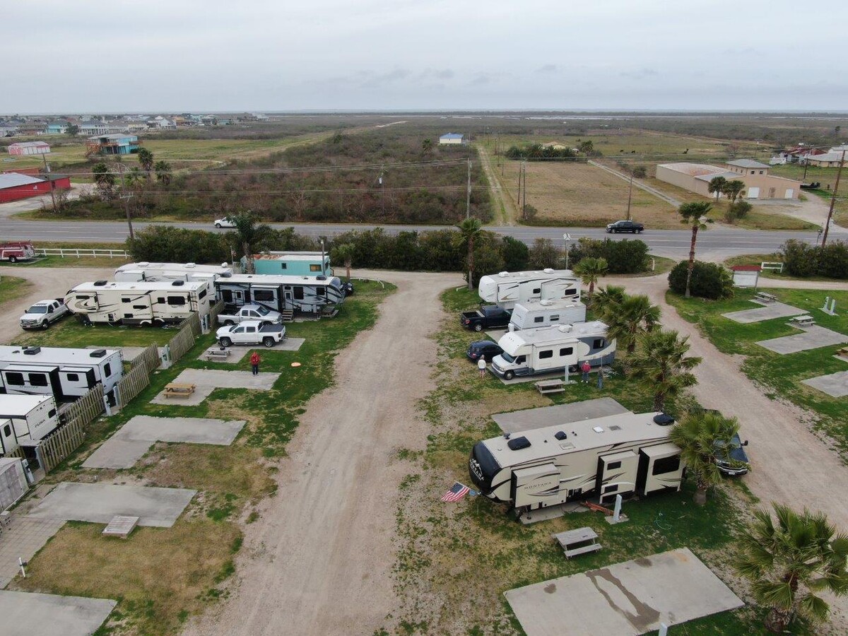
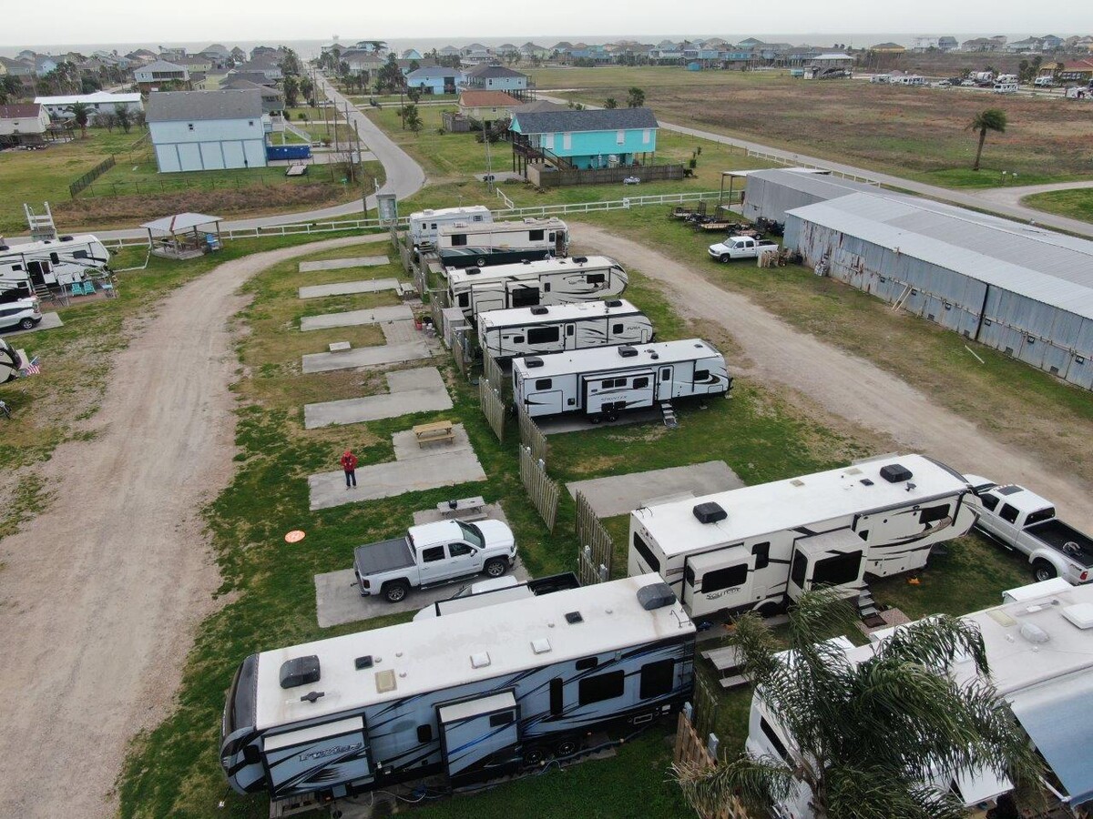
Property Record
1280 Highway 87, Port Bolivar, TX 77650
NEARBY LISTINGS FOR SALE OR LEASE
Property Detail
1280 Highway 87
3200-0000-0000-007
Emerald Beach
Commercialnec
ABST 179 J SHAW SUR RES O,P & W 75 FT OF RES N (0-7) EMERALD BEACH
VE
Galveston
48167C0308G
Texas
2023
1.89 AC
2023
Outlying Chambers County
7239001008
Houston
10,750 SF
Houston-The Woodlands-Sugar Land, TX
DEMOGRAPHICS near 1280 Highway 87
1 Mile
3 Mile
5 Mile
2024 Total Population
150
599
1,197
2029 Population
153
610
1,220
Pop Growth 2024-2029
+ 2.00%
+ 1.84%
+ 1.92%
Average Age
56
56
56
2024 Total Households
79
315
629
HH Growth 2024-2029
+ 1.27%
+ 2.22%
+ 2.38%
Median Household Inc
$66,500
$66,750
$66,687
Avg Household Size
1.90
1.90
1.90
2024 Avg HH Vehicles
2.00
2.00
2.00
Median Home Value
$407,143
$405,752
$405,973
Median Year Built
1997
1997
1997
Nearby Places
- Restaurants
- Banks
- Shops
- Fitness
- Groceries
SALE & LEASE HISTORY
LISTING DATE
SALE/LEASE

Mar 08, 2021
For Sale
Nearby Properties
Address
Land Use
TOTAL SIZE
Lot Size
Zoning
Address
Land Use
TOTAL SIZE
Lot Size
Zoning
55,023 SF
33.23 AC
Address
Land Use
TOTAL SIZE
Lot Size
Zoning
12,320 SF
32.38 AC
Address
Land Use
TOTAL SIZE
Lot Size
Zoning
36,085 SF
5.73 AC
Address
Land Use
TOTAL SIZE
Lot Size
Zoning
732 SF
40 AC
Address
Land Use
TOTAL SIZE
Lot Size
Zoning
48,600 SF
1.94 AC
Address
Land Use
TOTAL SIZE
Lot Size
Zoning
6,600 SF
3.62 AC
Address
Land Use
TOTAL SIZE
Lot Size
Zoning
55 SF
7.88 AC
Address
Land Use
TOTAL SIZE
Lot Size
Zoning
5,320 SF
1.25 AC
Address
Land Use
TOTAL SIZE
Lot Size
Zoning
4,563 SF
2.89 AC
Address
Land Use
TOTAL SIZE
Lot Size
Zoning
7,484 SF
9.90 AC
Address
Land Use
TOTAL SIZE
Lot Size
Zoning
11,312 SF
4.58 AC
Address
Land Use
TOTAL SIZE
Lot Size
Zoning
31,360 SF
5 AC
Address
Land Use
TOTAL SIZE
Lot Size
Zoning
41 SF
1.45 AC
Address
Land Use
TOTAL SIZE
Lot Size
Zoning
2,714 SF
1.95 AC
Address
Land Use
TOTAL SIZE
Lot Size
Zoning
51,900 SF
2.08 AC
Address
Land Use
TOTAL SIZE
Lot Size
Zoning
3,201 SF
1.88 AC
Address
Land Use
TOTAL SIZE
Lot Size
Zoning
3,947 SF
0.37 AC
Address
Land Use
TOTAL SIZE
Lot Size
Zoning
8,142 SF
1.32 AC
Address
Land Use
TOTAL SIZE
Lot Size
Zoning
4,800 SF
15 AC
Address
Land Use
TOTAL SIZE
Lot Size
Zoning
17 SF
0.57 AC
Address
Land Use
TOTAL SIZE
Lot Size
Zoning
5,729 SF
0.70 AC
Address
Land Use
TOTAL SIZE
Lot Size
Zoning
11.24 AC
Address
Land Use
TOTAL SIZE
Lot Size
Zoning
9,599 SF
2.26 AC
Address
Land Use
TOTAL SIZE
Lot Size
Zoning
5,790 SF
3.19 AC
Address
Land Use
TOTAL SIZE
Lot Size
Zoning
24 SF
5.49 AC
Address
Land Use
TOTAL SIZE
Lot Size
Zoning
2,786 SF
2 AC
Address
Land Use
TOTAL SIZE
Lot Size
Zoning
6,622 SF
0.29 AC
Address
Land Use
TOTAL SIZE
Lot Size
Zoning
4,140 SF
0.36 AC
Address
Land Use
TOTAL SIZE
Lot Size
Zoning
2,312 SF
0.35 AC
The World's #1 Commercial Real Estate Marketplace
Connect with us
© 2025 CoStar Group
The information above has been obtained from sources believed reliable. While we do not doubt its accuracy we have not verified it and make no guarantee, warranty or representation about it. It is your responsibility to independently confirm its accuracy and completeness. Any projections, opinions, assumptions, or estimates used are for example only and do not represent the current or future performance of the property. The value of this transaction to you depends on tax and other factors which should be evaluated by your tax, financial, and legal advisors. You and your advisors should conduct a careful, independent investigation of the property to determine to your satisfaction the suitability of the property for your needs.