Property Record
12801 Old Columbia Pike, Silver Spring, MD 20904
NEARBY LISTINGS FOR SALE OR LEASE
-
-
View all Silver Spring listings for sale on LoopNet.com
Property Detail
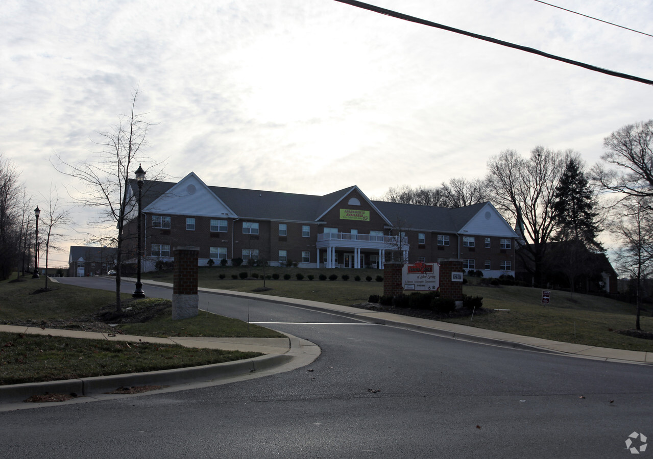
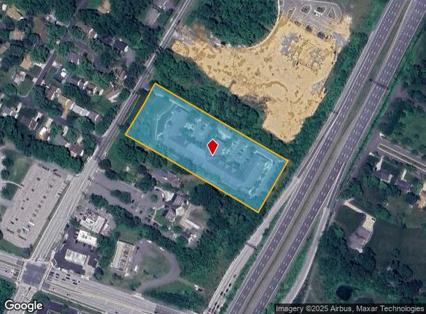
12801 Old Columbia Pike
Washington-Arlington-Alexandria, DC-VA-MD-WV
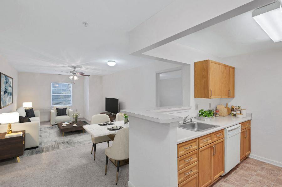
Bealls Manor
05-03411193
PAR B ST MARKS PARISH
Apartment
Montgomery
X
Maryland
24033C0030E
b
2024
3.71 AC
2024
Fairland
701414
Washington, DC
94,512 SF
DEMOGRAPHICS near 12801 Old Columbia Pike
1 Mile
3 Mile
5 Mile
2024 Total Population
15,494
102,368
259,897
2029 Population
15,585
100,915
255,611
Pop Growth 2024-2029
+ 0.59%
(1.42%)
(1.65%)
Average Age
46
41
39
2024 Total Households
5,852
35,247
85,774
HH Growth 2024-2029
+ 1.32%
(1.42%)
(1.74%)
Median Household Inc
$102,083
$93,444
$97,520
Avg Household Size
2.50
2.80
2.90
2024 Avg HH Vehicles
2.00
2.00
2.00
Median Home Value
$398,252
$452,286
$464,370
Median Year Built
1987
1980
1975
Nearby Places
- Restaurants
- Banks
- Shops
- Fitness
- Groceries
PUBLIC TRANSPORTATION
COMMUTER RAIL
Muirkirk (Camden Line - Maryland Area Regional Commuter Trains (The MARC))
DRIVE
WALK
Distance
Muirkirk (Camden Line - Maryland Area Regional Commuter Trains (The MARC))
9 min
5.9 mi
Greenbelt (Green Line - Washington Metropolitan Area Transit Authority Metrorail (Metrorail))
DRIVE
WALK
Distance
Greenbelt (Green Line - Washington Metropolitan Area Transit Authority Metrorail (Metrorail))
11 min
6.1 mi
AIRPORT
Ronald Reagan Washington Ntl
DRIVE
WALK
Distance
Ronald Reagan Washington Ntl
32 min
18.0 mi
Baltimore/Washington International Thurgood Marshall
DRIVE
WALK
Distance
Baltimore/Washington International Thurgood Marshall
33 min
24.5 mi
Washington Dulles International
DRIVE
WALK
Distance
Washington Dulles International
53 min
34.1 mi
Freight Ports
Port of Baltimore
DRIVE
WALK
Distance
Port of Baltimore
37 min
27.4 mi
Nearby Properties
Address
Land Use
TOTAL SIZE
Lot Size
Zoning
Address
Land Use
TOTAL SIZE
Lot Size
Zoning
610.61 AC
RE2
Address
Land Use
TOTAL SIZE
Lot Size
Zoning
456,429 SF
35.07 AC
I3
Address
Land Use
TOTAL SIZE
Lot Size
Zoning
1,244,733 SF
38.03 AC
RE2
Address
Land Use
TOTAL SIZE
Lot Size
Zoning
917,092 SF
17.19 AC
R10
Address
Land Use
TOTAL SIZE
Lot Size
Zoning
1,146,407 SF
60.25 AC
AG
Address
Land Use
TOTAL SIZE
Lot Size
Zoning
531,312 SF
25.70 AC
R30
Address
Land Use
TOTAL SIZE
Lot Size
Zoning
482,799 SF
17.79 AC
R30
Address
Land Use
TOTAL SIZE
Lot Size
Zoning
385,000 SF
16.42 AC
RH
Address
Land Use
TOTAL SIZE
Lot Size
Zoning
458,546 SF
8.56 AC
R10
Address
Land Use
TOTAL SIZE
Lot Size
Zoning
310,052 SF
9.63 AC
R20
Address
Land Use
TOTAL SIZE
Lot Size
Zoning
371,939 SF
21.54 AC
EOF1.
Address
Land Use
TOTAL SIZE
Lot Size
Zoning
285,116 SF
14.62 AC
AG
Address
Land Use
TOTAL SIZE
Lot Size
Zoning
545,265 SF
9.51 AC
R10
Address
Land Use
TOTAL SIZE
Lot Size
Zoning
170,619 SF
11.49 AC
R20
Address
Land Use
TOTAL SIZE
Lot Size
Zoning
235,616 SF
12.81 AC
R30
Address
Land Use
TOTAL SIZE
Lot Size
Zoning
222,345 SF
14.21 AC
R30
Address
Land Use
TOTAL SIZE
Lot Size
Zoning
16.09 AC
RMF20
Address
Land Use
TOTAL SIZE
Lot Size
Zoning
17.56 AC
RMF20
Address
Land Use
TOTAL SIZE
Lot Size
Zoning
291,413 SF
12.07 AC
R20
Address
Land Use
TOTAL SIZE
Lot Size
Zoning
169,000 SF
0.65 AC
I3
Address
Land Use
TOTAL SIZE
Lot Size
Zoning
4,380 SF
17.89 AC
CRT22
Address
Land Use
TOTAL SIZE
Lot Size
Zoning
350,684 SF
36.50 AC
EOF1.
Address
Land Use
TOTAL SIZE
Lot Size
Zoning
303,542 SF
25.13 AC
R200
Address
Land Use
TOTAL SIZE
Lot Size
Zoning
220,730 SF
13.11 AC
R20
Address
Land Use
TOTAL SIZE
Lot Size
Zoning
92,294 SF
3.22 AC
CR0.7
Address
Land Use
TOTAL SIZE
Lot Size
Zoning
239,072 SF
10.41 AC
R20
Address
Land Use
TOTAL SIZE
Lot Size
Zoning
227,552 SF
9.64 AC
R20
Address
Land Use
TOTAL SIZE
Lot Size
Zoning
254,416 SF
24.98 AC
CR1.0
Address
Land Use
TOTAL SIZE
Lot Size
Zoning
11.01 AC
RMF20
Address
Land Use
TOTAL SIZE
Lot Size
Zoning
195,788 SF
6.55 AC
R20
The World's #1 Commercial Real Estate Marketplace
Connect with us
© 2025 CoStar Group
The information above has been obtained from sources believed reliable. While we do not doubt its accuracy we have not verified it and make no guarantee, warranty or representation about it. It is your responsibility to independently confirm its accuracy and completeness. Any projections, opinions, assumptions, or estimates used are for example only and do not represent the current or future performance of the property. The value of this transaction to you depends on tax and other factors which should be evaluated by your tax, financial, and legal advisors. You and your advisors should conduct a careful, independent investigation of the property to determine to your satisfaction the suitability of the property for your needs.