Property Record
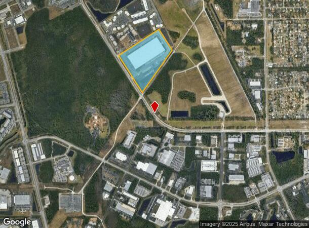
1285 N Clyde Morris Blvd, Daytona Beach, FL 32117


NEARBY LISTINGS FOR SALE OR LEASE
Property Detail
1285 N Clyde Morris Blvd
5210-00-00-0042
Parcel
Lightindustrial
10 & 11 15 32 IRREG PARCEL MEAS 1183.91 FT ALONG E/L OF CLYDE MORRIS BLVD & 1295 FT ON N/L & 665.91 FT ON E/L & 1394.77 FT ON S/L PER OR 6314 PG 1563 PER OR 7382 PG 1902 PER OR 7529 PG 1781
AE
Volusia
12127C0352H
Florida
2023
27.55 AC
2024
Downtown Daytona Beach
082302
Deltona/Daytona Beach
417,015 SF
Deltona-Daytona Beach-Ormond Beach, FL
DEMOGRAPHICS near 1285 N Clyde Morris Blvd
1 Mile
3 Mile
5 Mile
2024 Total Population
6,100
55,646
137,069
2029 Population
6,943
62,511
153,777
Pop Growth 2024-2029
+ 13.82%
+ 12.34%
+ 12.19%
Average Age
42
42
44
2024 Total Households
2,732
23,486
59,940
HH Growth 2024-2029
+ 14.68%
+ 12.74%
+ 12.69%
Median Household Inc
$54,031
$46,642
$48,420
Avg Household Size
2.10
2.20
2.10
2024 Avg HH Vehicles
2.00
2.00
2.00
Median Home Value
$170,712
$172,334
$216,609
Median Year Built
1989
1983
1980
Nearby Places
- Restaurants
- Banks
- Shops
- Fitness
- Groceries
PUBLIC TRANSPORTATION
AIRPORT
Daytona Beach International
DRIVE
WALK
Distance
Daytona Beach International
12 min
5.9 mi
Freight Ports
Port Canaveral
DRIVE
WALK
Distance
Port Canaveral
88 min
75.5 mi
Nearby Properties
Address
Land Use
TOTAL SIZE
Lot Size
Zoning
Address
Land Use
TOTAL SIZE
Lot Size
Zoning
863,820 SF
374 AC
AP
Address
Land Use
TOTAL SIZE
Lot Size
Zoning
787,943 SF
140.62 AC
01A2
Address
Land Use
TOTAL SIZE
Lot Size
Zoning
1,365,998 SF
13 AC
Address
Land Use
TOTAL SIZE
Lot Size
Zoning
664,082 SF
38.16 AC
02BA
Address
Land Use
TOTAL SIZE
Lot Size
Zoning
1,058,116 SF
54.22 AC
Address
Land Use
TOTAL SIZE
Lot Size
Zoning
831,398 SF
25.56 AC
Address
Land Use
TOTAL SIZE
Lot Size
Zoning
497,823 SF
73.48 AC
Address
Land Use
TOTAL SIZE
Lot Size
Zoning
451,526 SF
17.96 AC
Address
Land Use
TOTAL SIZE
Lot Size
Zoning
293,850 SF
29.38 AC
Address
Land Use
TOTAL SIZE
Lot Size
Zoning
353,548 SF
50.65 AC
Address
Land Use
TOTAL SIZE
Lot Size
Zoning
400,964 SF
38.93 AC
Address
Land Use
TOTAL SIZE
Lot Size
Zoning
356,386 SF
0.75 AC
Address
Land Use
TOTAL SIZE
Lot Size
Zoning
425,548 SF
10.16 AC
Address
Land Use
TOTAL SIZE
Lot Size
Zoning
346,734 SF
14 AC
Address
Land Use
TOTAL SIZE
Lot Size
Zoning
318,707 SF
12.16 AC
Address
Land Use
TOTAL SIZE
Lot Size
Zoning
275,814 SF
13 AC
Address
Land Use
TOTAL SIZE
Lot Size
Zoning
318,230 SF
21.28 AC
Address
Land Use
TOTAL SIZE
Lot Size
Zoning
409,718 SF
12.86 AC
Address
Land Use
TOTAL SIZE
Lot Size
Zoning
286,461 SF
945.48 AC
B62
Address
Land Use
TOTAL SIZE
Lot Size
Zoning
333,708 SF
0.24 AC
01A2
Address
Land Use
TOTAL SIZE
Lot Size
Zoning
135,122 SF
78 AC
Address
Land Use
TOTAL SIZE
Lot Size
Zoning
375,572 SF
0.13 AC
R2
Address
Land Use
TOTAL SIZE
Lot Size
Zoning
10,637 SF
0.15 AC
R2
Address
Land Use
TOTAL SIZE
Lot Size
Zoning
303,151 SF
13.58 AC
Address
Land Use
TOTAL SIZE
Lot Size
Zoning
535,856 SF
46.85 AC
Address
Land Use
TOTAL SIZE
Lot Size
Zoning
259,175 SF
23.45 AC
Address
Land Use
TOTAL SIZE
Lot Size
Zoning
560,165 SF
37.79 AC
02BR2
Address
Land Use
TOTAL SIZE
Lot Size
Zoning
199,301 SF
21.54 AC
Address
Land Use
TOTAL SIZE
Lot Size
Zoning
208,825 SF
30.30 AC
02BA
The World's #1 Commercial Real Estate Marketplace
Connect with us
© 2025 CoStar Group
The information above has been obtained from sources believed reliable. While we do not doubt its accuracy we have not verified it and make no guarantee, warranty or representation about it. It is your responsibility to independently confirm its accuracy and completeness. Any projections, opinions, assumptions, or estimates used are for example only and do not represent the current or future performance of the property. The value of this transaction to you depends on tax and other factors which should be evaluated by your tax, financial, and legal advisors. You and your advisors should conduct a careful, independent investigation of the property to determine to your satisfaction the suitability of the property for your needs.