Property Record
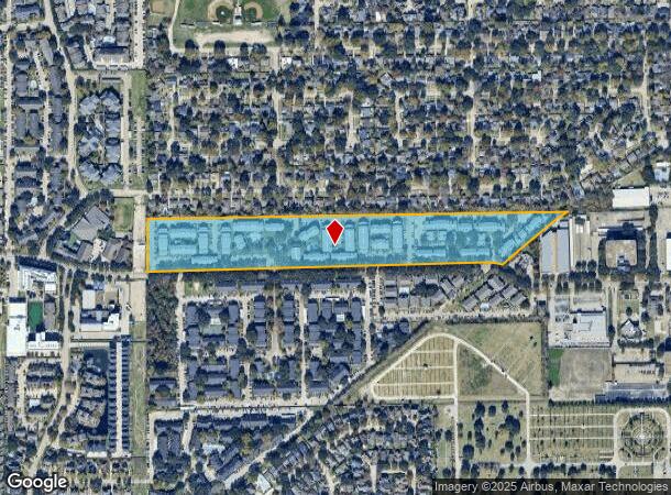
12850 Whittington Dr, Houston, TX 77077


NEARBY LISTINGS FOR SALE OR LEASE
-
-
View all Houston listings for sale on LoopNet.com
Property Detail
12850 Whittington Dr
1150850000004
A2 A3 & A4 Ashford Crossing Sec 1
Apartment
RES A1 A2 A3 & A4 ASHFORD CROSSING SEC 1
X
Harris
48157C0175L
Texas
2023
17.16 AC
2023
Briar Village
451401
Houston
423,596 SF
Houston-The Woodlands-Sugar Land, TX
DEMOGRAPHICS near 12850 Whittington Dr
1 Mile
3 Mile
5 Mile
2024 Total Population
28,835
159,306
367,509
2029 Population
29,404
162,637
376,808
Pop Growth 2024-2029
+ 1.97%
+ 2.09%
+ 2.53%
Average Age
36
37
37
2024 Total Households
13,603
66,271
141,668
HH Growth 2024-2029
+ 1.93%
+ 2.03%
+ 2.42%
Median Household Inc
$55,615
$60,426
$56,960
Avg Household Size
2.10
2.30
2.50
2024 Avg HH Vehicles
1.00
2.00
2.00
Median Home Value
$315,015
$321,465
$265,371
Median Year Built
1988
1987
1985
Nearby Places
- Restaurants
- Banks
- Shops
- Fitness
- Groceries
PUBLIC TRANSPORTATION
AIRPORT
William P Hobby
DRIVE
WALK
Distance
William P Hobby
47 min
28.7 mi
George Bush Intcntl/Houston
DRIVE
WALK
Distance
George Bush Intcntl/Houston
43 min
32.6 mi
Freight Ports
Port of Houston
DRIVE
WALK
Distance
Port of Houston
43 min
28.1 mi
Nearby Properties
Address
Land Use
TOTAL SIZE
Lot Size
Zoning
Address
Land Use
TOTAL SIZE
Lot Size
Zoning
2,976,779 SF
41.36 AC
Address
Land Use
TOTAL SIZE
Lot Size
Zoning
1,385,616 SF
6.48 AC
Address
Land Use
TOTAL SIZE
Lot Size
Zoning
1,131,022 SF
6.26 AC
Address
Land Use
TOTAL SIZE
Lot Size
Zoning
1,543,856 SF
10.03 AC
Address
Land Use
TOTAL SIZE
Lot Size
Zoning
1,208,144 SF
6.15 AC
Address
Land Use
TOTAL SIZE
Lot Size
Zoning
1,379,816 SF
113.43 AC
Address
Land Use
TOTAL SIZE
Lot Size
Zoning
933,829 SF
60.97 AC
Address
Land Use
TOTAL SIZE
Lot Size
Zoning
1,045,896 SF
11.14 AC
Address
Land Use
TOTAL SIZE
Lot Size
Zoning
647,423 SF
9.62 AC
Address
Land Use
TOTAL SIZE
Lot Size
Zoning
690,519 SF
26.57 AC
Address
Land Use
TOTAL SIZE
Lot Size
Zoning
828,328 SF
3.90 AC
Address
Land Use
TOTAL SIZE
Lot Size
Zoning
617,832 SF
9.24 AC
Address
Land Use
TOTAL SIZE
Lot Size
Zoning
845,902 SF
16.27 AC
Address
Land Use
TOTAL SIZE
Lot Size
Zoning
430,096 SF
18.98 AC
Address
Land Use
TOTAL SIZE
Lot Size
Zoning
422,801 SF
12.71 AC
Address
Land Use
TOTAL SIZE
Lot Size
Zoning
1,003,295 SF
5.82 AC
Address
Land Use
TOTAL SIZE
Lot Size
Zoning
541,498 SF
25.60 AC
Address
Land Use
TOTAL SIZE
Lot Size
Zoning
488,573 SF
20.57 AC
Address
Land Use
TOTAL SIZE
Lot Size
Zoning
775,560 SF
7.96 AC
Address
Land Use
TOTAL SIZE
Lot Size
Zoning
638,248 SF
23.38 AC
Address
Land Use
TOTAL SIZE
Lot Size
Zoning
845,371 SF
32.37 AC
Address
Land Use
TOTAL SIZE
Lot Size
Zoning
601,167 SF
14.93 AC
Address
Land Use
TOTAL SIZE
Lot Size
Zoning
672,183 SF
8.80 AC
Address
Land Use
TOTAL SIZE
Lot Size
Zoning
803,103 SF
5.78 AC
Address
Land Use
TOTAL SIZE
Lot Size
Zoning
497,267 SF
24.69 AC
Address
Land Use
TOTAL SIZE
Lot Size
Zoning
526,410 SF
20.43 AC
Address
Land Use
TOTAL SIZE
Lot Size
Zoning
487,054 SF
13.85 AC
Address
Land Use
TOTAL SIZE
Lot Size
Zoning
520,277 SF
10.04 AC
Address
Land Use
TOTAL SIZE
Lot Size
Zoning
682,312 SF
4.67 AC
Address
Land Use
TOTAL SIZE
Lot Size
Zoning
534,796 SF
6.94 AC
The World's #1 Commercial Real Estate Marketplace
Connect with us
© 2025 CoStar Group
The information above has been obtained from sources believed reliable. While we do not doubt its accuracy we have not verified it and make no guarantee, warranty or representation about it. It is your responsibility to independently confirm its accuracy and completeness. Any projections, opinions, assumptions, or estimates used are for example only and do not represent the current or future performance of the property. The value of this transaction to you depends on tax and other factors which should be evaluated by your tax, financial, and legal advisors. You and your advisors should conduct a careful, independent investigation of the property to determine to your satisfaction the suitability of the property for your needs.