Property Record
12871 Nw Us Highway 441, Alachua, FL 32615


NEARBY LISTINGS FOR SALE OR LEASE
-
-
View all Alachua listings for sale on LoopNet.com
Property Detail
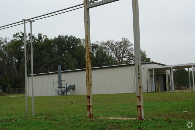
12871 Nw Us Highway 441
05855-004-000
Fernandez Grant
Lightindustrial
COM SE COR SEC W 1313.40 FT N 218.99 FT N 72 DEG 51 MIN 47 SEC W 171.11 FT NWLY ALG CURVE 1369.44 FT N 66 DEG 00 MIN 17 SEC W 58.98 FT POB N 23 DEG 59 MIN 25 SEC E 664.68 FT N 66 DEG 04 MIN 35 SEC W 265.85 FT N 24 DEG 28 MIN 46 SEC E 680.88 FT N 65 D
A
Alachua
12001C0143E
Florida
2025
21.04 AC
2025
Gainesville
001802
Other Market Areas
75,774 SF
Gainesville, FL
DEMOGRAPHICS near 12871 Nw Us Highway 441
1 Mile
3 Mile
5 Mile
2024 Total Population
244
3,510
17,142
2029 Population
255
3,739
18,084
Pop Growth 2024-2029
+ 4.51%
+ 6.52%
+ 5.50%
Average Age
41
43
42
2024 Total Households
96
1,453
6,979
HH Growth 2024-2029
+ 5.21%
+ 6.74%
+ 5.65%
Median Household Inc
$34,166
$81,462
$79,358
Avg Household Size
2.50
2.40
2.50
2024 Avg HH Vehicles
2.00
2.00
2.00
Median Home Value
$182,352
$240,876
$255,636
Median Year Built
1986
1995
1992
Nearby Places
Map Layers
Map Styles
 Street
 Aerial
- Restaurants
- Banks
- Shops
- Fitness
- Groceries
PUBLIC TRANSPORTATION
AIRPORT
Gainesville Regional
DRIVE
WALK
Distance
Gainesville Regional
24 min
13.2 mi
Freight Ports
Jacksonville Port
DRIVE
WALK
Distance
Jacksonville Port
109 min
83.1 mi
Nearby Properties
Address
Land Use
TOTAL SIZE
Lot Size
Zoning
Address
Land Use
TOTAL SIZE
Lot Size
Zoning
969.87 AC
PS
Address
Land Use
TOTAL SIZE
Lot Size
Zoning
147,781 SF
17.01 AC
PUD
Address
Land Use
TOTAL SIZE
Lot Size
Zoning
28,727 SF
6.04 AC
PUD
Address
Land Use
TOTAL SIZE
Lot Size
Zoning
16,430 SF
137.27 AC
PS
Address
Land Use
TOTAL SIZE
Lot Size
Zoning
40,804 SF
3.94 AC
ILW
Address
Land Use
TOTAL SIZE
Lot Size
Zoning
83,635 SF
182.70 AC
PUD
Address
Land Use
TOTAL SIZE
Lot Size
Zoning
95,185 SF
7.72 AC
CI
Address
Land Use
TOTAL SIZE
Lot Size
Zoning
41,464 SF
3.96 AC
PUD
Address
Land Use
TOTAL SIZE
Lot Size
Zoning
54,768 SF
11.63 AC
ILW
Address
Land Use
TOTAL SIZE
Lot Size
Zoning
15,922 SF
390 AC
A
Address
Land Use
TOTAL SIZE
Lot Size
Zoning
23,683 SF
6.02 AC
ILW
Address
Land Use
TOTAL SIZE
Lot Size
Zoning
44,384 SF
7.50 AC
CP
Address
Land Use
TOTAL SIZE
Lot Size
Zoning
21,446 SF
4.05 AC
ILW
Address
Land Use
TOTAL SIZE
Lot Size
Zoning
37,274 SF
6.14 AC
PUD
Address
Land Use
TOTAL SIZE
Lot Size
Zoning
1,189.30 AC
A
Address
Land Use
TOTAL SIZE
Lot Size
Zoning
31,248 SF
3.27 AC
PUD
Address
Land Use
TOTAL SIZE
Lot Size
Zoning
24,154 SF
3.46 AC
PUD
Address
Land Use
TOTAL SIZE
Lot Size
Zoning
64,052 SF
35.96 AC
ILW
Address
Land Use
TOTAL SIZE
Lot Size
Zoning
57,014 SF
5.82 AC
PUD
Address
Land Use
TOTAL SIZE
Lot Size
Zoning
31,928 SF
2.86 AC
PUD
Address
Land Use
TOTAL SIZE
Lot Size
Zoning
31,880 SF
3.32 AC
PUD
Address
Land Use
TOTAL SIZE
Lot Size
Zoning
60,600 SF
6.49 AC
CP
Address
Land Use
TOTAL SIZE
Lot Size
Zoning
60,600 SF
67.29 AC
CP
Address
Land Use
TOTAL SIZE
Lot Size
Zoning
22,342 SF
4.45 AC
PUD
Address
Land Use
TOTAL SIZE
Lot Size
Zoning
15,097 SF
2.68 AC
PUD
Address
Land Use
TOTAL SIZE
Lot Size
Zoning
12,977 SF
1.46 AC
ILW
Address
Land Use
TOTAL SIZE
Lot Size
Zoning
39,520 SF
38.67 AC
ILW
Address
Land Use
TOTAL SIZE
Lot Size
Zoning
16,554 SF
9.95 AC
A
Address
Land Use
TOTAL SIZE
Lot Size
Zoning
18,576 SF
2 AC
ILW
Address
Land Use
TOTAL SIZE
Lot Size
Zoning
15,924 SF
2.03 AC
PUD
The World's #1 Commercial Real Estate Marketplace
Connect with us
© 2026 CoStar Group
The information above has been obtained from sources believed reliable. While we do not doubt its accuracy we have not verified it and make no guarantee, warranty or representation about it. It is your responsibility to independently confirm its accuracy and completeness. Any projections, opinions, assumptions, or estimates used are for example only and do not represent the current or future performance of the property. The value of this transaction to you depends on tax and other factors which should be evaluated by your tax, financial, and legal advisors. You and your advisors should conduct a careful, independent investigation of the property to determine to your satisfaction the suitability of the property for your needs.