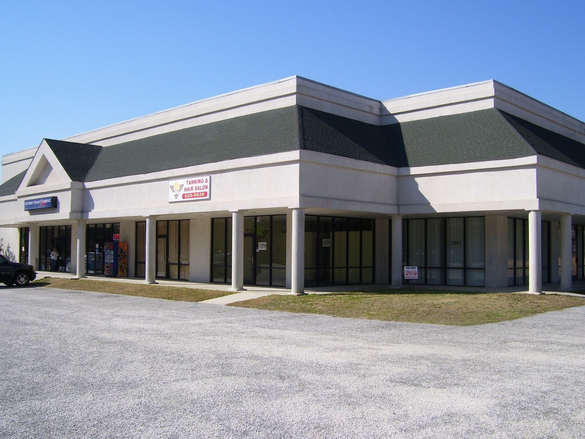
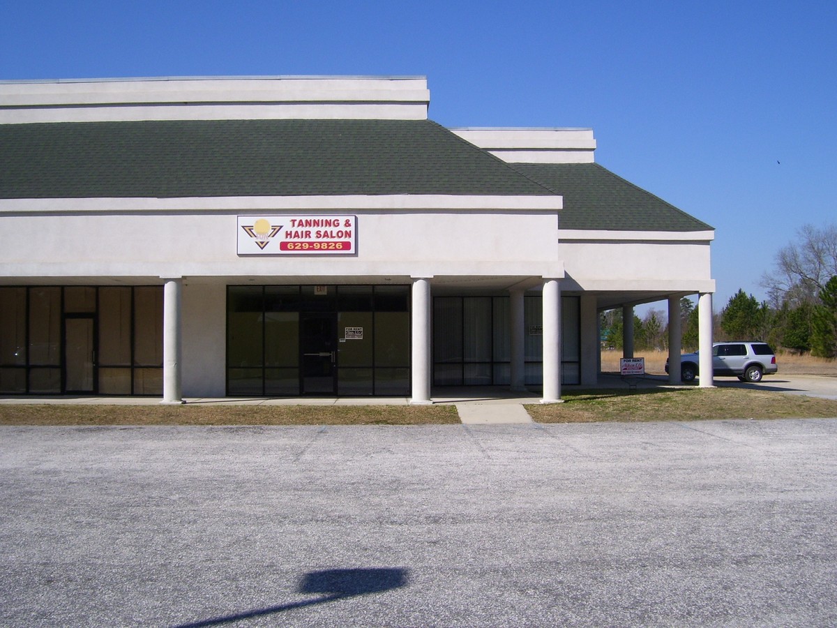
Property Record
129 Francis Marion Rd, Florence, SC 29506
NEARBY LISTINGS FOR SALE OR LEASE
-
-
View all Florence listings for sale on LoopNet.com
Property Detail
129 Francis Marion Rd
Commercialacreage
FRANCIS MARION RD LT1-B
X
Florence
45041C0158E
South Carolina
2023
1.50 AC
2023
Other Market Areas
000502
Florence, SC
7,759 SF
00276-01-031
DEMOGRAPHICS near 129 Francis Marion Rd
1 Mile
3 Mile
5 Mile
2024 Total Population
430
5,807
13,235
2029 Population
428
5,794
13,204
Pop Growth 2024-2029
(0.47%)
(0.22%)
(0.23%)
Average Age
36
38
38
2024 Total Households
184
2,202
4,793
HH Growth 2024-2029
(0.54%)
(0.14%)
(0.06%)
Median Household Inc
$42,142
$47,300
$46,471
Avg Household Size
2.20
2.40
2.40
2024 Avg HH Vehicles
2.00
2.00
2.00
Median Home Value
$578,125
$134,782
$148,233
Median Year Built
1988
1987
1987
Nearby Places
- Restaurants
- Banks
- Shops
- Fitness
- Groceries
PUBLIC TRANSPORTATION
COMMUTER RAIL
Florence Amtrak Station (Palmetto - Amtrak, Silver Meteor - Amtrak)
DRIVE
WALK
Distance
Florence Amtrak Station (Palmetto - Amtrak, Silver Meteor - Amtrak)
10 min
6.3 mi
Freight Ports
North Charleston Terminal
DRIVE
WALK
Distance
North Charleston Terminal
148 min
108.4 mi
Nearby Properties
Address
Land Use
TOTAL SIZE
Lot Size
Zoning
Address
Land Use
TOTAL SIZE
Lot Size
Zoning
200,000 SF
8.10 AC
Address
Land Use
TOTAL SIZE
Lot Size
Zoning
7,616 SF
33.92 AC
Address
Land Use
TOTAL SIZE
Lot Size
Zoning
201,000 SF
11.14 AC
Address
Land Use
TOTAL SIZE
Lot Size
Zoning
12,416 SF
9.41 AC
Address
Land Use
TOTAL SIZE
Lot Size
Zoning
3,448 SF
1.04 AC
Address
Land Use
TOTAL SIZE
Lot Size
Zoning
4,606 SF
1.88 AC
Address
Land Use
TOTAL SIZE
Lot Size
Zoning
Address
Land Use
TOTAL SIZE
Lot Size
Zoning
8,500 SF
1.05 AC
Address
Land Use
TOTAL SIZE
Lot Size
Zoning
Address
Land Use
TOTAL SIZE
Lot Size
Zoning
6,100 SF
6 AC
Address
Land Use
TOTAL SIZE
Lot Size
Zoning
4,500 SF
16.90 AC
Address
Land Use
TOTAL SIZE
Lot Size
Zoning
3,200 SF
2.23 AC
Address
Land Use
TOTAL SIZE
Lot Size
Zoning
Address
Land Use
TOTAL SIZE
Lot Size
Zoning
23.50 AC
Address
Land Use
TOTAL SIZE
Lot Size
Zoning
2,052 SF
1.14 AC
Address
Land Use
TOTAL SIZE
Lot Size
Zoning
2,580 SF
0.84 AC
Address
Land Use
TOTAL SIZE
Lot Size
Zoning
313.79 AC
Address
Land Use
TOTAL SIZE
Lot Size
Zoning
1,600 SF
102.85 AC
Address
Land Use
TOTAL SIZE
Lot Size
Zoning
Address
Land Use
TOTAL SIZE
Lot Size
Zoning
20.01 AC
Address
Land Use
TOTAL SIZE
Lot Size
Zoning
16.07 AC
Address
Land Use
TOTAL SIZE
Lot Size
Zoning
36.35 AC
Address
Land Use
TOTAL SIZE
Lot Size
Zoning
10.30 AC
Address
Land Use
TOTAL SIZE
Lot Size
Zoning
2,856 SF
1 AC
Address
Land Use
TOTAL SIZE
Lot Size
Zoning
6,000 SF
27.22 AC
Address
Land Use
TOTAL SIZE
Lot Size
Zoning
112.75 AC
Address
Land Use
TOTAL SIZE
Lot Size
Zoning
1,904 SF
107.50 AC
Address
Land Use
TOTAL SIZE
Lot Size
Zoning
10.53 AC
The World's #1 Commercial Real Estate Marketplace
Connect with us
© 2025 CoStar Group
The information above has been obtained from sources believed reliable. While we do not doubt its accuracy we have not verified it and make no guarantee, warranty or representation about it. It is your responsibility to independently confirm its accuracy and completeness. Any projections, opinions, assumptions, or estimates used are for example only and do not represent the current or future performance of the property. The value of this transaction to you depends on tax and other factors which should be evaluated by your tax, financial, and legal advisors. You and your advisors should conduct a careful, independent investigation of the property to determine to your satisfaction the suitability of the property for your needs.