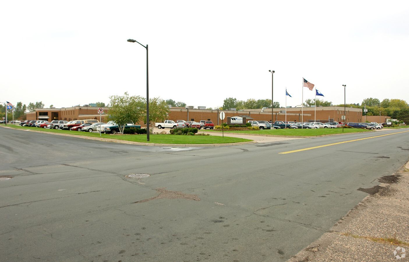
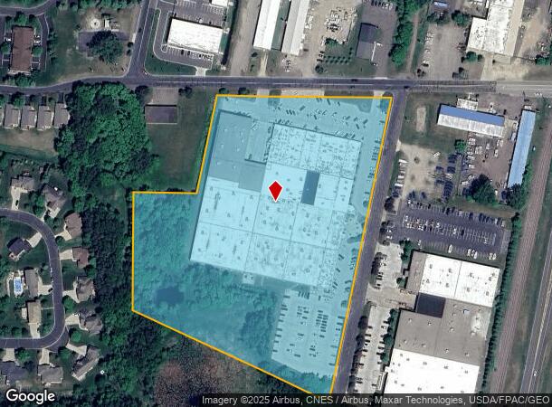
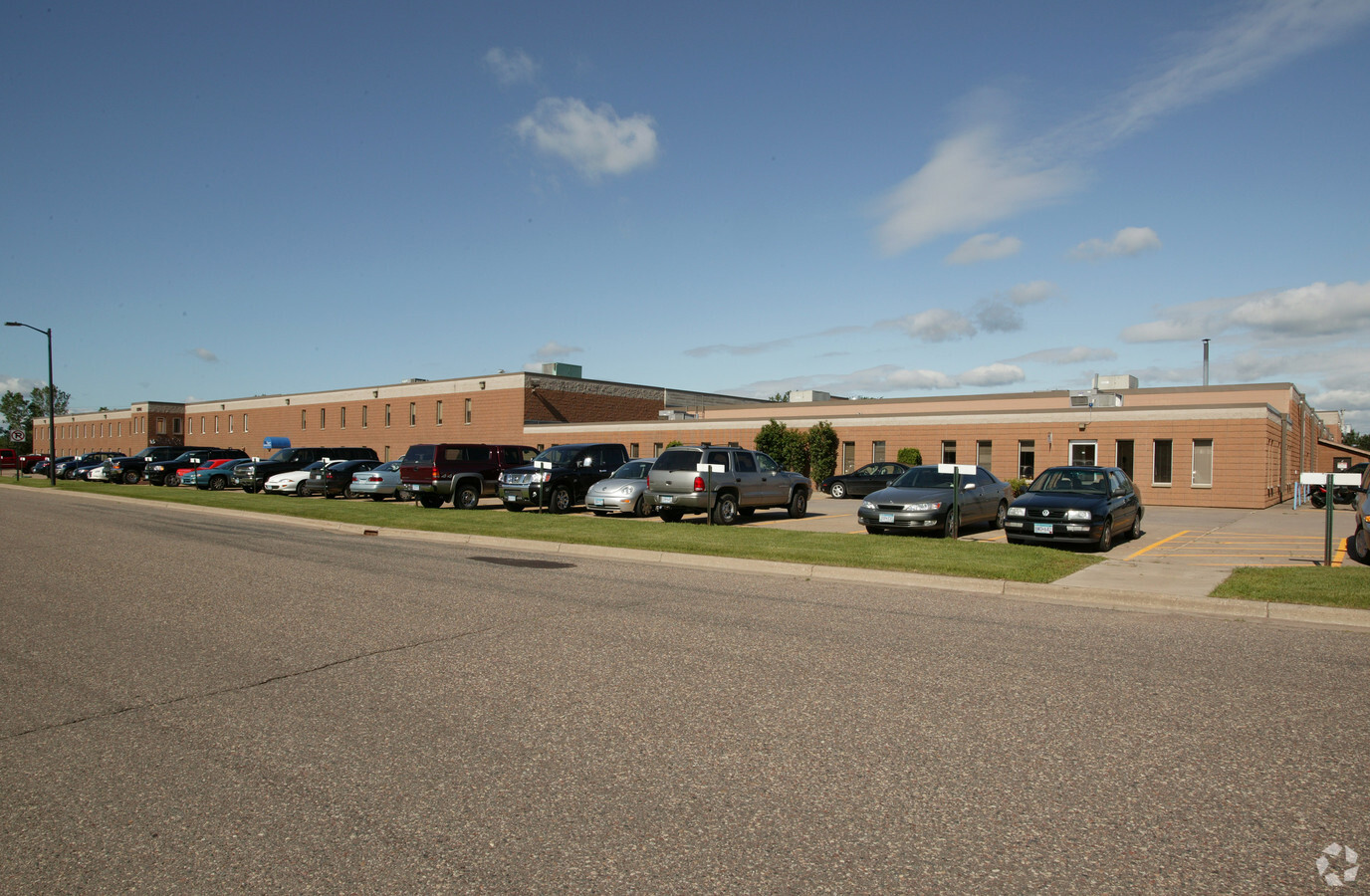
Property Record
12912 Farnham Ave N, Saint Paul, MN 55110
NEARBY LISTINGS FOR SALE OR LEASE
Property Detail
12912 Farnham Ave N
Minneapolis-St. Paul-Bloomington, MN-WI
Bald Eagle Industrial Park
31-031-21-11-0006
PT OF LOT 1 002 LYING S OF N LINE OF SEC31 T31 R21 SUB TO EASE EXC 93080 2160 AND INCLUDING:PART OT LOT 3 -BLOCK 2 LYING SOUT
Apartment
Washington
X
Minnesota
27003C0370E
1
2024
11.43 AC
2023
East
070204
Minneapolis/St Paul
202,000 SF
DEMOGRAPHICS near 12912 Farnham Ave N
1 Mile
3 Mile
5 Mile
2024 Total Population
3,680
27,750
52,338
2029 Population
4,013
29,174
53,924
Pop Growth 2024-2029
+ 9.05%
+ 5.13%
+ 3.03%
Average Age
41
40
42
2024 Total Households
1,391
10,367
19,984
HH Growth 2024-2029
+ 8.91%
+ 5.07%
+ 2.69%
Median Household Inc
$126,187
$121,134
$114,314
Avg Household Size
2.50
2.60
2.60
2024 Avg HH Vehicles
2.00
2.00
2.00
Median Home Value
$378,821
$373,296
$385,029
Median Year Built
2001
1998
1991
Nearby Places
- Restaurants
- Banks
- Shops
- Fitness
- Groceries
PUBLIC TRANSPORTATION
AIRPORT
Minneapolis-St Paul International/Wold-Chamberlain
DRIVE
WALK
Distance
Minneapolis-St Paul International/Wold-Chamberlain
38 min
25.5 mi
Freight Ports
Port Milwaukee
DRIVE
WALK
Distance
Port Milwaukee
377 min
339.0 mi
Nearby Properties
Address
Land Use
TOTAL SIZE
Lot Size
Zoning
Address
Land Use
TOTAL SIZE
Lot Size
Zoning
175,536 SF
7.60 AC
Address
Land Use
TOTAL SIZE
Lot Size
Zoning
402,000 SF
27.86 AC
Address
Land Use
TOTAL SIZE
Lot Size
Zoning
141,360 SF
Address
Land Use
TOTAL SIZE
Lot Size
Zoning
78,920 SF
7.50 AC
Address
Land Use
TOTAL SIZE
Lot Size
Zoning
Address
Land Use
TOTAL SIZE
Lot Size
Zoning
99,207 SF
5 AC
Address
Land Use
TOTAL SIZE
Lot Size
Zoning
100,794 SF
Address
Land Use
TOTAL SIZE
Lot Size
Zoning
163,329 SF
11.36 AC
Address
Land Use
TOTAL SIZE
Lot Size
Zoning
130,104 SF
3.35 AC
Address
Land Use
TOTAL SIZE
Lot Size
Zoning
82,403 SF
41.35 AC
Address
Land Use
TOTAL SIZE
Lot Size
Zoning
72,328 SF
8.63 AC
Address
Land Use
TOTAL SIZE
Lot Size
Zoning
180,080 SF
Address
Land Use
TOTAL SIZE
Lot Size
Zoning
65,950 SF
9.68 AC
Address
Land Use
TOTAL SIZE
Lot Size
Zoning
40,036 SF
18.45 AC
Address
Land Use
TOTAL SIZE
Lot Size
Zoning
1,920 SF
42.80 AC
Address
Land Use
TOTAL SIZE
Lot Size
Zoning
60,939 SF
Address
Land Use
TOTAL SIZE
Lot Size
Zoning
128,364 SF
19.10 AC
Address
Land Use
TOTAL SIZE
Lot Size
Zoning
Address
Land Use
TOTAL SIZE
Lot Size
Zoning
145,704 SF
7.05 AC
Address
Land Use
TOTAL SIZE
Lot Size
Zoning
21,671 SF
4.40 AC
Address
Land Use
TOTAL SIZE
Lot Size
Zoning
55,000 SF
Address
Land Use
TOTAL SIZE
Lot Size
Zoning
Address
Land Use
TOTAL SIZE
Lot Size
Zoning
44,110 SF
12.50 AC
Address
Land Use
TOTAL SIZE
Lot Size
Zoning
100,383 SF
5.75 AC
Address
Land Use
TOTAL SIZE
Lot Size
Zoning
93,800 SF
13.10 AC
Address
Land Use
TOTAL SIZE
Lot Size
Zoning
60,024 SF
2.48 AC
Address
Land Use
TOTAL SIZE
Lot Size
Zoning
111.73 AC
Address
Land Use
TOTAL SIZE
Lot Size
Zoning
3,450 SF
37.05 AC
Address
Land Use
TOTAL SIZE
Lot Size
Zoning
56,124 SF
13.76 AC
The World's #1 Commercial Real Estate Marketplace
Connect with us
© 2025 CoStar Group
The information above has been obtained from sources believed reliable. While we do not doubt its accuracy we have not verified it and make no guarantee, warranty or representation about it. It is your responsibility to independently confirm its accuracy and completeness. Any projections, opinions, assumptions, or estimates used are for example only and do not represent the current or future performance of the property. The value of this transaction to you depends on tax and other factors which should be evaluated by your tax, financial, and legal advisors. You and your advisors should conduct a careful, independent investigation of the property to determine to your satisfaction the suitability of the property for your needs.