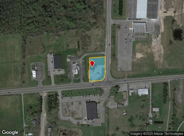
Property Record
12996 Main Rd, Akron, NY 14001


NEARBY LISTINGS FOR SALE OR LEASE
-
-
View all Akron listings for sale on LoopNet.com
Property Detail
12996 Main Rd
145689-061-000-0001-041-100
Erie
Servicestationmarket
New York
X
41.100
36029C0257H
1.01 AC
2023
Outlying Erie County
2023
Buffalo/Niagara Falls
014804
Buffalo-Cheektowaga-Niagara Falls, NY
2,545 SF
DEMOGRAPHICS near 12996 Main Rd
1 Mile
3 Mile
5 Mile
2024 Total Population
1,214
6,856
13,756
2029 Population
1,221
6,857
13,731
Pop Growth 2024-2029
+ 0.58%
+ 0.01%
(0.18%)
Average Age
46
44
45
2024 Total Households
541
3,061
5,881
HH Growth 2024-2029
+ 0.18%
(0.23%)
(0.36%)
Median Household Inc
$66,494
$59,729
$68,922
Avg Household Size
2.20
2.20
2.30
2024 Avg HH Vehicles
2.00
2.00
2.00
Median Home Value
$236,752
$224,516
$246,091
Median Year Built
1986
1974
1973
Nearby Places
- Restaurants
- Banks
- Shops
- Fitness
- Groceries
PUBLIC TRANSPORTATION
AIRPORT
Buffalo Niagara International
DRIVE
WALK
Distance
Buffalo Niagara International
22 min
13.3 mi
Niagara Falls International
DRIVE
WALK
Distance
Niagara Falls International
47 min
28.6 mi
Freight Ports
Albany, NY Port
DRIVE
WALK
Distance
Albany, NY Port
314 min
267.9 mi
Nearby Properties
Address
Land Use
TOTAL SIZE
Lot Size
Zoning
Address
Land Use
TOTAL SIZE
Lot Size
Zoning
Address
Land Use
TOTAL SIZE
Lot Size
Zoning
180,205 SF
22.80 AC
02 - SINGL
Address
Land Use
TOTAL SIZE
Lot Size
Zoning
Address
Land Use
TOTAL SIZE
Lot Size
Zoning
1,104 SF
50.20 AC
20
Address
Land Use
TOTAL SIZE
Lot Size
Zoning
48,852 SF
70.18 AC
19
Address
Land Use
TOTAL SIZE
Lot Size
Zoning
6,000 SF
40.17 AC
20
Address
Land Use
TOTAL SIZE
Lot Size
Zoning
7,632 SF
160.83 AC
11
Address
Land Use
TOTAL SIZE
Lot Size
Zoning
14,128 SF
11.30 AC
07 - MIXED
Address
Land Use
TOTAL SIZE
Lot Size
Zoning
14,128 SF
11.30 AC
07 - MIXED
Address
Land Use
TOTAL SIZE
Lot Size
Zoning
7,000 SF
1.50 AC
17
Address
Land Use
TOTAL SIZE
Lot Size
Zoning
768 SF
105.96 AC
21
Address
Land Use
TOTAL SIZE
Lot Size
Zoning
7,120 SF
64.71 AC
06 - INDUS
Address
Land Use
TOTAL SIZE
Lot Size
Zoning
0.01 AC
17
Address
Land Use
TOTAL SIZE
Lot Size
Zoning
5,335 SF
277.81 AC
11
Address
Land Use
TOTAL SIZE
Lot Size
Zoning
15,650 SF
42.39 AC
19
Address
Land Use
TOTAL SIZE
Lot Size
Zoning
3.91 AC
11
Address
Land Use
TOTAL SIZE
Lot Size
Zoning
17,516 SF
41.54 AC
07 - MIXED
Address
Land Use
TOTAL SIZE
Lot Size
Zoning
14,674 SF
6.15 AC
17
Address
Land Use
TOTAL SIZE
Lot Size
Zoning
249,402 SF
16 AC
07 - MIXED
Address
Land Use
TOTAL SIZE
Lot Size
Zoning
5,627 SF
303.30 AC
17
Address
Land Use
TOTAL SIZE
Lot Size
Zoning
7,500 SF
0.64 AC
04 - FARM
Address
Land Use
TOTAL SIZE
Lot Size
Zoning
51,683 SF
13 AC
07 - MIXED
Address
Land Use
TOTAL SIZE
Lot Size
Zoning
31,636 SF
5.20 AC
05 - COMME
Address
Land Use
TOTAL SIZE
Lot Size
Zoning
Address
Land Use
TOTAL SIZE
Lot Size
Zoning
5,616 SF
166.30 AC
08 - GOVER
Address
Land Use
TOTAL SIZE
Lot Size
Zoning
8,702 SF
13.60 AC
01 - NOT Z
Address
Land Use
TOTAL SIZE
Lot Size
Zoning
10,266 SF
3.80 AC
03 - MULTI
Address
Land Use
TOTAL SIZE
Lot Size
Zoning
3,480 SF
42 AC
17
Address
Land Use
TOTAL SIZE
Lot Size
Zoning
7,920 SF
8.72 AC
11
The World's #1 Commercial Real Estate Marketplace
Connect with us
© 2025 CoStar Group
The information above has been obtained from sources believed reliable. While we do not doubt its accuracy we have not verified it and make no guarantee, warranty or representation about it. It is your responsibility to independently confirm its accuracy and completeness. Any projections, opinions, assumptions, or estimates used are for example only and do not represent the current or future performance of the property. The value of this transaction to you depends on tax and other factors which should be evaluated by your tax, financial, and legal advisors. You and your advisors should conduct a careful, independent investigation of the property to determine to your satisfaction the suitability of the property for your needs.