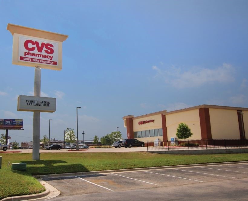
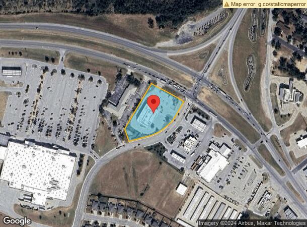
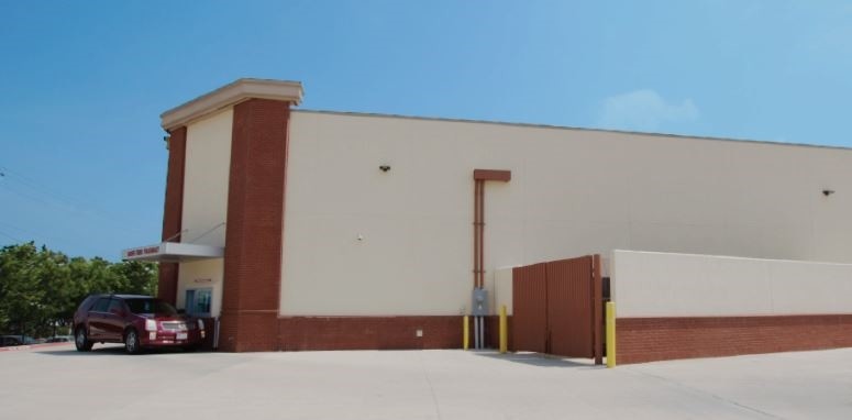
Property Record
1300 Highway 290 W, Elgin, TX 78621
NEARBY LISTINGS FOR SALE OR LEASE
Property Detail
1300 Highway 290 W
74022
Burleson, Jonathan
Commercialnec
A18 BURLESON, JONATHAN, ACRES 1.9035
X
Bastrop
48453C0510H
Texas
2023
1.90 AC
2023
Bastrop County
950200
Austin
13,317 SF
Austin-Round Rock, TX
DEMOGRAPHICS near 1300 Highway 290 W
1 Mile
3 Mile
5 Mile
2024 Total Population
4,723
16,172
21,824
2029 Population
5,956
19,530
26,362
Pop Growth 2024-2029
+ 26.11%
+ 20.76%
+ 20.79%
Average Age
36
37
37
2024 Total Households
1,620
5,405
7,286
HH Growth 2024-2029
+ 27.28%
+ 22.20%
+ 22.19%
Median Household Inc
$67,799
$77,545
$85,712
Avg Household Size
2.90
2.90
2.90
2024 Avg HH Vehicles
2.00
2.00
2.00
Median Home Value
$216,900
$242,301
$254,901
Median Year Built
1987
1993
1995
Nearby Places
- Restaurants
- Banks
- Shops
- Fitness
- Groceries
PUBLIC TRANSPORTATION
AIRPORT
Austin-Bergstrom International
DRIVE
WALK
Distance
Austin-Bergstrom International
40 min
28.1 mi
Freight Ports
Calhoun Port
DRIVE
WALK
Distance
Calhoun Port
192 min
163.1 mi
SALE & LEASE HISTORY
LISTING DATE
SALE/LEASE

Sep 18, 2017
For Sale
Nearby Properties
Address
Land Use
TOTAL SIZE
Lot Size
Zoning
Address
Land Use
TOTAL SIZE
Lot Size
Zoning
343,452 SF
92.46 AC
Address
Land Use
TOTAL SIZE
Lot Size
Zoning
125,720 SF
74.99 AC
Address
Land Use
TOTAL SIZE
Lot Size
Zoning
63,700 SF
15.48 AC
Address
Land Use
TOTAL SIZE
Lot Size
Zoning
155,983 SF
17.99 AC
Address
Land Use
TOTAL SIZE
Lot Size
Zoning
108,900 SF
27.89 AC
Address
Land Use
TOTAL SIZE
Lot Size
Zoning
85,780 SF
12.92 AC
Address
Land Use
TOTAL SIZE
Lot Size
Zoning
87,812 SF
11.77 AC
Address
Land Use
TOTAL SIZE
Lot Size
Zoning
77,263 SF
9.34 AC
Address
Land Use
TOTAL SIZE
Lot Size
Zoning
72,600 SF
19.72 AC
Address
Land Use
TOTAL SIZE
Lot Size
Zoning
57,279 SF
2.46 AC
Address
Land Use
TOTAL SIZE
Lot Size
Zoning
63,520 SF
5.49 AC
Address
Land Use
TOTAL SIZE
Lot Size
Zoning
22,016 SF
5.59 AC
Address
Land Use
TOTAL SIZE
Lot Size
Zoning
45,180 SF
5.34 AC
Address
Land Use
TOTAL SIZE
Lot Size
Zoning
1 SF
77.20 AC
Address
Land Use
TOTAL SIZE
Lot Size
Zoning
38,336 SF
4.02 AC
Address
Land Use
TOTAL SIZE
Lot Size
Zoning
18,697 SF
0.79 AC
Address
Land Use
TOTAL SIZE
Lot Size
Zoning
19,637 SF
2.71 AC
Address
Land Use
TOTAL SIZE
Lot Size
Zoning
18,359 SF
8.36 AC
Address
Land Use
TOTAL SIZE
Lot Size
Zoning
36,451 SF
1.23 AC
Address
Land Use
TOTAL SIZE
Lot Size
Zoning
6,720 SF
1.88 AC
Address
Land Use
TOTAL SIZE
Lot Size
Zoning
17,805 SF
22.11 AC
Address
Land Use
TOTAL SIZE
Lot Size
Zoning
52,393 SF
2.04 AC
Address
Land Use
TOTAL SIZE
Lot Size
Zoning
12,926 SF
1.92 AC
Address
Land Use
TOTAL SIZE
Lot Size
Zoning
20,641 SF
1.74 AC
Address
Land Use
TOTAL SIZE
Lot Size
Zoning
20,950 SF
1.76 AC
Address
Land Use
TOTAL SIZE
Lot Size
Zoning
14,890 SF
2.54 AC
Address
Land Use
TOTAL SIZE
Lot Size
Zoning
63,538 SF
19.18 AC
Address
Land Use
TOTAL SIZE
Lot Size
Zoning
12,976 SF
0.37 AC
Address
Land Use
TOTAL SIZE
Lot Size
Zoning
43,931 SF
1.62 AC
Address
Land Use
TOTAL SIZE
Lot Size
Zoning
295.67 AC
The World's #1 Commercial Real Estate Marketplace
Connect with us
© 2025 CoStar Group
The information above has been obtained from sources believed reliable. While we do not doubt its accuracy we have not verified it and make no guarantee, warranty or representation about it. It is your responsibility to independently confirm its accuracy and completeness. Any projections, opinions, assumptions, or estimates used are for example only and do not represent the current or future performance of the property. The value of this transaction to you depends on tax and other factors which should be evaluated by your tax, financial, and legal advisors. You and your advisors should conduct a careful, independent investigation of the property to determine to your satisfaction the suitability of the property for your needs.