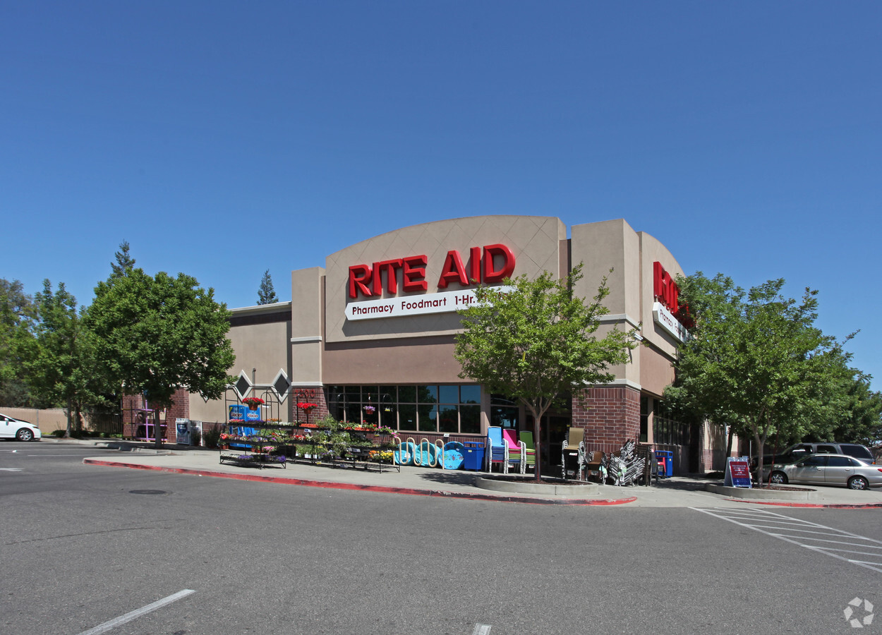
Property Record
1300 W F St, Oakdale, CA 95361

NEARBY LISTINGS FOR SALE OR LEASE
Property Detail
1300 W F St
063-10-38
EQUIPMENT & SUPPLIES DD
Storemultistory
Stanislaus
X
California
06099C0190E
1.40 AC
2024
Hughson/Oakdale/Waterford
2024
Stockton/Modesto
000201
Modesto, CA
12,583 SF
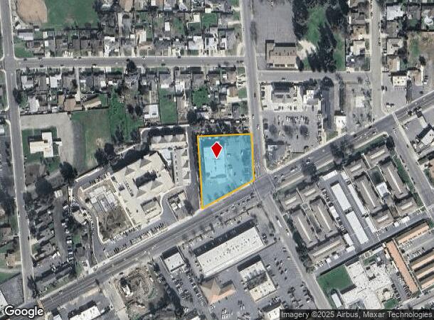
DEMOGRAPHICS near 1300 W F St
1 Mile
3 Mile
5 Mile
2024 Total Population
13,125
26,658
44,271
2029 Population
13,152
26,686
44,247
Pop Growth 2024-2029
+ 0.21%
+ 0.11%
(0.05%)
Average Age
37
38
38
2024 Total Households
4,511
9,442
14,995
HH Growth 2024-2029
+ 0.18%
+ 0.07%
(0.07%)
Median Household Inc
$86,328
$79,861
$80,356
Avg Household Size
2.80
2.80
2.90
2024 Avg HH Vehicles
2.00
2.00
2.00
Median Home Value
$444,140
$435,337
$443,344
Median Year Built
1979
1986
1985
Nearby Places
- Restaurants
- Banks
- Shops
- Fitness
- Groceries
PUBLIC TRANSPORTATION
COMMUTER RAIL
Modesto (San Joaquins - Amtrak)
DRIVE
WALK
Distance
Modesto (San Joaquins - Amtrak)
16 min
9.3 mi
AIRPORT
Stockton Metro
DRIVE
WALK
Distance
Stockton Metro
46 min
27.5 mi
Freight Ports
Port of Stockton
DRIVE
WALK
Distance
Port of Stockton
55 min
40.8 mi
Nearby Properties
Address
Land Use
TOTAL SIZE
Lot Size
Zoning
Address
Land Use
TOTAL SIZE
Lot Size
Zoning
26.73 AC
Address
Land Use
TOTAL SIZE
Lot Size
Zoning
1,470 SF
4.15 AC
OAKC2
Address
Land Use
TOTAL SIZE
Lot Size
Zoning
51,000 SF
0.99 AC
Address
Land Use
TOTAL SIZE
Lot Size
Zoning
543,278 SF
71.53 AC
Address
Land Use
TOTAL SIZE
Lot Size
Zoning
230,148 SF
13.25 AC
MI
Address
Land Use
TOTAL SIZE
Lot Size
Zoning
95,020 SF
9.82 AC
OAKPD
Address
Land Use
TOTAL SIZE
Lot Size
Zoning
151,200 SF
8.60 AC
MI
Address
Land Use
TOTAL SIZE
Lot Size
Zoning
86,946 SF
4.83 AC
OAKPD
Address
Land Use
TOTAL SIZE
Lot Size
Zoning
45,337 SF
3.97 AC
OAKPD
Address
Land Use
TOTAL SIZE
Lot Size
Zoning
96,550 SF
4.05 AC
Address
Land Use
TOTAL SIZE
Lot Size
Zoning
117,162 SF
5.17 AC
Address
Land Use
TOTAL SIZE
Lot Size
Zoning
386.13 AC
Address
Land Use
TOTAL SIZE
Lot Size
Zoning
37,998 SF
2.80 AC
Address
Land Use
TOTAL SIZE
Lot Size
Zoning
23,618 SF
2.93 AC
OAKPD
Address
Land Use
TOTAL SIZE
Lot Size
Zoning
15,114 SF
1.17 AC
Address
Land Use
TOTAL SIZE
Lot Size
Zoning
48,460 SF
5.64 AC
Address
Land Use
TOTAL SIZE
Lot Size
Zoning
86,549 SF
7.34 AC
Address
Land Use
TOTAL SIZE
Lot Size
Zoning
11,411 SF
133.33 AC
Address
Land Use
TOTAL SIZE
Lot Size
Zoning
133,627 SF
13.33 AC
Address
Land Use
TOTAL SIZE
Lot Size
Zoning
34,331 SF
1.70 AC
OAKC2
Address
Land Use
TOTAL SIZE
Lot Size
Zoning
1.34 AC
OAKC2
Address
Land Use
TOTAL SIZE
Lot Size
Zoning
25,575 SF
4.86 AC
C2
Address
Land Use
TOTAL SIZE
Lot Size
Zoning
69,323 SF
3.77 AC
M
Address
Land Use
TOTAL SIZE
Lot Size
Zoning
816 SF
156.30 AC
A240
Address
Land Use
TOTAL SIZE
Lot Size
Zoning
50,250 SF
5.26 AC
OAKR2
Address
Land Use
TOTAL SIZE
Lot Size
Zoning
47,375 SF
2 AC
Address
Land Use
TOTAL SIZE
Lot Size
Zoning
32,604 SF
23.08 AC
Address
Land Use
TOTAL SIZE
Lot Size
Zoning
499.79 AC
Address
Land Use
TOTAL SIZE
Lot Size
Zoning
190,416 SF
5.93 AC
Address
Land Use
TOTAL SIZE
Lot Size
Zoning
54,794 SF
3.42 AC
OAKM1
The World's #1 Commercial Real Estate Marketplace
Connect with us
© 2025 CoStar Group
The information above has been obtained from sources believed reliable. While we do not doubt its accuracy we have not verified it and make no guarantee, warranty or representation about it. It is your responsibility to independently confirm its accuracy and completeness. Any projections, opinions, assumptions, or estimates used are for example only and do not represent the current or future performance of the property. The value of this transaction to you depends on tax and other factors which should be evaluated by your tax, financial, and legal advisors. You and your advisors should conduct a careful, independent investigation of the property to determine to your satisfaction the suitability of the property for your needs.