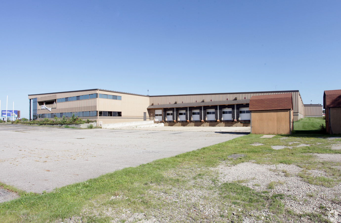
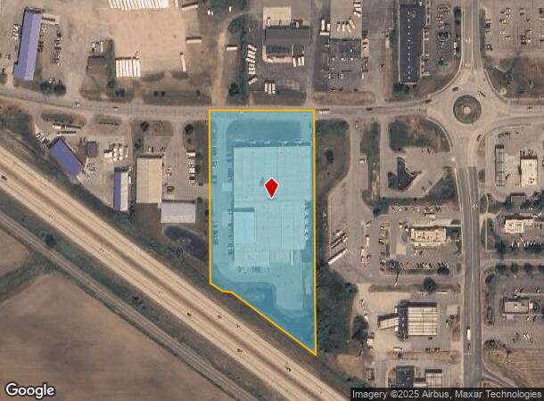
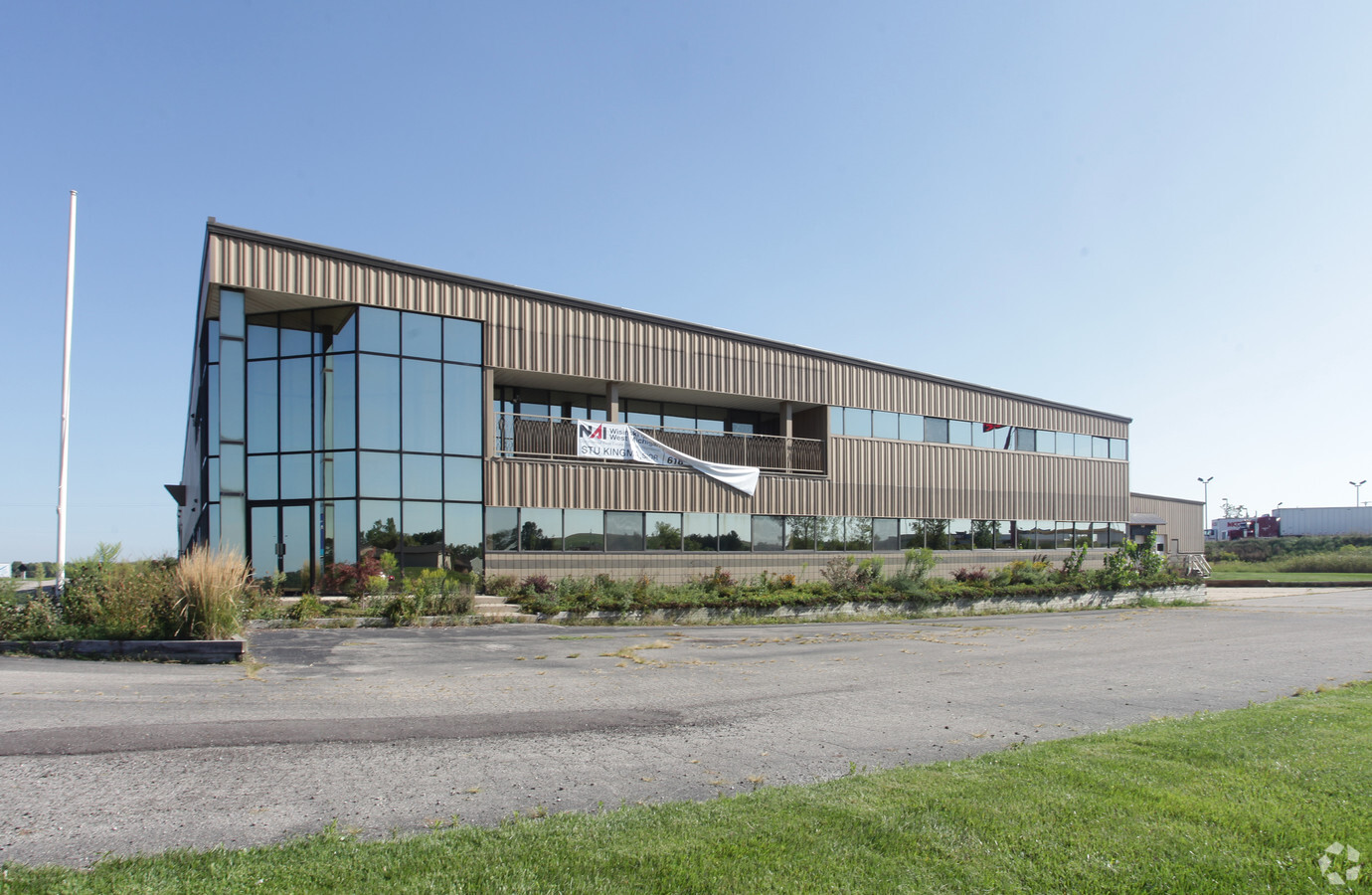
Property Record
1300 W Randall St, Coopersville, MI 49404
NEARBY LISTINGS FOR SALE OR LEASE
Property Detail
1300 W Randall St
70-05-27-100-029
PART OF NW 1/4 COM 506 FT W OF N 1/4 COR,TH W 337 FT, S 0D 19M E 55569 FT, S 53D 45M E 4639 FT ALG NE'LY R/W LI OF I-96, E 3174 FT, S 53D 23M E 33531 FT TH N 0D 19M 30S E 78312 FT TO BEG SEC 27 T8N R14W
Lightindustrial
Ottawa
X
Michigan
26121C0475D
5.14 AC
2023
Northern Ottawa County
2024
West Michigan
020200
Grand Rapids-Wyoming, MI
76,019 SF
DEMOGRAPHICS near 1300 W Randall St
1 Mile
3 Mile
5 Mile
2024 Total Population
279
5,577
10,305
2029 Population
288
5,758
10,673
Pop Growth 2024-2029
+ 3.23%
+ 3.25%
+ 3.57%
Average Age
35
37
38
2024 Total Households
104
2,006
3,662
HH Growth 2024-2029
+ 3.85%
+ 3.34%
+ 3.69%
Median Household Inc
$56,176
$65,253
$77,794
Avg Household Size
2.60
2.80
2.80
2024 Avg HH Vehicles
2.00
2.00
2.00
Median Home Value
$137,500
$231,949
$269,959
Median Year Built
1986
1982
1982
Nearby Places
- Restaurants
- Banks
- Shops
- Fitness
- Groceries
PUBLIC TRANSPORTATION
AIRPORT
Gerald R Ford International
DRIVE
WALK
Distance
Gerald R Ford International
41 min
32.6 mi
Freight Ports
Port Milwaukee
DRIVE
WALK
Distance
Port Milwaukee
312 min
263.3 mi
Nearby Properties
Address
Land Use
TOTAL SIZE
Lot Size
Zoning
Address
Land Use
TOTAL SIZE
Lot Size
Zoning
318,505 SF
131.30 AC
I-2
Address
Land Use
TOTAL SIZE
Lot Size
Zoning
38,432 SF
I-2
Address
Land Use
TOTAL SIZE
Lot Size
Zoning
5,490 SF
R-1
Address
Land Use
TOTAL SIZE
Lot Size
Zoning
212,705 SF
28 AC
I-1
Address
Land Use
TOTAL SIZE
Lot Size
Zoning
38,568 SF
I-2
Address
Land Use
TOTAL SIZE
Lot Size
Zoning
81,768 SF
R-1
Address
Land Use
TOTAL SIZE
Lot Size
Zoning
63.56 AC
R-5
Address
Land Use
TOTAL SIZE
Lot Size
Zoning
86,806 SF
9.90 AC
C-1
Address
Land Use
TOTAL SIZE
Lot Size
Zoning
27,918 SF
R-1
Address
Land Use
TOTAL SIZE
Lot Size
Zoning
17,082 SF
9.86 AC
MPUD
Address
Land Use
TOTAL SIZE
Lot Size
Zoning
140,989 SF
20.53 AC
I-1
Address
Land Use
TOTAL SIZE
Lot Size
Zoning
2,480 SF
167.77 AC
AG-1
Address
Land Use
TOTAL SIZE
Lot Size
Zoning
3,742 SF
182.98 AC
AG-1
Address
Land Use
TOTAL SIZE
Lot Size
Zoning
13,056 SF
155.80 AC
AG-1
Address
Land Use
TOTAL SIZE
Lot Size
Zoning
720 SF
151.82 AC
AG-1
Address
Land Use
TOTAL SIZE
Lot Size
Zoning
22,160 SF
9.45 AC
MPUD
Address
Land Use
TOTAL SIZE
Lot Size
Zoning
117,168 SF
17.75 AC
I-1
Address
Land Use
TOTAL SIZE
Lot Size
Zoning
242,802 SF
31.47 AC
I-1
Address
Land Use
TOTAL SIZE
Lot Size
Zoning
83,321 SF
5.22 AC
I-1
Address
Land Use
TOTAL SIZE
Lot Size
Zoning
16,288 SF
160.85 AC
AG-1
Address
Land Use
TOTAL SIZE
Lot Size
Zoning
46,032 SF
4.80 AC
R-4
Address
Land Use
TOTAL SIZE
Lot Size
Zoning
37.60 AC
MPUD
Address
Land Use
TOTAL SIZE
Lot Size
Zoning
38,163 SF
4.86 AC
R-4
Address
Land Use
TOTAL SIZE
Lot Size
Zoning
31,098 SF
4.93 AC
R-4
Address
Land Use
TOTAL SIZE
Lot Size
Zoning
35,000 SF
I-1
Address
Land Use
TOTAL SIZE
Lot Size
Zoning
7,332 SF
I-1
Address
Land Use
TOTAL SIZE
Lot Size
Zoning
34,310 SF
13.75 AC
I-1
Address
Land Use
TOTAL SIZE
Lot Size
Zoning
Address
Land Use
TOTAL SIZE
Lot Size
Zoning
39.53 AC
AG-1
The World's #1 Commercial Real Estate Marketplace
Connect with us
© 2025 CoStar Group
The information above has been obtained from sources believed reliable. While we do not doubt its accuracy we have not verified it and make no guarantee, warranty or representation about it. It is your responsibility to independently confirm its accuracy and completeness. Any projections, opinions, assumptions, or estimates used are for example only and do not represent the current or future performance of the property. The value of this transaction to you depends on tax and other factors which should be evaluated by your tax, financial, and legal advisors. You and your advisors should conduct a careful, independent investigation of the property to determine to your satisfaction the suitability of the property for your needs.