Property Record
1300 W Saunders St, Mount Pleasant, IA 52641
Current Lease Availabilities
NEARBY LISTINGS FOR SALE OR LEASE
-
-
View all Mount Pleasant listings for lease on LoopNet.com
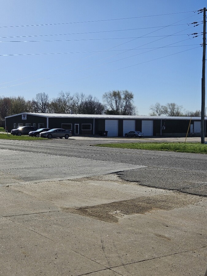
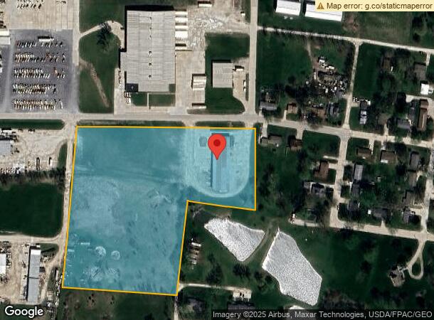
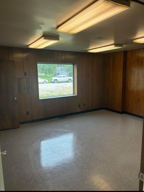
Property Detail
1300 W Saunders St
Warehouse
TR E MID PT W 1/2 NE
X
Henry
19087C0227B
Iowa
2024
9.79 AC
2024
Iowa Southeast Area
970300
Other Market Areas
15,260 SF
180080825100400
DEMOGRAPHICS near 1300 W Saunders St
1 Mile
3 Mile
5 Mile
2024 Total Population
2,984
10,618
11,340
2029 Population
2,964
10,503
11,204
Pop Growth 2024-2029
(0.67%)
(1.08%)
(1.20%)
Average Age
39
40
41
2024 Total Households
1,177
3,752
4,045
HH Growth 2024-2029
(0.68%)
(1.09%)
(1.24%)
Median Household Inc
$54,736
$59,774
$60,634
Avg Household Size
2.30
2.30
2.30
2024 Avg HH Vehicles
2.00
2.00
2.00
Median Home Value
$152,968
$151,902
$153,558
Median Year Built
1966
1967
1967
Nearby Places
- Restaurants
- Banks
- Shops
- Fitness
- Groceries
PUBLIC TRANSPORTATION
COMMUTER RAIL
Mt. Pleasant Amtrak Station (California Zephyr - Amtrak)
DRIVE
WALK
Distance
Mt. Pleasant Amtrak Station (California Zephyr - Amtrak)
4 min
1.2 mi
Freight Ports
Port Milwaukee
DRIVE
WALK
Distance
Port Milwaukee
351 min
302.6 mi
Nearby Properties
Address
Land Use
TOTAL SIZE
Lot Size
Zoning
Address
Land Use
TOTAL SIZE
Lot Size
Zoning
756 SF
75.10 AC
Address
Land Use
TOTAL SIZE
Lot Size
Zoning
159,209 SF
19 AC
Address
Land Use
TOTAL SIZE
Lot Size
Zoning
111,586 SF
38.30 AC
Address
Land Use
TOTAL SIZE
Lot Size
Zoning
456 SF
63.04 AC
Address
Land Use
TOTAL SIZE
Lot Size
Zoning
576 SF
30.23 AC
Address
Land Use
TOTAL SIZE
Lot Size
Zoning
11,440 SF
27.27 AC
Address
Land Use
TOTAL SIZE
Lot Size
Zoning
68,001 SF
20.01 AC
Address
Land Use
TOTAL SIZE
Lot Size
Zoning
57,301 SF
9.31 AC
Address
Land Use
TOTAL SIZE
Lot Size
Zoning
21,857 SF
18.14 AC
Address
Land Use
TOTAL SIZE
Lot Size
Zoning
1,400 SF
29.24 AC
Address
Land Use
TOTAL SIZE
Lot Size
Zoning
11,740 SF
40.56 AC
Address
Land Use
TOTAL SIZE
Lot Size
Zoning
12,191 SF
22.38 AC
Address
Land Use
TOTAL SIZE
Lot Size
Zoning
2,964 SF
8.50 AC
Address
Land Use
TOTAL SIZE
Lot Size
Zoning
64,806 SF
3.40 AC
Address
Land Use
TOTAL SIZE
Lot Size
Zoning
38,835 SF
5.97 AC
Address
Land Use
TOTAL SIZE
Lot Size
Zoning
139,649 SF
20.45 AC
Address
Land Use
TOTAL SIZE
Lot Size
Zoning
8,108 SF
2.30 AC
Address
Land Use
TOTAL SIZE
Lot Size
Zoning
24,599 SF
1.52 AC
Address
Land Use
TOTAL SIZE
Lot Size
Zoning
35,476 SF
0.38 AC
Address
Land Use
TOTAL SIZE
Lot Size
Zoning
13,603 SF
12.17 AC
Address
Land Use
TOTAL SIZE
Lot Size
Zoning
32,160 SF
3.69 AC
Address
Land Use
TOTAL SIZE
Lot Size
Zoning
14,000 SF
5.94 AC
Address
Land Use
TOTAL SIZE
Lot Size
Zoning
134,000 SF
8.92 AC
Address
Land Use
TOTAL SIZE
Lot Size
Zoning
27,744 SF
1.96 AC
Address
Land Use
TOTAL SIZE
Lot Size
Zoning
77,290 SF
7.20 AC
Address
Land Use
TOTAL SIZE
Lot Size
Zoning
58,200 SF
9.83 AC
Address
Land Use
TOTAL SIZE
Lot Size
Zoning
50,784 SF
5.22 AC
Address
Land Use
TOTAL SIZE
Lot Size
Zoning
1,680 SF
3.09 AC
Address
Land Use
TOTAL SIZE
Lot Size
Zoning
4,500 SF
5.40 AC
The World's #1 Commercial Real Estate Marketplace
Connect with us
© 2025 CoStar Group
The information above has been obtained from sources believed reliable. While we do not doubt its accuracy we have not verified it and make no guarantee, warranty or representation about it. It is your responsibility to independently confirm its accuracy and completeness. Any projections, opinions, assumptions, or estimates used are for example only and do not represent the current or future performance of the property. The value of this transaction to you depends on tax and other factors which should be evaluated by your tax, financial, and legal advisors. You and your advisors should conduct a careful, independent investigation of the property to determine to your satisfaction the suitability of the property for your needs.