Property Record
1301 Alabama Ave, Flint, MI 48505

NEARBY LISTINGS FOR SALE OR LEASE
Property Detail
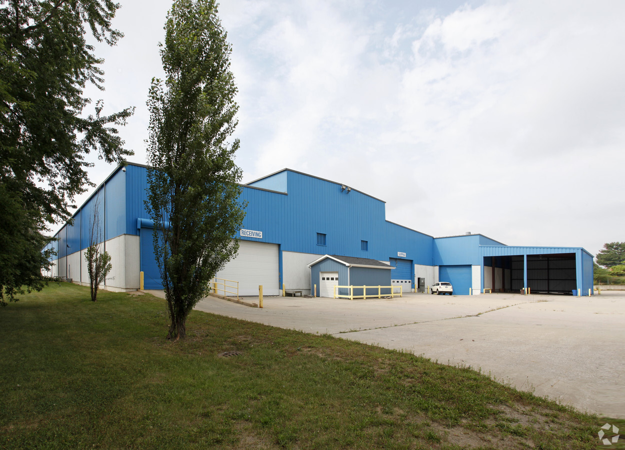
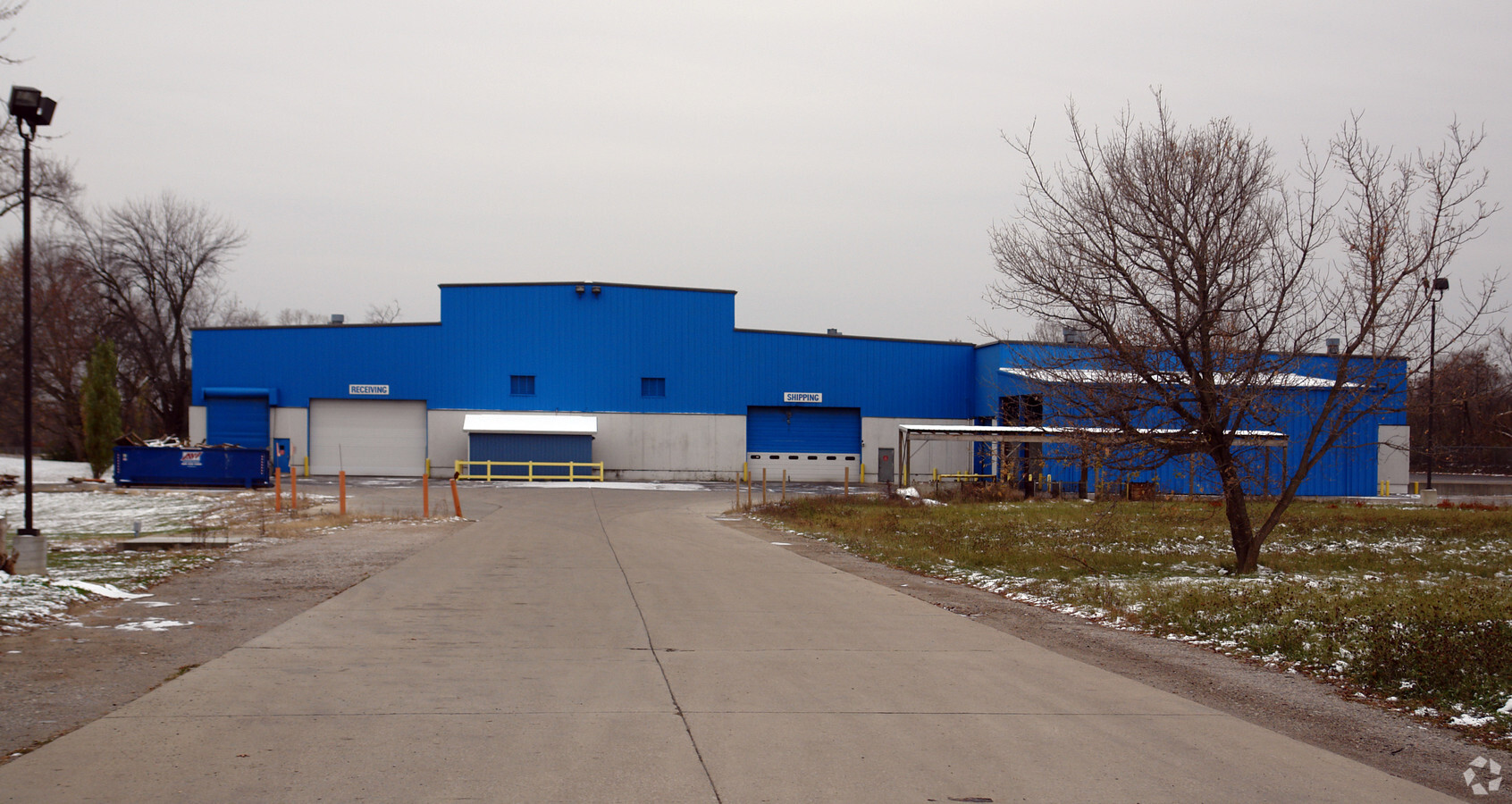
1301 Alabama Ave
47-31-452-036
General Motors Park
Industrialgeneral
GENERAL MOTORS PARK LOTS 85 THRU 90; LOTS 95 THRU 102; LOTS 124 THRU 134; LOTS 137 THRU 147; LOTS 168 THRU 178; LOTS 181 THRU 191; LOTS 213 THRU 223; LOTS 228 THRU 236; ALSO PART OF LOTS 84, 91, 92, 103, 123, 148, 167, 192, 212, 226, 227 AND 237 DESC
X
Genesee
26049C0191D
Michigan
2024
9.41 AC
2024
Flint
980100
Detroit
86,786 SF
Flint, MI
DEMOGRAPHICS near 1301 Alabama Ave
1 Mile
3 Mile
5 Mile
2024 Total Population
3,916
71,984
148,977
2029 Population
4,204
74,433
150,706
Pop Growth 2024-2029
+ 7.35%
+ 3.40%
+ 1.16%
Average Age
40
40
39
2024 Total Households
1,679
29,990
61,635
HH Growth 2024-2029
+ 7.44%
+ 3.37%
+ 1.12%
Median Household Inc
$25,757
$32,134
$36,432
Avg Household Size
2.10
2.20
2.30
2024 Avg HH Vehicles
1.00
1.00
1.00
Median Home Value
$59,751
$63,515
$72,840
Median Year Built
1952
1957
1959
Nearby Places
- Restaurants
- Banks
- Shops
- Fitness
- Groceries
PUBLIC TRANSPORTATION
COMMUTER RAIL
Flint Amtrak Station (Blue Water - Amtrak)
DRIVE
WALK
Distance
Flint Amtrak Station (Blue Water - Amtrak)
8 min
4.0 mi
AIRPORT
Bishop International
DRIVE
WALK
Distance
Bishop International
24 min
11.9 mi
Freight Ports
Port of Toledo
DRIVE
WALK
Distance
Port of Toledo
139 min
117.8 mi
SALE & LEASE HISTORY
LISTING DATE
SALE/LEASE

Feb 23, 2017
For Sale
Nearby Properties
Address
Land Use
TOTAL SIZE
Lot Size
Zoning
Address
Land Use
TOTAL SIZE
Lot Size
Zoning
130,291 SF
Address
Land Use
TOTAL SIZE
Lot Size
Zoning
46,808 SF
32.06 AC
I-2 HVY IN
Address
Land Use
TOTAL SIZE
Lot Size
Zoning
144,896 SF
0.23 AC
Address
Land Use
TOTAL SIZE
Lot Size
Zoning
371,636 SF
12.50 AC
M-1
Address
Land Use
TOTAL SIZE
Lot Size
Zoning
290,267 SF
79 AC
Address
Land Use
TOTAL SIZE
Lot Size
Zoning
68,571 SF
0.81 AC
Address
Land Use
TOTAL SIZE
Lot Size
Zoning
215,000 SF
Address
Land Use
TOTAL SIZE
Lot Size
Zoning
412,500 SF
57.18 AC
M-2
Address
Land Use
TOTAL SIZE
Lot Size
Zoning
156,250 SF
Address
Land Use
TOTAL SIZE
Lot Size
Zoning
182,408 SF
Address
Land Use
TOTAL SIZE
Lot Size
Zoning
114,888 SF
11.86 AC
I-2 HVY IN
Address
Land Use
TOTAL SIZE
Lot Size
Zoning
121,133 SF
3.41 AC
Address
Land Use
TOTAL SIZE
Lot Size
Zoning
85,697 SF
0.30 AC
Address
Land Use
TOTAL SIZE
Lot Size
Zoning
65,488 SF
0.30 AC
Address
Land Use
TOTAL SIZE
Lot Size
Zoning
203,200 SF
0.92 AC
Address
Land Use
TOTAL SIZE
Lot Size
Zoning
74,816 SF
Address
Land Use
TOTAL SIZE
Lot Size
Zoning
217,389 SF
37.64 AC
Address
Land Use
TOTAL SIZE
Lot Size
Zoning
Address
Land Use
TOTAL SIZE
Lot Size
Zoning
155,633 SF
29.88 AC
Address
Land Use
TOTAL SIZE
Lot Size
Zoning
149,136 SF
9.35 AC
Address
Land Use
TOTAL SIZE
Lot Size
Zoning
84,896 SF
0.55 AC
Address
Land Use
TOTAL SIZE
Lot Size
Zoning
192,900 SF
6.50 AC
Address
Land Use
TOTAL SIZE
Lot Size
Zoning
0.37 AC
Address
Land Use
TOTAL SIZE
Lot Size
Zoning
118,210 SF
6.60 AC
Address
Land Use
TOTAL SIZE
Lot Size
Zoning
36,870 SF
Address
Land Use
TOTAL SIZE
Lot Size
Zoning
173,312 SF
23.49 AC
Address
Land Use
TOTAL SIZE
Lot Size
Zoning
224,263 SF
24.98 AC
Address
Land Use
TOTAL SIZE
Lot Size
Zoning
66,800 SF
110 AC
Address
Land Use
TOTAL SIZE
Lot Size
Zoning
4.24 AC
Address
Land Use
TOTAL SIZE
Lot Size
Zoning
46,354 SF
0.15 AC
The World's #1 Commercial Real Estate Marketplace
Connect with us
© 2025 CoStar Group
The information above has been obtained from sources believed reliable. While we do not doubt its accuracy we have not verified it and make no guarantee, warranty or representation about it. It is your responsibility to independently confirm its accuracy and completeness. Any projections, opinions, assumptions, or estimates used are for example only and do not represent the current or future performance of the property. The value of this transaction to you depends on tax and other factors which should be evaluated by your tax, financial, and legal advisors. You and your advisors should conduct a careful, independent investigation of the property to determine to your satisfaction the suitability of the property for your needs.