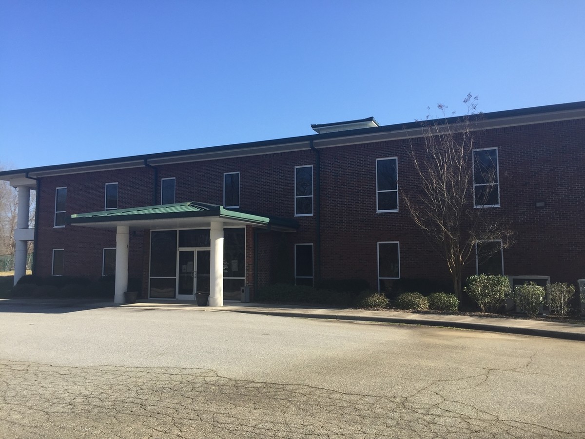
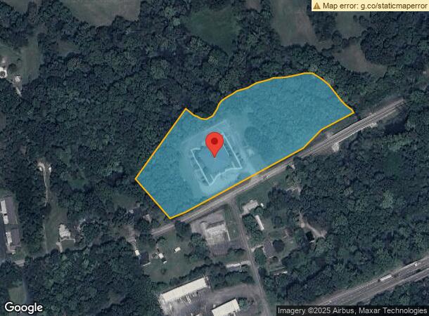
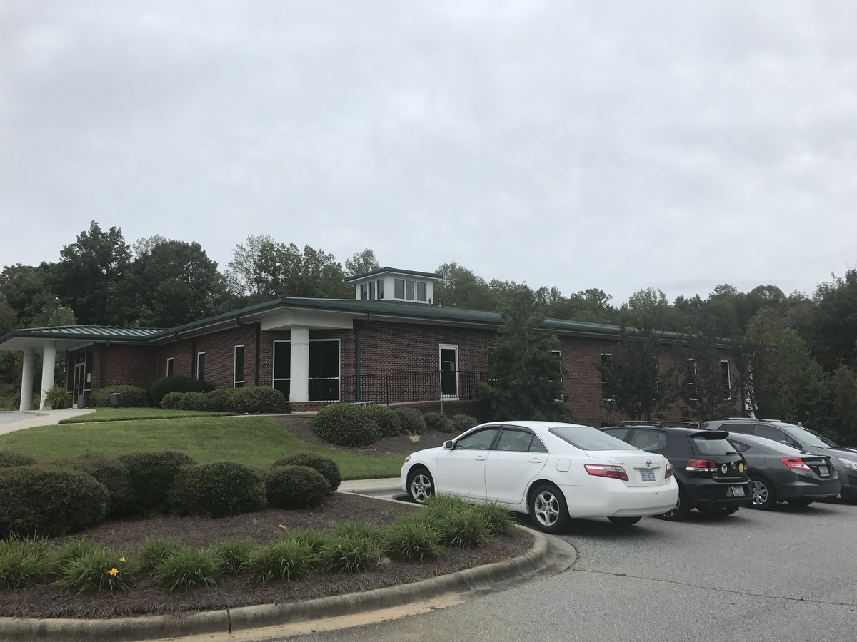
Property Record
1303 Greensboro Street Ext, Lexington, NC 27295
NEARBY LISTINGS FOR SALE OR LEASE
Property Detail
1303 Greensboro Street Ext
11-326-0-000-0035-0-0-0
L35 BK1137-1152&2336-1 OLD GREENSBOR
Countyproperty
Davidson
AE
North Carolina
3710673600J
7.65 AC
0
South Davidson County
2024
Greensboro/Winston-Salem
061204
Winston-Salem, NC
21,082 SF
DEMOGRAPHICS near 1303 Greensboro Street Ext
1 Mile
3 Mile
5 Mile
2024 Total Population
832
19,411
38,338
2029 Population
882
20,683
40,630
Pop Growth 2024-2029
+ 6.01%
+ 6.55%
+ 5.98%
Average Age
40
40
41
2024 Total Households
338
7,724
15,461
HH Growth 2024-2029
+ 5.92%
+ 6.51%
+ 5.90%
Median Household Inc
$37,887
$36,912
$38,952
Avg Household Size
2.40
2.40
2.40
2024 Avg HH Vehicles
3.00
2.00
2.00
Median Home Value
$148,760
$142,453
$151,182
Median Year Built
1982
1972
1977
Nearby Places
- Restaurants
- Banks
- Shops
- Fitness
- Groceries
PUBLIC TRANSPORTATION
AIRPORT
Piedmont Triad International
DRIVE
WALK
Distance
Piedmont Triad International
45 min
29.4 mi
Freight Ports
Port of Wilmington
DRIVE
WALK
Distance
Port of Wilmington
258 min
214.0 mi
SALE & LEASE HISTORY
LISTING DATE
SALE/LEASE

Sep 25, 2016
For Lease
Nearby Properties
Address
Land Use
TOTAL SIZE
Lot Size
Zoning
Address
Land Use
TOTAL SIZE
Lot Size
Zoning
4,788 SF
11.95 AC
HC
Address
Land Use
TOTAL SIZE
Lot Size
Zoning
56,721 SF
4.77 AC
U
Address
Land Use
TOTAL SIZE
Lot Size
Zoning
32,834 SF
30 AC
RA3
Address
Land Use
TOTAL SIZE
Lot Size
Zoning
20,651 SF
12.03 AC
B
Address
Land Use
TOTAL SIZE
Lot Size
Zoning
33,282 SF
4.41 AC
B
Address
Land Use
TOTAL SIZE
Lot Size
Zoning
8,008 SF
9.26 AC
TN
Address
Land Use
TOTAL SIZE
Lot Size
Zoning
45,732 SF
5.82 AC
LI
Address
Land Use
TOTAL SIZE
Lot Size
Zoning
85,425 SF
1.16 AC
U
Address
Land Use
TOTAL SIZE
Lot Size
Zoning
115,748 SF
8.14 AC
B
Address
Land Use
TOTAL SIZE
Lot Size
Zoning
1,272 SF
107.80 AC
PD
Address
Land Use
TOTAL SIZE
Lot Size
Zoning
115,600 SF
13.15 AC
I
Address
Land Use
TOTAL SIZE
Lot Size
Zoning
95,953 SF
1.42 AC
U
Address
Land Use
TOTAL SIZE
Lot Size
Zoning
42,132 SF
6.33 AC
B
Address
Land Use
TOTAL SIZE
Lot Size
Zoning
2,414 SF
16.14 AC
TN
Address
Land Use
TOTAL SIZE
Lot Size
Zoning
91,758 SF
12.07 AC
B
Address
Land Use
TOTAL SIZE
Lot Size
Zoning
2,148 SF
6.62 AC
TN
Address
Land Use
TOTAL SIZE
Lot Size
Zoning
18,986 SF
6.79 AC
TN
Address
Land Use
TOTAL SIZE
Lot Size
Zoning
11,024 SF
15.93 AC
OI
Address
Land Use
TOTAL SIZE
Lot Size
Zoning
60,944 SF
10.70 AC
B
Address
Land Use
TOTAL SIZE
Lot Size
Zoning
9,054 SF
24.77 AC
TN
Address
Land Use
TOTAL SIZE
Lot Size
Zoning
36,014 SF
0.73 AC
U
Address
Land Use
TOTAL SIZE
Lot Size
Zoning
35,396 SF
10.31 AC
I
Address
Land Use
TOTAL SIZE
Lot Size
Zoning
7,080 SF
364.78 AC
RA3
Address
Land Use
TOTAL SIZE
Lot Size
Zoning
90,833 SF
9.34 AC
B
Address
Land Use
TOTAL SIZE
Lot Size
Zoning
22,415 SF
5 AC
B
Address
Land Use
TOTAL SIZE
Lot Size
Zoning
20,930 SF
12.77 AC
OI
Address
Land Use
TOTAL SIZE
Lot Size
Zoning
15,532 SF
0.67 AC
U
Address
Land Use
TOTAL SIZE
Lot Size
Zoning
29,782 SF
3.06 AC
B
Address
Land Use
TOTAL SIZE
Lot Size
Zoning
38,380 SF
1.74 AC
U
Address
Land Use
TOTAL SIZE
Lot Size
Zoning
34,372 SF
4.17 AC
B
The World's #1 Commercial Real Estate Marketplace
Connect with us
© 2025 CoStar Group
The information above has been obtained from sources believed reliable. While we do not doubt its accuracy we have not verified it and make no guarantee, warranty or representation about it. It is your responsibility to independently confirm its accuracy and completeness. Any projections, opinions, assumptions, or estimates used are for example only and do not represent the current or future performance of the property. The value of this transaction to you depends on tax and other factors which should be evaluated by your tax, financial, and legal advisors. You and your advisors should conduct a careful, independent investigation of the property to determine to your satisfaction the suitability of the property for your needs.