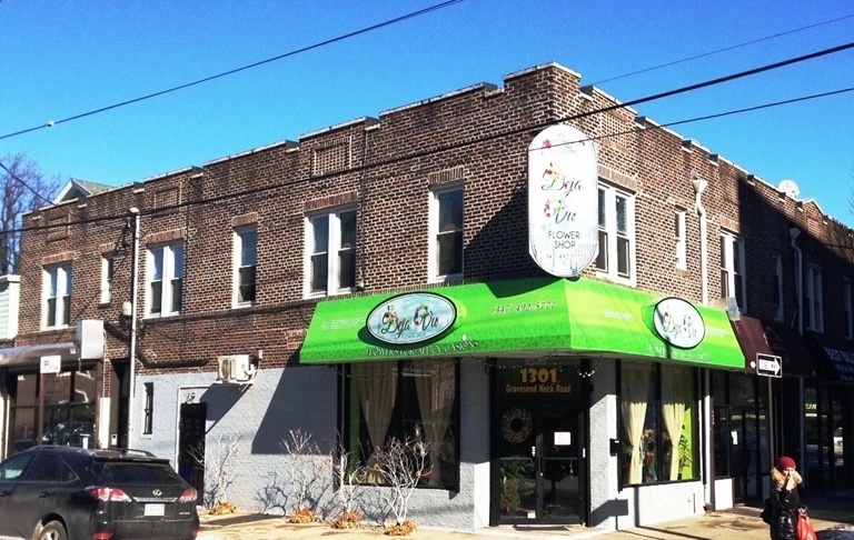
Property Record
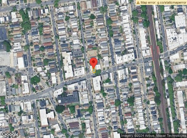
1305 Gravesend Neck Rd, Brooklyn, NY 11229

NEARBY LISTINGS FOR SALE OR LEASE
Property Detail
1305 Gravesend Neck Rd
07374-0055
DOCID-2021090700711001
Commercialofficeresidentialmixeduse
Kings
X
New York
3604970352F
55
2024
0.03 AC
2024
South Brooklyn
058400
Long Island (New York)
2,340 SF
New York-Jersey City-White Plains, NY-NJ
DEMOGRAPHICS near 1305 Gravesend Neck Rd
1 Mile
3 Mile
5 Mile
2024 Total Population
122,868
668,627
1,386,636
2029 Population
114,290
622,940
1,286,941
Pop Growth 2024-2029
(6.98%)
(6.83%)
(7.19%)
Average Age
42
41
40
2024 Total Households
44,838
234,309
483,521
HH Growth 2024-2029
(7.36%)
(7.19%)
(7.49%)
Median Household Inc
$64,196
$62,775
$65,181
Avg Household Size
2.60
2.70
2.70
2024 Avg HH Vehicles
1.00
1.00
1.00
Median Home Value
$782,947
$765,877
$777,410
Median Year Built
1949
1949
1948
Nearby Places
- Restaurants
- Banks
- Shops
- Fitness
- Groceries
PUBLIC TRANSPORTATION
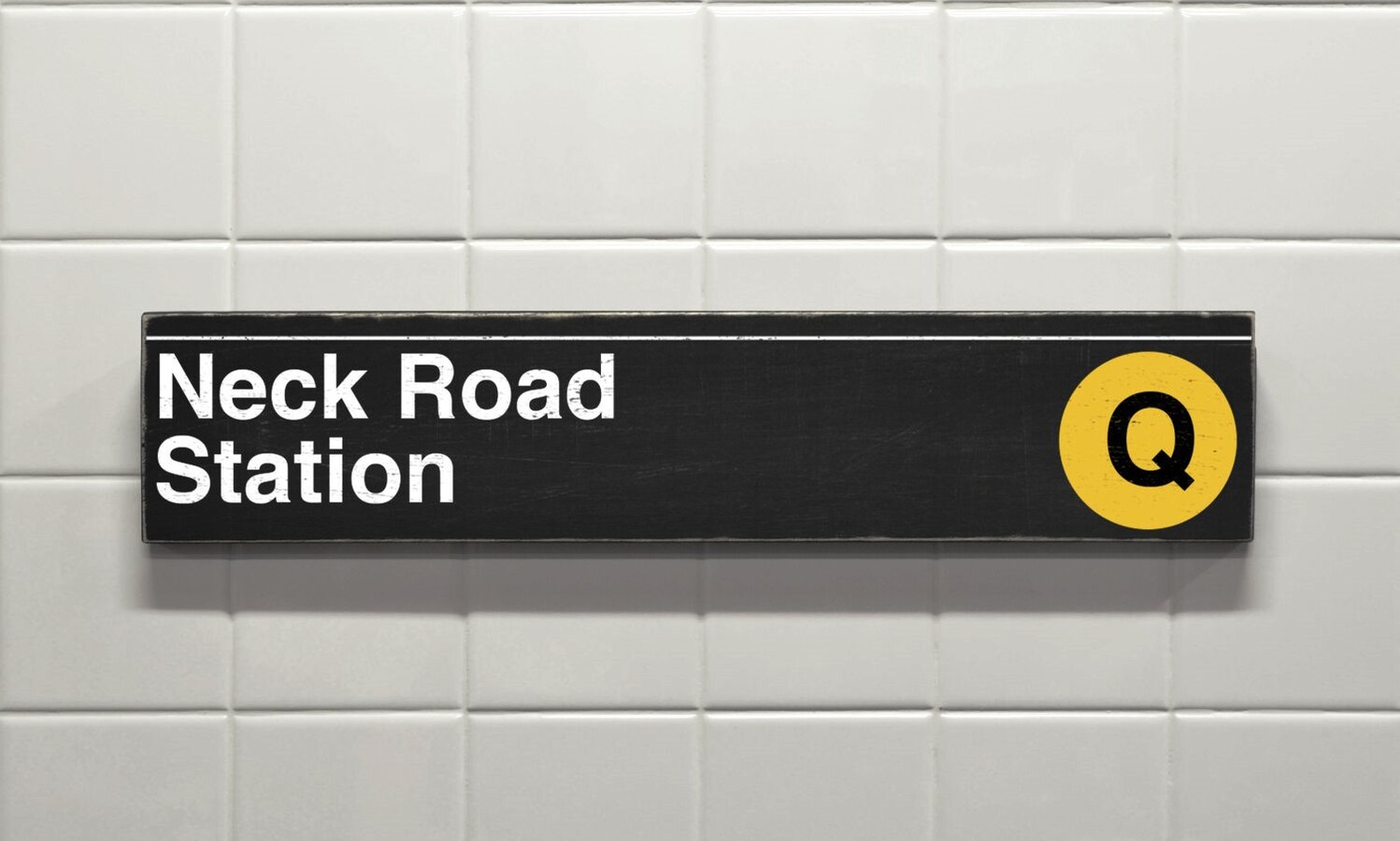
TRANSIT/SUBWAY
Neck Road (Q - New York MTA Subway (The Subway))
Drive
Walk
Distance
Neck Road (Q - New York MTA Subway (The Subway))
1 min
2 min
0.1 mi
Avenue U (Q Line) (Q - New York MTA Subway (The Subway))
Drive
Walk
Distance
Avenue U (Q Line) (Q - New York MTA Subway (The Subway))
1 min
7 min
0.4 mi
Sheepshead Bay (B - New York MTA Subway (The Subway), Q - New York MTA Subway (The Subway))
Drive
Walk
Distance
Sheepshead Bay (B - New York MTA Subway (The Subway), Q - New York MTA Subway (The Subway))
3 min
11 min
0.6 mi
Avenue U (F Line) (F - New York MTA Subway (The Subway))
Drive
Walk
Distance
Avenue U (F Line) (F - New York MTA Subway (The Subway))
5 min
19 min
1.0 mi
Avenue X (F - New York MTA Subway (The Subway))
Drive
Walk
Distance
Avenue X (F - New York MTA Subway (The Subway))
6 min
19 min
1.0 mi
COMMUTER RAIL
East New York Station (Far Rockaway Branch - Long Island Rail Road, Long Beach Branch - Long Island Rail Road, West Hempstead Branch - Long Island Rail Road)
Drive
Walk
Distance
East New York Station (Far Rockaway Branch - Long Island Rail Road, Long Beach Branch - Long Island Rail Road, West Hempstead Branch - Long Island Rail Road)
26 min
7.1 mi
Nostrand Avenue Station (Far Rockaway Branch - Long Island Rail Road, Hempstead Branch - Long Island Rail Road, Long Beach Branch - Long Island Rail Road, West Hempstead Branch - Long Island Rail Road)
Drive
Walk
Distance
Nostrand Avenue Station (Far Rockaway Branch - Long Island Rail Road, Hempstead Branch - Long Island Rail Road, Long Beach Branch - Long Island Rail Road, West Hempstead Branch - Long Island Rail Road)
23 min
7.3 mi
AIRPORT
John F. Kennedy International
Drive
Walk
Distance
John F. Kennedy International
25 min
15.9 mi
La Guardia
Drive
Walk
Distance
La Guardia
31 min
18.7 mi
Newark Liberty International
Drive
Walk
Distance
Newark Liberty International
35 min
26.1 mi
Freight Ports
NY - Red Hook Container Terminal
Drive
Walk
Distance
NY - Red Hook Container Terminal
1 min
6.8 mi
SALE & LEASE HISTORY
LISTING DATE
SALE/LEASE

Sep 19, 2019
For Sale
Nov 03, 2017
For Sale
May 30, 2019
For Sale
Jun 19, 2019
For Sale
Jan 28, 2019
For Sale
Jan 27, 2020
For Sale
Jan 26, 2021
For Sale
Dec 21, 2017
For Sale
Dec 04, 2018
For Sale
Apr 13, 2021
For Sale
Nearby Properties
Address
Land Use
TOTAL SIZE
Lot Size
Zoning
Address
Land Use
TOTAL SIZE
Lot Size
Zoning
520825
2.13 AC
LAC2
Address
Land Use
TOTAL SIZE
Lot Size
Zoning
2401524
20.78 AC
M3-1
Address
Land Use
TOTAL SIZE
Lot Size
Zoning
1066042
10.45 AC
R4
Address
Land Use
TOTAL SIZE
Lot Size
Zoning
530.51 AC
R4-1
Address
Land Use
TOTAL SIZE
Lot Size
Zoning
10250
773.50 AC
PARK
Address
Land Use
TOTAL SIZE
Lot Size
Zoning
965600
6.65 AC
R5
Address
Land Use
TOTAL SIZE
Lot Size
Zoning
1073920
16.53 AC
R6
Address
Land Use
TOTAL SIZE
Lot Size
Zoning
54.78 AC
PARK
Address
Land Use
TOTAL SIZE
Lot Size
Zoning
785450
14.22 AC
R6
Address
Land Use
TOTAL SIZE
Lot Size
Zoning
353600
55.79 AC
Address
Land Use
TOTAL SIZE
Lot Size
Zoning
838567
5.11 AC
R6
Address
Land Use
TOTAL SIZE
Lot Size
Zoning
301400
22.27 AC
M3-1
Address
Land Use
TOTAL SIZE
Lot Size
Zoning
241735
1.99 AC
C8-4
Address
Land Use
TOTAL SIZE
Lot Size
Zoning
409919
1.60 AC
R7-3
Address
Land Use
TOTAL SIZE
Lot Size
Zoning
259823
11.47 AC
M1-1
Address
Land Use
TOTAL SIZE
Lot Size
Zoning
275163
9.69 AC
R3-1
Address
Land Use
TOTAL SIZE
Lot Size
Zoning
59063
21.56 AC
PARK
Address
Land Use
TOTAL SIZE
Lot Size
Zoning
209346
18.29 AC
PARK
Address
Land Use
TOTAL SIZE
Lot Size
Zoning
702770
4.47 AC
R6
Address
Land Use
TOTAL SIZE
Lot Size
Zoning
846056
20.71 AC
R5
Address
Land Use
TOTAL SIZE
Lot Size
Zoning
22.96 AC
PARK
Address
Land Use
TOTAL SIZE
Lot Size
Zoning
356000
8.19 AC
R5
Address
Land Use
TOTAL SIZE
Lot Size
Zoning
514015
6.22 AC
R5
Address
Land Use
TOTAL SIZE
Lot Size
Zoning
382162
1.65 AC
R7A
Address
Land Use
TOTAL SIZE
Lot Size
Zoning
221704
0.82 AC
R5B
Address
Land Use
TOTAL SIZE
Lot Size
Zoning
128170
0.87 AC
R7A
Address
Land Use
TOTAL SIZE
Lot Size
Zoning
822192
14.15 AC
R6
Address
Land Use
TOTAL SIZE
Lot Size
Zoning
470000
3.39 AC
R6
Address
Land Use
TOTAL SIZE
Lot Size
Zoning
105328
0.11 AC
M1-6
Address
Land Use
TOTAL SIZE
Lot Size
Zoning
57198
0.55 AC
LAR3
Start a new search to find other properties for sale or lease
Connect with us
© 2024 CoStar Group
The information above has been obtained from sources believed reliable. While we do not doubt its accuracy we have not verified it and make no guarantee, warranty or representation about it. It is your responsibility to independently confirm its accuracy and completeness. Any projections, opinions, assumptions, or estimates used are for example only and do not represent the current or future performance of the property. The value of this transaction to you depends on tax and other factors which should be evaluated by your tax, financial, and legal advisors. You and your advisors should conduct a careful, independent investigation of the property to determine to your satisfaction the suitability of the property for your needs.