Property Record
13065 Anderson Rd, Granger, IN 46530
NEARBY LISTINGS FOR SALE OR LEASE
-
-
View all Granger listings for sale on LoopNet.com
Property Detail
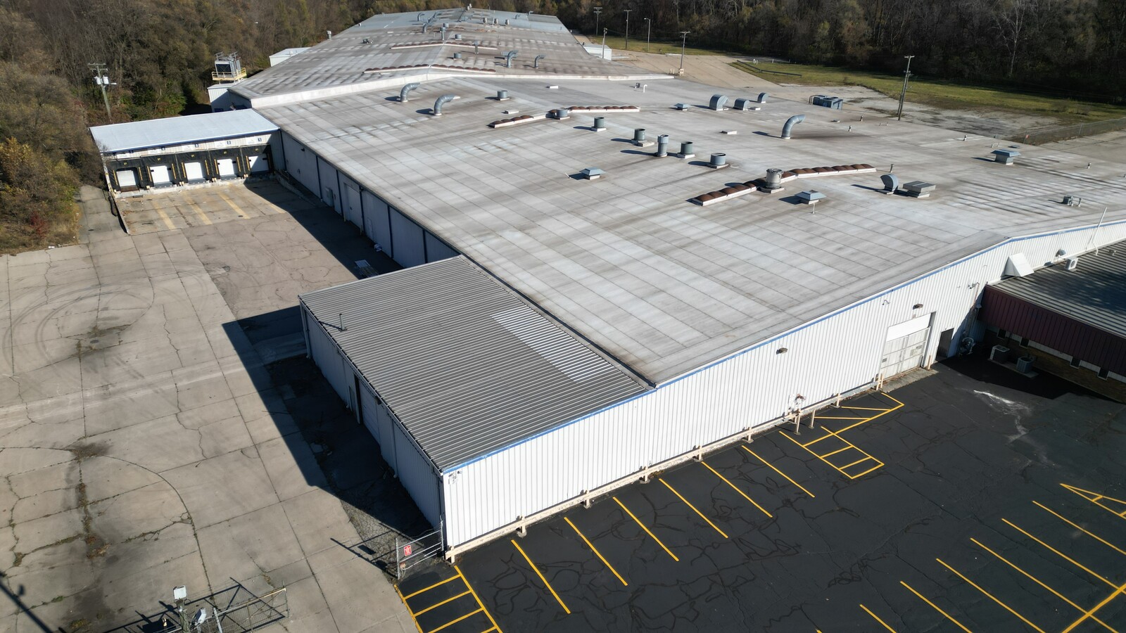
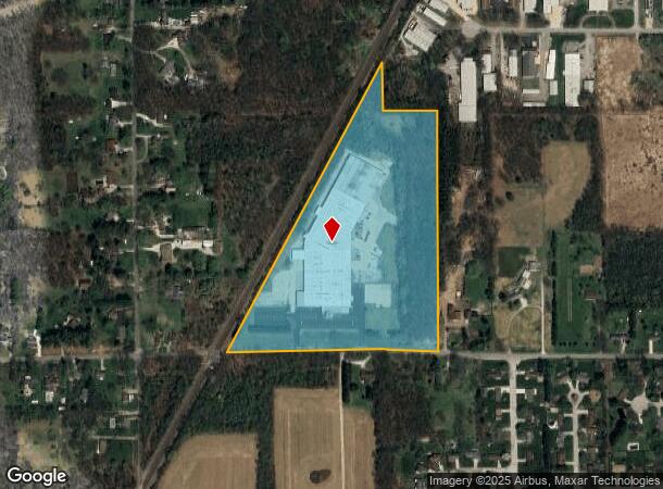
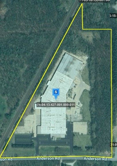
13065 Anderson Rd
71-04-13-427-001.000-011
NE COR OF SW 1517.78 X 874.99 15.323 AC 13-38-3E & NW SW 9 AC 18-38-4E
Lightindustrial
St Joseph
X
Indiana
18039C0125D
24.33 AC
2023
Outlying St Joseph County
2023
South Bend/Mishawaka
011406
South Bend-Mishawaka, IN-MI
200,554 SF
DEMOGRAPHICS near 13065 Anderson Rd
1 Mile
3 Mile
5 Mile
2024 Total Population
3,882
20,176
62,520
2029 Population
3,845
19,896
61,707
Pop Growth 2024-2029
(0.95%)
(1.39%)
(1.30%)
Average Age
40
39
40
2024 Total Households
1,277
6,785
24,049
HH Growth 2024-2029
(1.02%)
(1.43%)
(1.31%)
Median Household Inc
$99,764
$119,770
$87,328
Avg Household Size
2.90
2.90
2.50
2024 Avg HH Vehicles
2.00
2.00
2.00
Median Home Value
$249,424
$270,528
$240,204
Median Year Built
1988
1989
1985
Nearby Places
- Restaurants
- Banks
- Shops
- Fitness
- Groceries
PUBLIC TRANSPORTATION
AIRPORT
South Bend International
DRIVE
WALK
Distance
South Bend International
34 min
18.4 mi
Freight Ports
Port Milwaukee
DRIVE
WALK
Distance
Port Milwaukee
225 min
186.0 mi
SALE & LEASE HISTORY
LISTING DATE
SALE/LEASE

Oct 03, 2024
For Sale
Nov 09, 2022
For Lease
Nov 09, 2022
For Sale
May 02, 2024
For Sale
Dec 11, 2023
For Lease
Dec 11, 2023
For Sale
Aug 08, 2022
For Lease
Nearby Properties
Address
Land Use
TOTAL SIZE
Lot Size
Zoning
Address
Land Use
TOTAL SIZE
Lot Size
Zoning
529,154 SF
30.30 AC
Address
Land Use
TOTAL SIZE
Lot Size
Zoning
276,540 SF
13.81 AC
Address
Land Use
TOTAL SIZE
Lot Size
Zoning
239,363 SF
8.26 AC
Address
Land Use
TOTAL SIZE
Lot Size
Zoning
146,337 SF
20.82 AC
Address
Land Use
TOTAL SIZE
Lot Size
Zoning
85,367 SF
5.67 AC
Address
Land Use
TOTAL SIZE
Lot Size
Zoning
125,887 SF
14.79 AC
Address
Land Use
TOTAL SIZE
Lot Size
Zoning
66,856 SF
16.33 AC
Address
Land Use
TOTAL SIZE
Lot Size
Zoning
115,225 SF
8.38 AC
Address
Land Use
TOTAL SIZE
Lot Size
Zoning
89,694 SF
29.54 AC
Address
Land Use
TOTAL SIZE
Lot Size
Zoning
67,537 SF
7.74 AC
Address
Land Use
TOTAL SIZE
Lot Size
Zoning
108,400 SF
9.38 AC
Address
Land Use
TOTAL SIZE
Lot Size
Zoning
90,310 SF
9.60 AC
Address
Land Use
TOTAL SIZE
Lot Size
Zoning
43,894 SF
4.92 AC
Address
Land Use
TOTAL SIZE
Lot Size
Zoning
36,438 SF
14.61 AC
Address
Land Use
TOTAL SIZE
Lot Size
Zoning
208.06 AC
Address
Land Use
TOTAL SIZE
Lot Size
Zoning
48,005 SF
9.22 AC
Address
Land Use
TOTAL SIZE
Lot Size
Zoning
25,366 SF
3.08 AC
Address
Land Use
TOTAL SIZE
Lot Size
Zoning
86,382 SF
5.13 AC
Address
Land Use
TOTAL SIZE
Lot Size
Zoning
23,072 SF
3.58 AC
Address
Land Use
TOTAL SIZE
Lot Size
Zoning
28,156 SF
4.53 AC
Address
Land Use
TOTAL SIZE
Lot Size
Zoning
30,724 SF
7.55 AC
Address
Land Use
TOTAL SIZE
Lot Size
Zoning
12,096 SF
6.01 AC
Address
Land Use
TOTAL SIZE
Lot Size
Zoning
9.60 AC
Address
Land Use
TOTAL SIZE
Lot Size
Zoning
23,072 SF
3.88 AC
Address
Land Use
TOTAL SIZE
Lot Size
Zoning
17,148 SF
5.24 AC
Address
Land Use
TOTAL SIZE
Lot Size
Zoning
7.07 AC
Address
Land Use
TOTAL SIZE
Lot Size
Zoning
9,840 SF
38.89 AC
Address
Land Use
TOTAL SIZE
Lot Size
Zoning
1.48 AC
Address
Land Use
TOTAL SIZE
Lot Size
Zoning
67,724 SF
40.51 AC
The World's #1 Commercial Real Estate Marketplace
Connect with us
© 2025 CoStar Group
The information above has been obtained from sources believed reliable. While we do not doubt its accuracy we have not verified it and make no guarantee, warranty or representation about it. It is your responsibility to independently confirm its accuracy and completeness. Any projections, opinions, assumptions, or estimates used are for example only and do not represent the current or future performance of the property. The value of this transaction to you depends on tax and other factors which should be evaluated by your tax, financial, and legal advisors. You and your advisors should conduct a careful, independent investigation of the property to determine to your satisfaction the suitability of the property for your needs.