Property Record
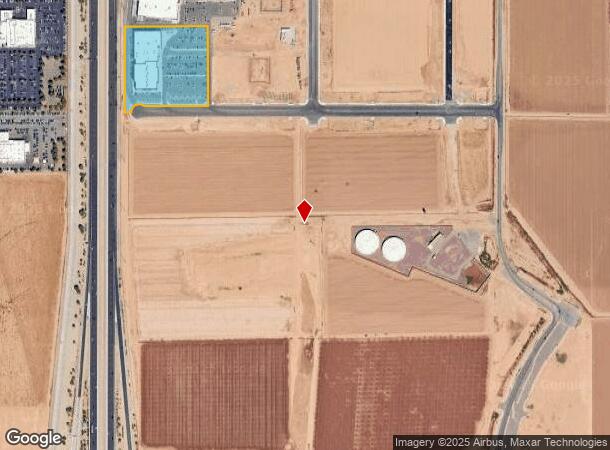
13100 N Prasada Pkwy, Surprise, AZ 85388
NEARBY LISTINGS FOR SALE OR LEASE
Property Detail
13100 N Prasada Pkwy
Phoenix
Village At Prasada
Phoenix-Mesa-Scottsdale, AZ
VILLAGE AT PRASADA MCR 1628-16
501-11-956
Maricopa
Amusementpark
Arizona
2024
3
2025
6.50 AC
061031
N Goodyear/Litchfield
61,000 SF
DEMOGRAPHICS near 13100 N Prasada Pkwy
1 Mile
3 Mile
5 Mile
2024 Total Population
2,599
88,764
166,590
2029 Population
2,848
96,928
182,200
Pop Growth 2024-2029
+ 9.58%
+ 9.20%
+ 9.37%
Average Age
35
38
42
2024 Total Households
828
28,971
59,864
HH Growth 2024-2029
+ 9.42%
+ 9.55%
+ 9.66%
Median Household Inc
$104,536
$92,228
$82,675
Avg Household Size
3.10
3.00
2.70
2024 Avg HH Vehicles
2.00
2.00
2.00
Median Home Value
$355,609
$354,770
$357,136
Median Year Built
2004
2004
2003
Nearby Places
- Restaurants
- Banks
- Shops
- Fitness
- Groceries
PUBLIC TRANSPORTATION
AIRPORT
Phoenix Sky Harbor International
DRIVE
WALK
Distance
Phoenix Sky Harbor International
48 min
37.2 mi
Freight Ports
Port of San Diego
DRIVE
WALK
Distance
Port of San Diego
384 min
344.5 mi
Nearby Properties
Address
Land Use
TOTAL SIZE
Lot Size
Zoning
Address
Land Use
TOTAL SIZE
Lot Size
Zoning
290,294 SF
61.55 AC
PAD
Address
Land Use
TOTAL SIZE
Lot Size
Zoning
283,614 SF
55.80 AC
PAD
Address
Land Use
TOTAL SIZE
Lot Size
Zoning
197,699 SF
40.78 AC
PAD
Address
Land Use
TOTAL SIZE
Lot Size
Zoning
256,094 SF
49.15 AC
PAD
Address
Land Use
TOTAL SIZE
Lot Size
Zoning
1,178,814 SF
64.63 AC
Address
Land Use
TOTAL SIZE
Lot Size
Zoning
296,463 SF
12.27 AC
M-H
Address
Land Use
TOTAL SIZE
Lot Size
Zoning
455,936 SF
23.97 AC
Address
Land Use
TOTAL SIZE
Lot Size
Zoning
134,364 SF
15.26 AC
PAD
Address
Land Use
TOTAL SIZE
Lot Size
Zoning
232,202 SF
27.32 AC
PAD
Address
Land Use
TOTAL SIZE
Lot Size
Zoning
210,197 SF
19.40 AC
RH15
Address
Land Use
TOTAL SIZE
Lot Size
Zoning
345,916 SF
30.97 AC
PAD
Address
Land Use
TOTAL SIZE
Lot Size
Zoning
67,417 SF
12.16 AC
PAD
Address
Land Use
TOTAL SIZE
Lot Size
Zoning
90,636 SF
13.27 AC
PAD
Address
Land Use
TOTAL SIZE
Lot Size
Zoning
106,244 SF
13.55 AC
PAD
Address
Land Use
TOTAL SIZE
Lot Size
Zoning
90,387 SF
14.96 AC
PAD
Address
Land Use
TOTAL SIZE
Lot Size
Zoning
797,969 SF
66.20 AC
PAD
Address
Land Use
TOTAL SIZE
Lot Size
Zoning
98,560 SF
12.87 AC
PAD
Address
Land Use
TOTAL SIZE
Lot Size
Zoning
236,026 SF
6.66 AC
PAD
Address
Land Use
TOTAL SIZE
Lot Size
Zoning
104,102 SF
10.81 AC
PAD
Address
Land Use
TOTAL SIZE
Lot Size
Zoning
96,782 SF
15.66 AC
PAD
Address
Land Use
TOTAL SIZE
Lot Size
Zoning
102,295 SF
12.58 AC
R-6
Address
Land Use
TOTAL SIZE
Lot Size
Zoning
104,619 SF
11.45 AC
PAD
Address
Land Use
TOTAL SIZE
Lot Size
Zoning
707,380 SF
46.26 AC
I-2
Address
Land Use
TOTAL SIZE
Lot Size
Zoning
153,918 SF
20.58 AC
PAD
Address
Land Use
TOTAL SIZE
Lot Size
Zoning
905,330 SF
88.90 AC
PAD
Address
Land Use
TOTAL SIZE
Lot Size
Zoning
154,628 SF
16.36 AC
PAD
Address
Land Use
TOTAL SIZE
Lot Size
Zoning
89,601 SF
19.92 AC
PAD
Address
Land Use
TOTAL SIZE
Lot Size
Zoning
86,770 SF
18.26 AC
PAD
Address
Land Use
TOTAL SIZE
Lot Size
Zoning
340,420 SF
16.26 AC
The World's #1 Commercial Real Estate Marketplace
Connect with us
© 2025 CoStar Group
The information above has been obtained from sources believed reliable. While we do not doubt its accuracy we have not verified it and make no guarantee, warranty or representation about it. It is your responsibility to independently confirm its accuracy and completeness. Any projections, opinions, assumptions, or estimates used are for example only and do not represent the current or future performance of the property. The value of this transaction to you depends on tax and other factors which should be evaluated by your tax, financial, and legal advisors. You and your advisors should conduct a careful, independent investigation of the property to determine to your satisfaction the suitability of the property for your needs.