Property Record
1317 E Carol Ave, Phoenix, AZ 85020
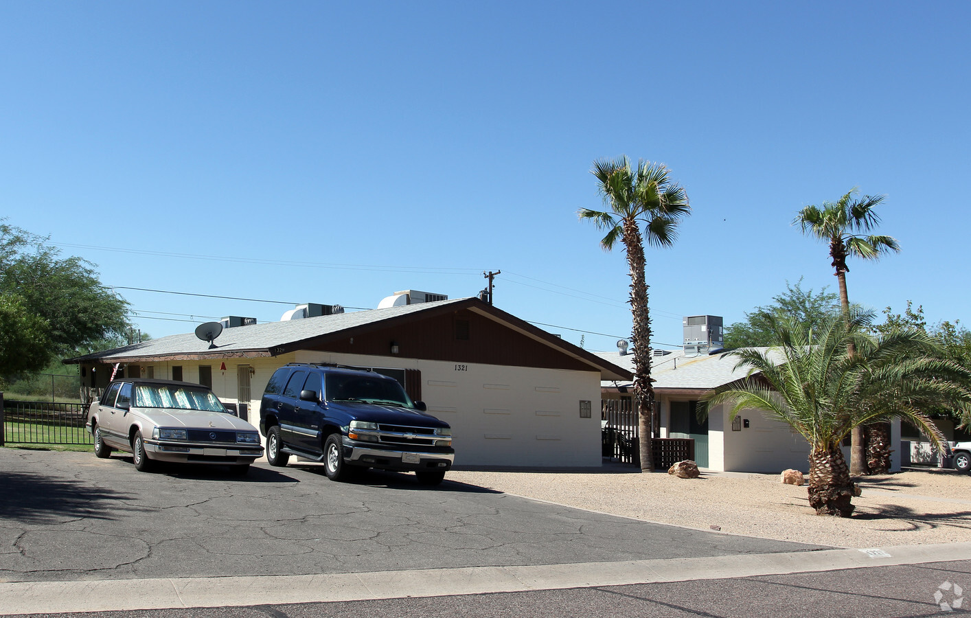
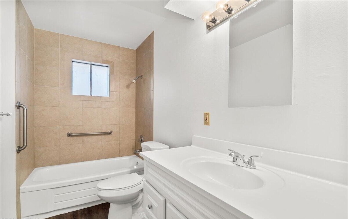

This Property Is For Sale
NEARBY LISTINGS FOR SALE OR LEASE
Property Detail
1317 E Carol Ave
Phoenix-Mesa-Scottsdale, AZ
Bickerstaff Homes
159-31-107
Maricopa
Triplex
Arizona
X
0.22 AC
04013C1735L
North Mountain
2,637 SF
Phoenix
DEMOGRAPHICS near 1317 E Carol Ave
1 Mile
3 Mile
5 Mile
2024 Total Population
16,499
100,237
347,748
2029 Population
17,947
108,485
376,601
Pop Growth 2024-2029
+ 8.78%
+ 8.23%
+ 8.30%
Average Age
42
41
39
2024 Total Households
7,523
42,805
147,445
HH Growth 2024-2029
+ 8.91%
+ 8.35%
+ 8.52%
Median Household Inc
$61,826
$71,531
$64,364
Avg Household Size
2.10
2.30
2.30
2024 Avg HH Vehicles
2.00
2.00
2.00
Median Home Value
$340,260
$472,544
$419,414
Median Year Built
1976
1975
1977
Nearby Places
- Restaurants
- Banks
- Shops
- Fitness
- Groceries
PUBLIC TRANSPORTATION
AIRPORT
Phoenix Sky Harbor International
DRIVE
WALK
Distance
Phoenix Sky Harbor International
23 min
12.9 mi
Phoenix-Mesa Gateway
DRIVE
WALK
Distance
Phoenix-Mesa Gateway
55 min
39.7 mi
Freight Ports
Port of San Diego
DRIVE
WALK
Distance
Port of San Diego
410 min
363.4 mi
Nearby Properties
Address
Land Use
TOTAL SIZE
Lot Size
Zoning
Address
Land Use
TOTAL SIZE
Lot Size
Zoning
281,880 SF
14.13 AC
Address
Land Use
TOTAL SIZE
Lot Size
Zoning
558,361 SF
14.61 AC
C-2
Address
Land Use
TOTAL SIZE
Lot Size
Zoning
367,399 SF
14.88 AC
C-1
Address
Land Use
TOTAL SIZE
Lot Size
Zoning
515,418 SF
19.72 AC
R-3
Address
Land Use
TOTAL SIZE
Lot Size
Zoning
215,150 SF
13.24 AC
R-3
Address
Land Use
TOTAL SIZE
Lot Size
Zoning
323,288 SF
40.56 AC
R1-10
Address
Land Use
TOTAL SIZE
Lot Size
Zoning
452,506 SF
55.11 AC
RH
Address
Land Use
TOTAL SIZE
Lot Size
Zoning
394,793 SF
3.60 AC
PUD
Address
Land Use
TOTAL SIZE
Lot Size
Zoning
349,252 SF
15.11 AC
Address
Land Use
TOTAL SIZE
Lot Size
Zoning
123,370 SF
0.82 AC
C-C
Address
Land Use
TOTAL SIZE
Lot Size
Zoning
302,016 SF
28.06 AC
Address
Land Use
TOTAL SIZE
Lot Size
Zoning
231,327 SF
5.46 AC
M-H
Address
Land Use
TOTAL SIZE
Lot Size
Zoning
84,738 SF
8.83 AC
R-6
Address
Land Use
TOTAL SIZE
Lot Size
Zoning
362,106 SF
15.60 AC
M-H
Address
Land Use
TOTAL SIZE
Lot Size
Zoning
81,692 SF
8.65 AC
R-10
Address
Land Use
TOTAL SIZE
Lot Size
Zoning
110,623 SF
4.39 AC
R-10
Address
Land Use
TOTAL SIZE
Lot Size
Zoning
122,646 SF
14.69 AC
I-P
Address
Land Use
TOTAL SIZE
Lot Size
Zoning
339,043 SF
5.43 AC
C-O
Address
Land Use
TOTAL SIZE
Lot Size
Zoning
210,064 SF
8.60 AC
C-T
Address
Land Use
TOTAL SIZE
Lot Size
Zoning
435,890 SF
16.51 AC
R5
Address
Land Use
TOTAL SIZE
Lot Size
Zoning
341,747 SF
17.61 AC
R-2
Address
Land Use
TOTAL SIZE
Lot Size
Zoning
855 SF
156.18 AC
R-10
Address
Land Use
TOTAL SIZE
Lot Size
Zoning
77,582 SF
9.18 AC
R-6
Address
Land Use
TOTAL SIZE
Lot Size
Zoning
115,186 SF
8.74 AC
R1-10
Address
Land Use
TOTAL SIZE
Lot Size
Zoning
80,944 SF
9.59 AC
R1-10
Address
Land Use
TOTAL SIZE
Lot Size
Zoning
298,492 SF
12.01 AC
M-H
Address
Land Use
TOTAL SIZE
Lot Size
Zoning
78.23 AC
R-10
Address
Land Use
TOTAL SIZE
Lot Size
Zoning
156,617 SF
8.36 AC
C-O
Address
Land Use
TOTAL SIZE
Lot Size
Zoning
61,845 SF
9.98 AC
I-1
Address
Land Use
TOTAL SIZE
Lot Size
Zoning
99,292 SF
11.39 AC
R-6
The World's #1 Commercial Real Estate Marketplace
Connect with us
© 2025 CoStar Group
The information above has been obtained from sources believed reliable. While we do not doubt its accuracy we have not verified it and make no guarantee, warranty or representation about it. It is your responsibility to independently confirm its accuracy and completeness. Any projections, opinions, assumptions, or estimates used are for example only and do not represent the current or future performance of the property. The value of this transaction to you depends on tax and other factors which should be evaluated by your tax, financial, and legal advisors. You and your advisors should conduct a careful, independent investigation of the property to determine to your satisfaction the suitability of the property for your needs.