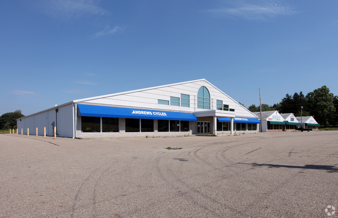
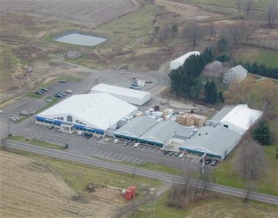
Property Record
13174 Salem Alliance Rd, Salem, OH 44460
NEARBY LISTINGS FOR SALE OR LEASE
Property Detail
13174 Salem Alliance Rd
Youngstown/Warren/Boardman
Goldie Clayton Pl 1
Youngstown-Warren-Boardman, OH-PA
LOT 1 100 X 892.20 GOLDIE CLAYTON PL 1
13-028-0-009.00-0
Mahoning
Vehiclerentalsvehiclesales
Ohio
2023
1
2023
2.05 AC
950500
Mahoning County
28,780 SF
DEMOGRAPHICS near 13174 Salem Alliance Rd
1 Mile
3 Mile
5 Mile
2024 Total Population
528
13,687
22,982
2029 Population
509
13,451
22,501
Pop Growth 2024-2029
(3.60%)
(1.72%)
(2.09%)
Average Age
45
42
44
2024 Total Households
230
5,777
9,740
HH Growth 2024-2029
(3.91%)
(1.75%)
(2.07%)
Median Household Inc
$48,593
$47,449
$51,681
Avg Household Size
2.20
2.30
2.30
2024 Avg HH Vehicles
2.00
2.00
2.00
Median Home Value
$153,797
$133,843
$143,585
Median Year Built
1969
1958
1962
Nearby Places
- Restaurants
- Banks
- Shops
- Fitness
- Groceries
PUBLIC TRANSPORTATION
AIRPORT
Akron-Canton Regional
DRIVE
WALK
Distance
Akron-Canton Regional
50 min
30.1 mi
Freight Ports
Port of Toledo
DRIVE
WALK
Distance
Port of Toledo
205 min
166.9 mi
Nearby Properties
Address
Land Use
TOTAL SIZE
Lot Size
Zoning
Address
Land Use
TOTAL SIZE
Lot Size
Zoning
27.88 AC
Address
Land Use
TOTAL SIZE
Lot Size
Zoning
58,425 SF
5.46 AC
Address
Land Use
TOTAL SIZE
Lot Size
Zoning
1,728 SF
21.65 AC
Address
Land Use
TOTAL SIZE
Lot Size
Zoning
72,432 SF
5.05 AC
Address
Land Use
TOTAL SIZE
Lot Size
Zoning
60.86 AC
Address
Land Use
TOTAL SIZE
Lot Size
Zoning
54,218 SF
2.28 AC
Address
Land Use
TOTAL SIZE
Lot Size
Zoning
15,742 SF
1.25 AC
Address
Land Use
TOTAL SIZE
Lot Size
Zoning
28,234 SF
7.23 AC
Address
Land Use
TOTAL SIZE
Lot Size
Zoning
13,544 SF
6.70 AC
Address
Land Use
TOTAL SIZE
Lot Size
Zoning
28,814 SF
1.17 AC
Address
Land Use
TOTAL SIZE
Lot Size
Zoning
51,560 SF
5.18 AC
Address
Land Use
TOTAL SIZE
Lot Size
Zoning
40,424 SF
6.23 AC
Address
Land Use
TOTAL SIZE
Lot Size
Zoning
42,673 SF
2.09 AC
Address
Land Use
TOTAL SIZE
Lot Size
Zoning
57,108 SF
1.38 AC
Address
Land Use
TOTAL SIZE
Lot Size
Zoning
22,712 SF
4 AC
Address
Land Use
TOTAL SIZE
Lot Size
Zoning
31,207 SF
0.21 AC
Address
Land Use
TOTAL SIZE
Lot Size
Zoning
8.72 AC
Address
Land Use
TOTAL SIZE
Lot Size
Zoning
4,924 SF
2.59 AC
G-2 WHO
Address
Land Use
TOTAL SIZE
Lot Size
Zoning
139,764 SF
17.47 AC
Address
Land Use
TOTAL SIZE
Lot Size
Zoning
2.44 AC
Address
Land Use
TOTAL SIZE
Lot Size
Zoning
4,304 SF
0.39 AC
Address
Land Use
TOTAL SIZE
Lot Size
Zoning
42,713 SF
4.09 AC
Address
Land Use
TOTAL SIZE
Lot Size
Zoning
18,750 SF
2.35 AC
Address
Land Use
TOTAL SIZE
Lot Size
Zoning
60,192 SF
15.48 AC
Address
Land Use
TOTAL SIZE
Lot Size
Zoning
2,016 SF
7.65 AC
Address
Land Use
TOTAL SIZE
Lot Size
Zoning
49,200 SF
6.78 AC
Address
Land Use
TOTAL SIZE
Lot Size
Zoning
31,538 SF
2.48 AC
Address
Land Use
TOTAL SIZE
Lot Size
Zoning
17,504 SF
6.50 AC
Address
Land Use
TOTAL SIZE
Lot Size
Zoning
4,266 SF
0.63 AC
Address
Land Use
TOTAL SIZE
Lot Size
Zoning
18,020 SF
0.29 AC
The World's #1 Commercial Real Estate Marketplace
Connect with us
© 2025 CoStar Group
The information above has been obtained from sources believed reliable. While we do not doubt its accuracy we have not verified it and make no guarantee, warranty or representation about it. It is your responsibility to independently confirm its accuracy and completeness. Any projections, opinions, assumptions, or estimates used are for example only and do not represent the current or future performance of the property. The value of this transaction to you depends on tax and other factors which should be evaluated by your tax, financial, and legal advisors. You and your advisors should conduct a careful, independent investigation of the property to determine to your satisfaction the suitability of the property for your needs.