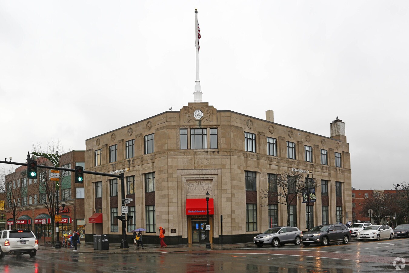
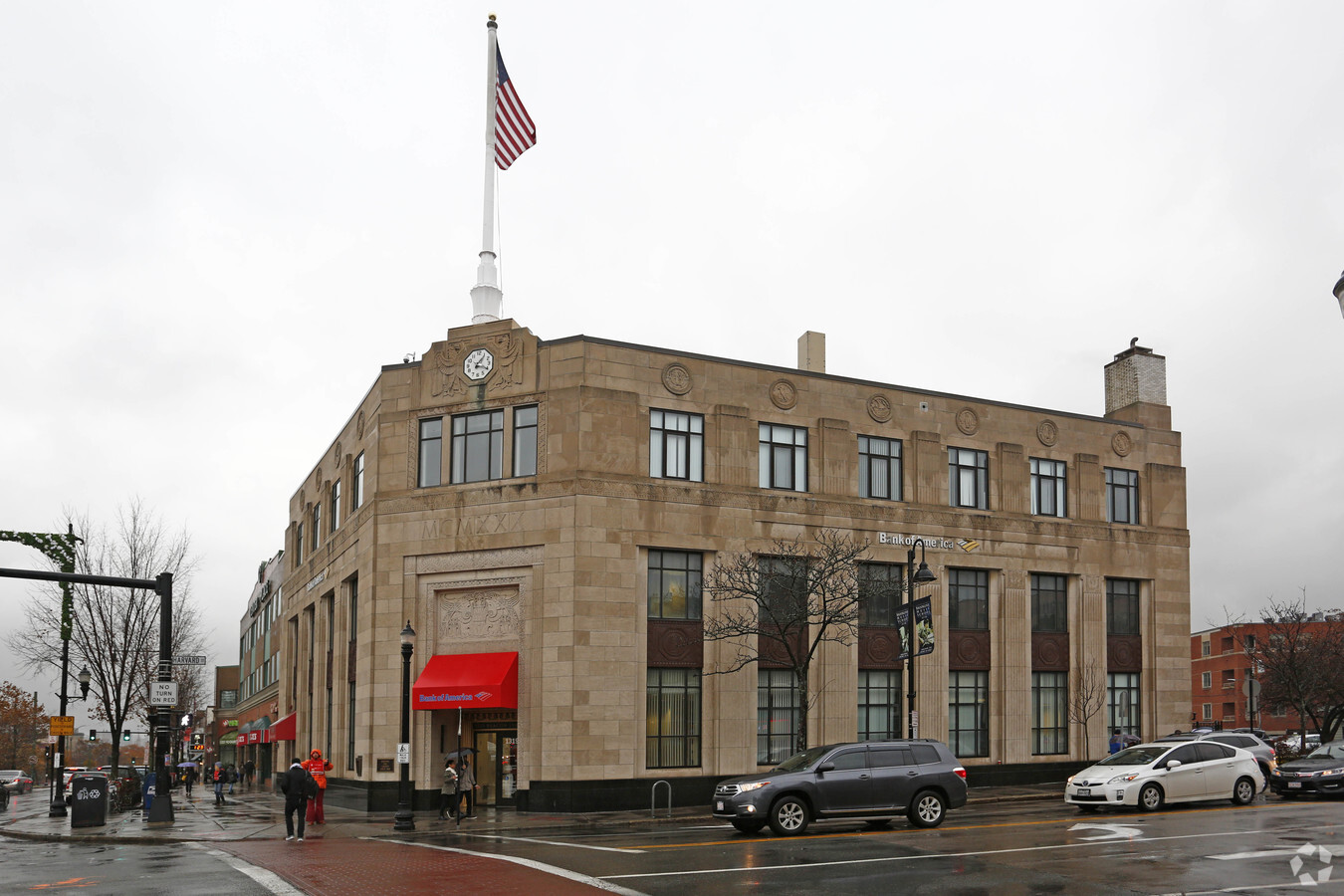
Property Record
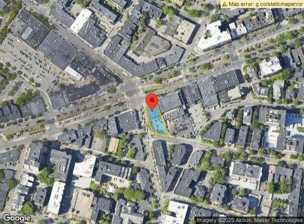
1319 Beacon St, Brookline, MA 02446

NEARBY LISTINGS FOR SALE OR LEASE
Property Detail
1319 Beacon St
BROO-000161-000001
Norfolk
Financialbuilding
Massachusetts
X
1
25021C0053E
0.36 AC
2025
Newton/Brookline
2025
Boston
400201
Boston-Cambridge-Newton, MA-NH
17,175 SF
DEMOGRAPHICS near 1319 Beacon St
1 Mile
3 Mile
5 Mile
2024 Total Population
72,117
444,748
957,434
2029 Population
70,430
430,740
925,364
Pop Growth 2024-2029
(2.34%)
(3.15%)
(3.35%)
Average Age
35
36
37
2024 Total Households
30,417
185,881
400,568
HH Growth 2024-2029
(2.59%)
(3.42%)
(3.58%)
Median Household Inc
$86,431
$88,214
$98,716
Avg Household Size
2.10
2.10
2.20
2024 Avg HH Vehicles
1.00
1.00
1.00
Median Home Value
$1,020,963
$919,100
$837,900
Median Year Built
1949
1949
1949
Nearby Places
- Restaurants
- Banks
- Shops
- Fitness
- Groceries
PUBLIC TRANSPORTATION
TRANSIT/SUBWAY
Coolidge Corner Station (Green Line - C - Massachusetts Bay Transportation Authority Subway (The T))
DRIVE
WALK
Distance
Coolidge Corner Station (Green Line - C - Massachusetts Bay Transportation Authority Subway (The T))
1 min
0 min
0.0 mi
St Paul Street Station (Green Line C) (Green Line - C - Massachusetts Bay Transportation Authority Subway (The T))
DRIVE
WALK
Distance
St Paul Street Station (Green Line C) (Green Line - C - Massachusetts Bay Transportation Authority Subway (The T))
0 min
4 min
0.2 mi
Summit Avenue Station (Green Line - C - Massachusetts Bay Transportation Authority Subway (The T))
DRIVE
WALK
Distance
Summit Avenue Station (Green Line - C - Massachusetts Bay Transportation Authority Subway (The T))
1 min
5 min
0.3 mi
Kent Street Station (Green Line - C - Massachusetts Bay Transportation Authority Subway (The T))
DRIVE
WALK
Distance
Kent Street Station (Green Line - C - Massachusetts Bay Transportation Authority Subway (The T))
1 min
7 min
0.4 mi
Brandon Hall Station (Green Line - C - Massachusetts Bay Transportation Authority Subway (The T))
DRIVE
WALK
Distance
Brandon Hall Station (Green Line - C - Massachusetts Bay Transportation Authority Subway (The T))
1 min
8 min
0.4 mi
COMMUTER RAIL
Yawkey (Framingham/Worcester Line - Massachusetts Bay Transportation Authority Commuter Rail (Purple Line))
DRIVE
WALK
Distance
Yawkey (Framingham/Worcester Line - Massachusetts Bay Transportation Authority Commuter Rail (Purple Line))
7 min
3.4 mi
Boston Landing (Framingham/Worcester Line - MBTA)
DRIVE
WALK
Distance
Boston Landing (Framingham/Worcester Line - MBTA)
13 min
6.0 mi
AIRPORT
General Edward Lawrence Logan International
DRIVE
WALK
Distance
General Edward Lawrence Logan International
16 min
7.2 mi
Freight Ports
Port of Boston
DRIVE
WALK
Distance
Port of Boston
14 min
6.4 mi
SALE & LEASE HISTORY
LISTING DATE
SALE/LEASE

Mar 29, 2017
For Lease
Feb 06, 2018
For Lease
Dec 14, 2022
For Lease
Nearby Properties
Address
Land Use
TOTAL SIZE
Lot Size
Zoning
Address
Land Use
TOTAL SIZE
Lot Size
Zoning
909,764 SF
25.13 AC
E
Address
Land Use
TOTAL SIZE
Lot Size
Zoning
610,560 SF
4 AC
E
Address
Land Use
TOTAL SIZE
Lot Size
Zoning
2.79 AC
Address
Land Use
TOTAL SIZE
Lot Size
Zoning
488,832 SF
1.38 AC
BB
Address
Land Use
TOTAL SIZE
Lot Size
Zoning
469,670 SF
7.60 AC
C
Address
Land Use
TOTAL SIZE
Lot Size
Zoning
142,458 SF
1.67 AC
C-3
Address
Land Use
TOTAL SIZE
Lot Size
Zoning
230,394 SF
0.60 AC
MXD
Address
Land Use
TOTAL SIZE
Lot Size
Zoning
448,796 SF
1.84 AC
C
Address
Land Use
TOTAL SIZE
Lot Size
Zoning
304,349 SF
1.72 AC
Address
Land Use
TOTAL SIZE
Lot Size
Zoning
150,192 SF
10.27 AC
E
Address
Land Use
TOTAL SIZE
Lot Size
Zoning
530,200 SF
62.08 AC
E
Address
Land Use
TOTAL SIZE
Lot Size
Zoning
239,377 SF
0.71 AC
MXD
Address
Land Use
TOTAL SIZE
Lot Size
Zoning
114,000 SF
1.20 AC
RC
Address
Land Use
TOTAL SIZE
Lot Size
Zoning
46,259 SF
1.04 AC
E
Address
Land Use
TOTAL SIZE
Lot Size
Zoning
4,355 SF
13.12 AC
E
Address
Land Use
TOTAL SIZE
Lot Size
Zoning
1.13 AC
C
Address
Land Use
TOTAL SIZE
Lot Size
Zoning
2.81 AC
O-2
Address
Land Use
TOTAL SIZE
Lot Size
Zoning
387,083 SF
1.92 AC
RC
Address
Land Use
TOTAL SIZE
Lot Size
Zoning
2.25 AC
SD-12
Address
Land Use
TOTAL SIZE
Lot Size
Zoning
157,083 SF
0.41 AC
C
Address
Land Use
TOTAL SIZE
Lot Size
Zoning
227,107 SF
7.70 AC
E
Address
Land Use
TOTAL SIZE
Lot Size
Zoning
334,522 SF
1.26 AC
C
Address
Land Use
TOTAL SIZE
Lot Size
Zoning
419,722 SF
2.02 AC
RC
Address
Land Use
TOTAL SIZE
Lot Size
Zoning
237,928 SF
1.27 AC
C-3
Address
Land Use
TOTAL SIZE
Lot Size
Zoning
155,818 SF
5.33 AC
OS
Address
Land Use
TOTAL SIZE
Lot Size
Zoning
262,120 SF
0.62 AC
C
Address
Land Use
TOTAL SIZE
Lot Size
Zoning
214,398 SF
0.63 AC
BB-CSQ
Address
Land Use
TOTAL SIZE
Lot Size
Zoning
3.52 AC
C-3
Address
Land Use
TOTAL SIZE
Lot Size
Zoning
399,897 SF
1.57 AC
Address
Land Use
TOTAL SIZE
Lot Size
Zoning
158,526 SF
1.13 AC
MXD
The World's #1 Commercial Real Estate Marketplace
Connect with us
© 2025 CoStar Group
The information above has been obtained from sources believed reliable. While we do not doubt its accuracy we have not verified it and make no guarantee, warranty or representation about it. It is your responsibility to independently confirm its accuracy and completeness. Any projections, opinions, assumptions, or estimates used are for example only and do not represent the current or future performance of the property. The value of this transaction to you depends on tax and other factors which should be evaluated by your tax, financial, and legal advisors. You and your advisors should conduct a careful, independent investigation of the property to determine to your satisfaction the suitability of the property for your needs.