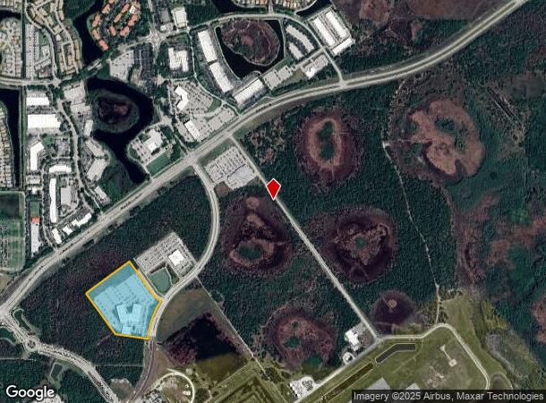
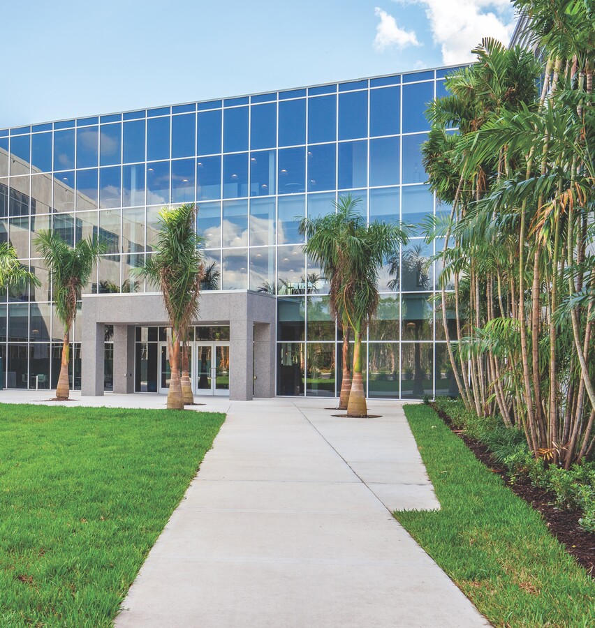
Property Record
13200 Paul J Doherty Pky, Fort Myers, FL 33913


NEARBY LISTINGS FOR SALE OR LEASE
Property Detail
13200 Paul J Doherty Pky
19-45-26-98-U2496.3683
E. Daniels Rd / Airport
Structuresonleasedland
GROUND LEASE AS DESC IN #2017000182628 IMPROVEMENTS ONLY
X
Lee
12071C0434F
Florida
2023
18.54 AC
2024
S Ft Myers/San Carlos
980000
Southwest Florida
246,785 SF
Cape Coral-Fort Myers, FL
DEMOGRAPHICS near 13200 Paul J Doherty Pky
1 Mile
3 Mile
5 Mile
2024 Total Population
1,122
16,436
65,233
2029 Population
1,366
19,716
77,814
Pop Growth 2024-2029
+ 21.75%
+ 19.96%
+ 19.29%
Average Age
50
50
46
2024 Total Households
538
7,329
26,188
HH Growth 2024-2029
+ 21.56%
+ 19.89%
+ 19.33%
Median Household Inc
$70,161
$88,751
$78,215
Avg Household Size
2.10
2.20
2.40
2024 Avg HH Vehicles
2.00
2.00
2.00
Median Home Value
$412,805
$371,897
$329,832
Median Year Built
2010
2010
2005
Nearby Places
- Restaurants
- Banks
- Shops
- Fitness
- Groceries
PUBLIC TRANSPORTATION
AIRPORT
Southwest Florida International
DRIVE
WALK
Distance
Southwest Florida International
6 min
1.9 mi
Punta Gorda
DRIVE
WALK
Distance
Punta Gorda
43 min
34.6 mi
Freight Ports
Port Manatee
DRIVE
WALK
Distance
Port Manatee
123 min
106.3 mi
SALE & LEASE HISTORY
LISTING DATE
SALE/LEASE

Oct 18, 2022
For Sale
Nearby Properties
Address
Land Use
TOTAL SIZE
Lot Size
Zoning
Address
Land Use
TOTAL SIZE
Lot Size
Zoning
2,830,434 SF
6,201.32 AC
AOPD
Address
Land Use
TOTAL SIZE
Lot Size
Zoning
545,043 SF
16.29 AC
C-1
Address
Land Use
TOTAL SIZE
Lot Size
Zoning
420,851 SF
23.83 AC
MPD
Address
Land Use
TOTAL SIZE
Lot Size
Zoning
320,574 SF
16.10 AC
MPD
Address
Land Use
TOTAL SIZE
Lot Size
Zoning
21.08 AC
MDP-3
Address
Land Use
TOTAL SIZE
Lot Size
Zoning
204,456 SF
5.20 AC
C-1
Address
Land Use
TOTAL SIZE
Lot Size
Zoning
315,233 SF
75.18 AC
CPD
Address
Land Use
TOTAL SIZE
Lot Size
Zoning
134,369 SF
8.31 AC
PUD
Address
Land Use
TOTAL SIZE
Lot Size
Zoning
213,556 SF
18.17 AC
CPD
Address
Land Use
TOTAL SIZE
Lot Size
Zoning
130,970 SF
8.68 AC
PUD
Address
Land Use
TOTAL SIZE
Lot Size
Zoning
Address
Land Use
TOTAL SIZE
Lot Size
Zoning
105,332 SF
11.08 AC
PUD
Address
Land Use
TOTAL SIZE
Lot Size
Zoning
16.84 AC
IPD
Address
Land Use
TOTAL SIZE
Lot Size
Zoning
174,712 SF
9.70 AC
MPD
Address
Land Use
TOTAL SIZE
Lot Size
Zoning
68.11 AC
PUD
Address
Land Use
TOTAL SIZE
Lot Size
Zoning
8.90 AC
MPD
Address
Land Use
TOTAL SIZE
Lot Size
Zoning
96,408 SF
5.75 AC
PUD
Address
Land Use
TOTAL SIZE
Lot Size
Zoning
10.16 AC
MDP-3
Address
Land Use
TOTAL SIZE
Lot Size
Zoning
154.54 AC
MPD
Address
Land Use
TOTAL SIZE
Lot Size
Zoning
Address
Land Use
TOTAL SIZE
Lot Size
Zoning
119,952 SF
5 AC
PUD
Address
Land Use
TOTAL SIZE
Lot Size
Zoning
63,900 SF
4.18 AC
CT
Address
Land Use
TOTAL SIZE
Lot Size
Zoning
807.12 AC
IPD
Address
Land Use
TOTAL SIZE
Lot Size
Zoning
21.94 AC
MPD
Address
Land Use
TOTAL SIZE
Lot Size
Zoning
185,360 SF
9.90 AC
PUD
Address
Land Use
TOTAL SIZE
Lot Size
Zoning
50,290 SF
2.37 AC
MPD
Address
Land Use
TOTAL SIZE
Lot Size
Zoning
106,286 SF
16.57 AC
PUD
Address
Land Use
TOTAL SIZE
Lot Size
Zoning
63,275 SF
10.12 AC
PUD
Address
Land Use
TOTAL SIZE
Lot Size
Zoning
74,274 SF
10.40 AC
The World's #1 Commercial Real Estate Marketplace
Connect with us
© 2025 CoStar Group
The information above has been obtained from sources believed reliable. While we do not doubt its accuracy we have not verified it and make no guarantee, warranty or representation about it. It is your responsibility to independently confirm its accuracy and completeness. Any projections, opinions, assumptions, or estimates used are for example only and do not represent the current or future performance of the property. The value of this transaction to you depends on tax and other factors which should be evaluated by your tax, financial, and legal advisors. You and your advisors should conduct a careful, independent investigation of the property to determine to your satisfaction the suitability of the property for your needs.