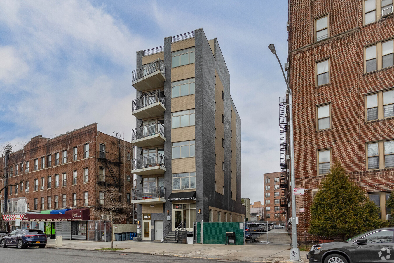
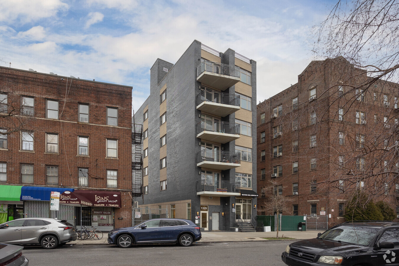
Property Record
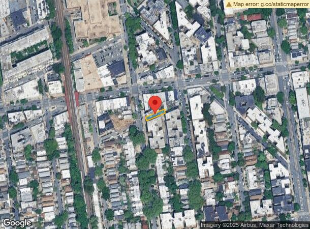
1329 E 17Th St, Brooklyn, NY 11230
NEARBY LISTINGS FOR SALE OR LEASE
Property Detail
1329 E 17Th St
New York-Jersey City-White Plains, NY-NJ
Kings
06746-7501
New York
Condominium
0.07 AC
X
Midwood
3604970352F
Long Island (New York)
14,861 SF
DEMOGRAPHICS near 1329 E 17Th St
1 Mile
3 Mile
5 Mile
2024 Total Population
129,455
1,036,323
1,896,830
2029 Population
123,109
962,906
1,768,254
Pop Growth 2024-2029
(4.90%)
(7.08%)
(6.78%)
Average Age
39
40
40
2024 Total Households
44,000
356,288
689,894
HH Growth 2024-2029
(5.25%)
(7.41%)
(7.09%)
Median Household Inc
$67,545
$65,307
$66,902
Avg Household Size
2.80
2.80
2.60
2024 Avg HH Vehicles
1.00
1.00
1.00
Median Home Value
$855,857
$775,992
$816,494
Median Year Built
1947
1948
1948
Nearby Places
- Restaurants
- Banks
- Shops
- Fitness
- Groceries
PUBLIC TRANSPORTATION
TRANSIT/SUBWAY
Avenue M (Q - New York MTA Subway (The Subway))
DRIVE
WALK
Distance
Avenue M (Q - New York MTA Subway (The Subway))
1 min
2 min
0.1 mi
Avenue J (Q - New York MTA Subway (The Subway))
DRIVE
WALK
Distance
Avenue J (Q - New York MTA Subway (The Subway))
2 min
11 min
0.6 mi
Kings Highway (B,Q Line) (B - New York MTA Subway (The Subway), Q - New York MTA Subway (The Subway))
DRIVE
WALK
Distance
Kings Highway (B,Q Line) (B - New York MTA Subway (The Subway), Q - New York MTA Subway (The Subway))
2 min
12 min
0.6 mi
Avenue N (F - New York MTA Subway (The Subway))
DRIVE
WALK
Distance
Avenue N (F - New York MTA Subway (The Subway))
5 min
18 min
1.0 mi
COMMUTER RAIL
Nostrand Avenue Station (Far Rockaway Branch - Long Island Rail Road, Hempstead Branch - Long Island Rail Road, Long Beach Branch - Long Island Rail Road, West Hempstead Branch - Long Island Rail Road)
DRIVE
WALK
Distance
Nostrand Avenue Station (Far Rockaway Branch - Long Island Rail Road, Hempstead Branch - Long Island Rail Road, Long Beach Branch - Long Island Rail Road, West Hempstead Branch - Long Island Rail Road)
19 min
4.9 mi
Flatbush Avenue Station (Far Rockaway Branch - Long Island Rail Road, Hempstead Branch - Long Island Rail Road, Long Beach Branch - Long Island Rail Road, West Hempstead Branch - Long Island Rail Road)
DRIVE
WALK
Distance
Flatbush Avenue Station (Far Rockaway Branch - Long Island Rail Road, Hempstead Branch - Long Island Rail Road, Long Beach Branch - Long Island Rail Road, West Hempstead Branch - Long Island Rail Road)
20 min
6.2 mi
AIRPORT
John F. Kennedy International
DRIVE
WALK
Distance
John F. Kennedy International
29 min
15.9 mi
La Guardia
DRIVE
WALK
Distance
La Guardia
28 min
17.3 mi
Newark Liberty International
DRIVE
WALK
Distance
Newark Liberty International
40 min
20.7 mi
Freight Ports
NY - Red Hook Container Terminal
DRIVE
WALK
Distance
NY - Red Hook Container Terminal
1 min
5.3 mi
SALE & LEASE HISTORY
LISTING DATE
SALE/LEASE

Nov 04, 2016
For Sale
Jan 23, 2019
For Sale
Dec 05, 2017
For Lease
Aug 05, 2017
For Sale
Nearby Properties
Address
Land Use
TOTAL SIZE
Lot Size
Zoning
Address
Land Use
TOTAL SIZE
Lot Size
Zoning
2,401,524 SF
20.78 AC
M3-1
Address
Land Use
TOTAL SIZE
Lot Size
Zoning
1,503,150 SF
20.47 AC
R5
Address
Land Use
TOTAL SIZE
Lot Size
Zoning
1,066,042 SF
10.45 AC
R4
Address
Land Use
TOTAL SIZE
Lot Size
Zoning
530.51 AC
R4-1
Address
Land Use
TOTAL SIZE
Lot Size
Zoning
10,250 SF
773.50 AC
PARK
Address
Land Use
TOTAL SIZE
Lot Size
Zoning
965,600 SF
6.65 AC
R5
Address
Land Use
TOTAL SIZE
Lot Size
Zoning
1,061,228 SF
8.86 AC
R5
Address
Land Use
TOTAL SIZE
Lot Size
Zoning
1,073,920 SF
16.53 AC
R6
Address
Land Use
TOTAL SIZE
Lot Size
Zoning
561,945 SF
11.58 AC
R6
Address
Land Use
TOTAL SIZE
Lot Size
Zoning
335,800 SF
1.51 AC
R6
Address
Land Use
TOTAL SIZE
Lot Size
Zoning
54.78 AC
PARK
Address
Land Use
TOTAL SIZE
Lot Size
Zoning
785,450 SF
14.22 AC
R6
Address
Land Use
TOTAL SIZE
Lot Size
Zoning
353,600 SF
55.79 AC
Address
Land Use
TOTAL SIZE
Lot Size
Zoning
61.60 AC
PARK
Address
Land Use
TOTAL SIZE
Lot Size
Zoning
838,567 SF
5.11 AC
R6
Address
Land Use
TOTAL SIZE
Lot Size
Zoning
371,139 SF
3.22 AC
R5
Address
Land Use
TOTAL SIZE
Lot Size
Zoning
229,456 SF
4.15 AC
M1-1
Address
Land Use
TOTAL SIZE
Lot Size
Zoning
226,429 SF
1.52 AC
R5B
Address
Land Use
TOTAL SIZE
Lot Size
Zoning
635,994 SF
17.90 AC
R5
Address
Land Use
TOTAL SIZE
Lot Size
Zoning
301,400 SF
22.27 AC
M3-1
Address
Land Use
TOTAL SIZE
Lot Size
Zoning
241,735 SF
1.99 AC
C8-4
Address
Land Use
TOTAL SIZE
Lot Size
Zoning
540,672 SF
10.65 AC
PARK
Address
Land Use
TOTAL SIZE
Lot Size
Zoning
259,823 SF
11.47 AC
M1-1
Address
Land Use
TOTAL SIZE
Lot Size
Zoning
7,948 SF
65.50 AC
R4
Address
Land Use
TOTAL SIZE
Lot Size
Zoning
366,757 SF
0.74 AC
R7-1
Address
Land Use
TOTAL SIZE
Lot Size
Zoning
247,400 SF
4.34 AC
C44A
Address
Land Use
TOTAL SIZE
Lot Size
Zoning
846,056 SF
20.71 AC
R5
Address
Land Use
TOTAL SIZE
Lot Size
Zoning
137,500 SF
2.13 AC
M1-1
Address
Land Use
TOTAL SIZE
Lot Size
Zoning
379,664 SF
8.96 AC
R5
Address
Land Use
TOTAL SIZE
Lot Size
Zoning
22.96 AC
PARK
The World's #1 Commercial Real Estate Marketplace
Connect with us
© 2025 CoStar Group
The information above has been obtained from sources believed reliable. While we do not doubt its accuracy we have not verified it and make no guarantee, warranty or representation about it. It is your responsibility to independently confirm its accuracy and completeness. Any projections, opinions, assumptions, or estimates used are for example only and do not represent the current or future performance of the property. The value of this transaction to you depends on tax and other factors which should be evaluated by your tax, financial, and legal advisors. You and your advisors should conduct a careful, independent investigation of the property to determine to your satisfaction the suitability of the property for your needs.