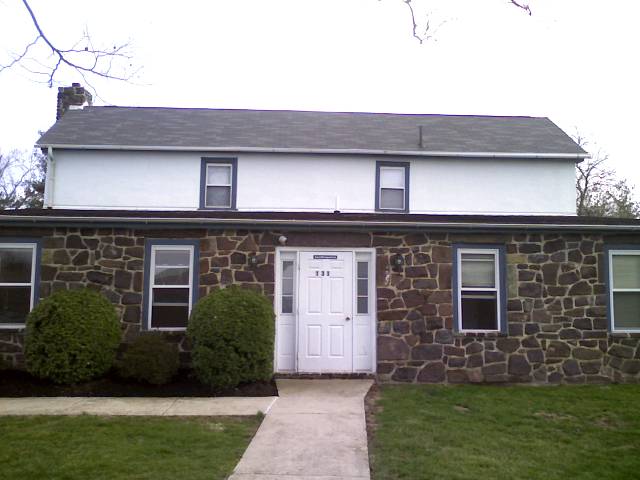
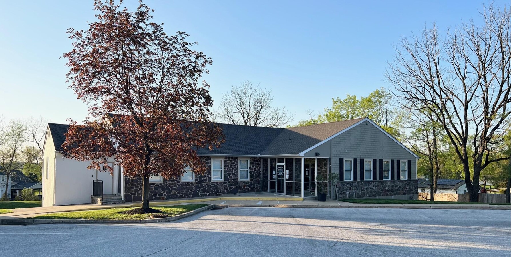
Property Record
133 Level Rd, Collegeville, PA 19426
Current Lease Availabilities
NEARBY LISTINGS FOR SALE OR LEASE
Property Detail
133 Level Rd
43-00-07333-211
3000 SF
Officecondo
Montgomery
X
Pennsylvania
42029C0065G
95
2024
0.07 AC
2024
Norristown/Valley Forge
210700
Philadelphia
6,151 SF
Philadelphia-Camden-Wilmington, PA-NJ-DE-MD
DEMOGRAPHICS near 133 Level Rd
1 Mile
3 Mile
5 Mile
2024 Total Population
4,473
46,984
122,732
2029 Population
4,598
47,899
125,122
Pop Growth 2024-2029
+ 2.79%
+ 1.95%
+ 1.95%
Average Age
42
40
41
2024 Total Households
1,647
16,198
45,948
HH Growth 2024-2029
+ 2.73%
+ 1.99%
+ 1.99%
Median Household Inc
$148,880
$129,856
$113,014
Avg Household Size
2.70
2.70
2.50
2024 Avg HH Vehicles
2.00
2.00
2.00
Median Home Value
$419,099
$441,356
$386,291
Median Year Built
1988
1991
1984
Nearby Places
- Restaurants
- Banks
- Shops
- Fitness
- Groceries
PUBLIC TRANSPORTATION
COMMUTER RAIL
Main Street (Norristown) (R6 - Southeastern Pennsylvania Transportation Authority Regional Rail (SEPTA Regional Rail))
DRIVE
WALK
Distance
Main Street (Norristown) (R6 - Southeastern Pennsylvania Transportation Authority Regional Rail (SEPTA Regional Rail))
16 min
7.1 mi
Elm Street (Norristown) (R6 - Southeastern Pennsylvania Transportation Authority Regional Rail (SEPTA Regional Rail))
DRIVE
WALK
Distance
Elm Street (Norristown) (R6 - Southeastern Pennsylvania Transportation Authority Regional Rail (SEPTA Regional Rail))
17 min
7.5 mi
AIRPORT
Philadelphia International
DRIVE
WALK
Distance
Philadelphia International
59 min
35.4 mi
Freight Ports
Port of Philadelphia
DRIVE
WALK
Distance
Port of Philadelphia
54 min
32.7 mi
Nearby Properties
Address
Land Use
TOTAL SIZE
Lot Size
Zoning
Address
Land Use
TOTAL SIZE
Lot Size
Zoning
989,814 SF
8.87 AC
IO
Address
Land Use
TOTAL SIZE
Lot Size
Zoning
1,113,725 SF
196.05 AC
IO
Address
Land Use
TOTAL SIZE
Lot Size
Zoning
975,535 SF
67.40 AC
R2
Address
Land Use
TOTAL SIZE
Lot Size
Zoning
768,913 SF
81.88 AC
IO
Address
Land Use
TOTAL SIZE
Lot Size
Zoning
1,145,005 SF
149.21 AC
IO
Address
Land Use
TOTAL SIZE
Lot Size
Zoning
124,789 SF
155.99 AC
INO
Address
Land Use
TOTAL SIZE
Lot Size
Zoning
348,190 SF
68 AC
R1
Address
Land Use
TOTAL SIZE
Lot Size
Zoning
1,470,449 SF
80.02 AC
R1
Address
Land Use
TOTAL SIZE
Lot Size
Zoning
199,873 SF
71.47 AC
INO
Address
Land Use
TOTAL SIZE
Lot Size
Zoning
400,875 SF
32.32 AC
IO
Address
Land Use
TOTAL SIZE
Lot Size
Zoning
367,115 SF
62.90 AC
AGR
Address
Land Use
TOTAL SIZE
Lot Size
Zoning
435,884 SF
26.70 AC
R5
Address
Land Use
TOTAL SIZE
Lot Size
Zoning
273,724 SF
8.05 AC
INO
Address
Land Use
TOTAL SIZE
Lot Size
Zoning
204,483 SF
25.02 AC
IO
Address
Land Use
TOTAL SIZE
Lot Size
Zoning
811,455 SF
18.15 AC
M1
Address
Land Use
TOTAL SIZE
Lot Size
Zoning
634,096 SF
3.09 AC
IO
Address
Land Use
TOTAL SIZE
Lot Size
Zoning
154,371 SF
27.18 AC
IO
Address
Land Use
TOTAL SIZE
Lot Size
Zoning
305,760 SF
22.50 AC
R2
Address
Land Use
TOTAL SIZE
Lot Size
Zoning
234,091 SF
53.94 AC
PBO
Address
Land Use
TOTAL SIZE
Lot Size
Zoning
86,046 SF
12.03 AC
R1
Address
Land Use
TOTAL SIZE
Lot Size
Zoning
102,279 SF
17.14 AC
R1
Address
Land Use
TOTAL SIZE
Lot Size
Zoning
137,689 SF
21.46 AC
GC
Address
Land Use
TOTAL SIZE
Lot Size
Zoning
176,130 SF
18.88 AC
C3
Address
Land Use
TOTAL SIZE
Lot Size
Zoning
84,664 SF
14.71 AC
R2
Address
Land Use
TOTAL SIZE
Lot Size
Zoning
86,632 SF
3.88 AC
M1
Address
Land Use
TOTAL SIZE
Lot Size
Zoning
126,833 SF
11.92 AC
GC
Address
Land Use
TOTAL SIZE
Lot Size
Zoning
122,036 SF
8.61 AC
M1
Address
Land Use
TOTAL SIZE
Lot Size
Zoning
192,464 SF
9.89 AC
M1
Address
Land Use
TOTAL SIZE
Lot Size
Zoning
154,825 SF
10 AC
R5
Address
Land Use
TOTAL SIZE
Lot Size
Zoning
66,894 SF
14.18 AC
R2
The World's #1 Commercial Real Estate Marketplace
Connect with us
© 2025 CoStar Group
The information above has been obtained from sources believed reliable. While we do not doubt its accuracy we have not verified it and make no guarantee, warranty or representation about it. It is your responsibility to independently confirm its accuracy and completeness. Any projections, opinions, assumptions, or estimates used are for example only and do not represent the current or future performance of the property. The value of this transaction to you depends on tax and other factors which should be evaluated by your tax, financial, and legal advisors. You and your advisors should conduct a careful, independent investigation of the property to determine to your satisfaction the suitability of the property for your needs.