Property Record
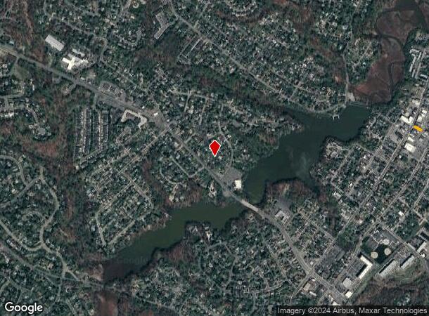
133 Main St, Manasquan, NJ 08736

NEARBY LISTINGS FOR SALE OR LEASE
Property Detail
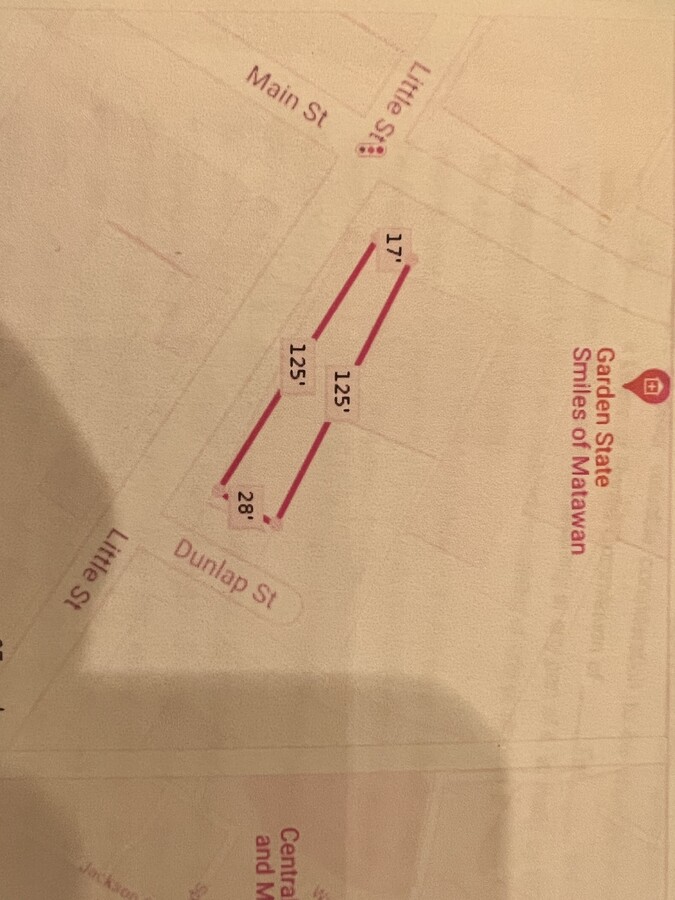
133 Main St
31-00009-0000-00028
Monmouth
Storemultistory
New Jersey
X
28
34025C0036G
0.07 AC
2023
Eastern Monmouth
2024
Northern New Jersey
803000
New York-Jersey City-White Plains, NY-NJ
2,961 SF
DEMOGRAPHICS near 133 Main St
1 Mile
3 Mile
5 Mile
2024 Total Population
11,530
70,789
145,212
2029 Population
11,441
70,321
144,139
Pop Growth 2024-2029
(0.77%)
(0.66%)
(0.74%)
Average Age
40
42
42
2024 Total Households
4,540
26,851
54,521
HH Growth 2024-2029
(0.93%)
(0.82%)
(0.86%)
Median Household Inc
$116,446
$109,837
$105,723
Avg Household Size
2.50
2.60
2.60
2024 Avg HH Vehicles
2.00
2.00
2.00
Median Home Value
$417,301
$407,359
$417,239
Median Year Built
1967
1971
1973
Nearby Places
- Restaurants
- Banks
- Shops
- Fitness
- Groceries
PUBLIC TRANSPORTATION
COMMUTER RAIL
Aberdeen Matawan (North Jersey Coast Line - NJ Transit Commuter Rail (NJ Transit))
DRIVE
WALK
Distance
Aberdeen Matawan (North Jersey Coast Line - NJ Transit Commuter Rail (NJ Transit))
2 min
1.6 mi
Hazlet (North Jersey Coast Line - NJ Transit Commuter Rail (NJ Transit))
DRIVE
WALK
Distance
Hazlet (North Jersey Coast Line - NJ Transit Commuter Rail (NJ Transit))
6 min
4.2 mi
AIRPORT
Newark Liberty International
DRIVE
WALK
Distance
Newark Liberty International
39 min
31.4 mi
John F Kennedy International
DRIVE
WALK
Distance
John F Kennedy International
71 min
49.0 mi
Freight Ports
New York Container Terminal
DRIVE
WALK
Distance
New York Container Terminal
33 min
23.6 mi
SALE & LEASE HISTORY
LISTING DATE
SALE/LEASE

Sep 24, 2016
For Sale
May 02, 2018
For Sale
Jul 31, 2018
For Lease
Jan 24, 2023
For Lease
Jan 10, 2019
For Lease
Jan 10, 2019
For Sale
Jan 06, 2022
For Sale
Feb 14, 2018
For Sale
Nearby Properties
Address
Land Use
TOTAL SIZE
Lot Size
Zoning
Address
Land Use
TOTAL SIZE
Lot Size
Zoning
197,568 SF
28.01 AC
Address
Land Use
TOTAL SIZE
Lot Size
Zoning
Address
Land Use
TOTAL SIZE
Lot Size
Zoning
157,615 SF
17.08 AC
M
Address
Land Use
TOTAL SIZE
Lot Size
Zoning
1.90 AC
LI
Address
Land Use
TOTAL SIZE
Lot Size
Zoning
3.98 AC
MUD
Address
Land Use
TOTAL SIZE
Lot Size
Zoning
10.58 AC
APTH
Address
Land Use
TOTAL SIZE
Lot Size
Zoning
4.23 AC
LI
Address
Land Use
TOTAL SIZE
Lot Size
Zoning
192,538 SF
45.11 AC
R100
Address
Land Use
TOTAL SIZE
Lot Size
Zoning
94,150 SF
13.62 AC
M
Address
Land Use
TOTAL SIZE
Lot Size
Zoning
186,567 SF
2.31 AC
RC
Address
Land Use
TOTAL SIZE
Lot Size
Zoning
148 AC
APTH
Address
Land Use
TOTAL SIZE
Lot Size
Zoning
70,854 SF
14.30 AC
MF0
Address
Land Use
TOTAL SIZE
Lot Size
Zoning
140 AC
MF0
Address
Land Use
TOTAL SIZE
Lot Size
Zoning
7,902 SF
62.41 AC
R20
Address
Land Use
TOTAL SIZE
Lot Size
Zoning
26.84 AC
CF
Address
Land Use
TOTAL SIZE
Lot Size
Zoning
7,904 SF
39.92 AC
TCD
Address
Land Use
TOTAL SIZE
Lot Size
Zoning
420 SF
87.76 AC
OL2
Address
Land Use
TOTAL SIZE
Lot Size
Zoning
15.35 AC
Address
Land Use
TOTAL SIZE
Lot Size
Zoning
6 AC
RC
Address
Land Use
TOTAL SIZE
Lot Size
Zoning
6.80 AC
RM
Address
Land Use
TOTAL SIZE
Lot Size
Zoning
162,250 SF
2.80 AC
RC
Address
Land Use
TOTAL SIZE
Lot Size
Zoning
81.64 AC
R70
Address
Land Use
TOTAL SIZE
Lot Size
Zoning
85,752 SF
8.92 AC
Address
Land Use
TOTAL SIZE
Lot Size
Zoning
42,681 SF
10.34 AC
P
Address
Land Use
TOTAL SIZE
Lot Size
Zoning
287,915 SF
31.10 AC
I
Address
Land Use
TOTAL SIZE
Lot Size
Zoning
6.87 AC
APTH
Address
Land Use
TOTAL SIZE
Lot Size
Zoning
91,171 SF
25.94 AC
PC
Address
Land Use
TOTAL SIZE
Lot Size
Zoning
6.40 AC
RM
Address
Land Use
TOTAL SIZE
Lot Size
Zoning
104,250 SF
18.75 AC
BH
Address
Land Use
TOTAL SIZE
Lot Size
Zoning
136,925 SF
6.66 AC
R100
The World's #1 Commercial Real Estate Marketplace
Connect with us
© 2025 CoStar Group
The information above has been obtained from sources believed reliable. While we do not doubt its accuracy we have not verified it and make no guarantee, warranty or representation about it. It is your responsibility to independently confirm its accuracy and completeness. Any projections, opinions, assumptions, or estimates used are for example only and do not represent the current or future performance of the property. The value of this transaction to you depends on tax and other factors which should be evaluated by your tax, financial, and legal advisors. You and your advisors should conduct a careful, independent investigation of the property to determine to your satisfaction the suitability of the property for your needs.