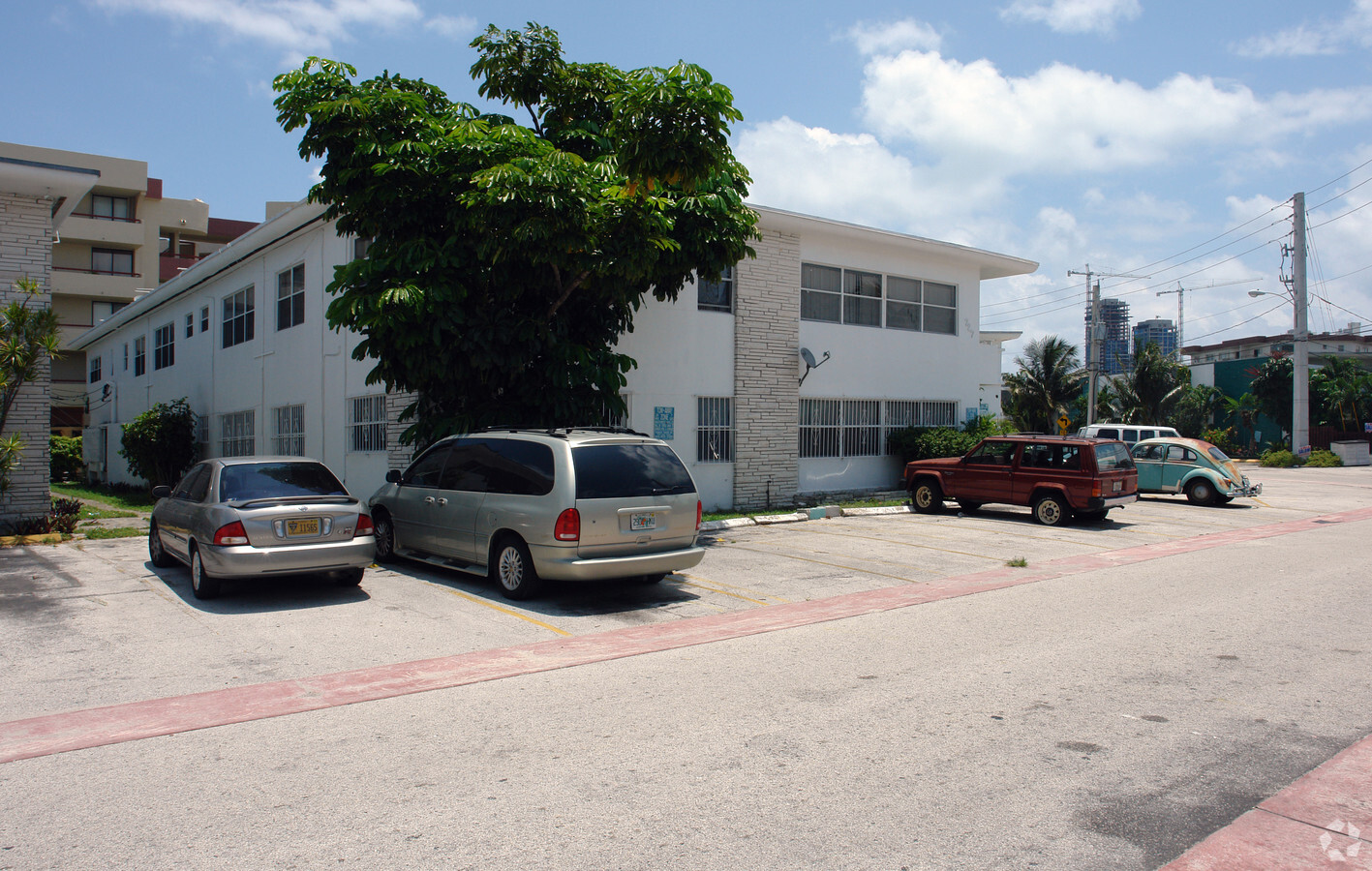
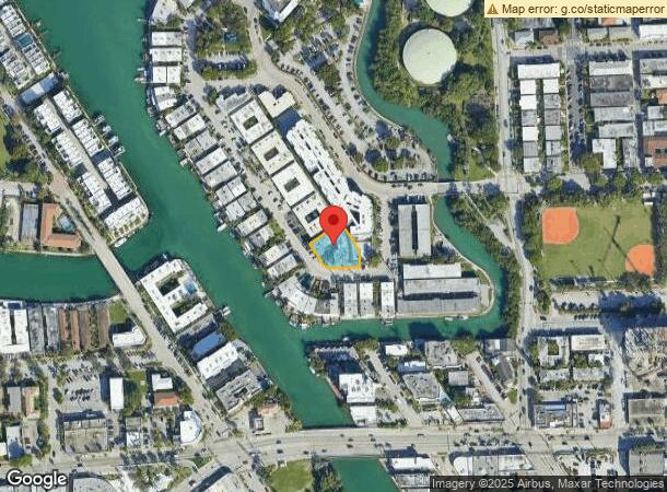
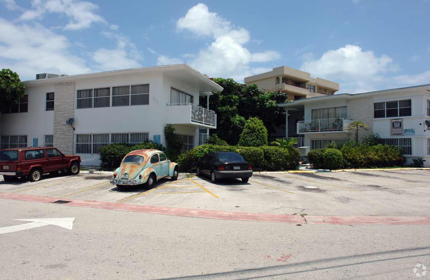
Property Record
7271 Gary Ave, Miami Beach, FL 33141

NEARBY LISTINGS FOR SALE OR LEASE
Property Detail
7271 Gary Ave
Miami-Miami Beach-Kendall, FL
Park View Island
02-3202-014-1080
PARK VIEW ISLAND PB 60-6 LOTS 16 & 17 BLK 3 LOT SIZE IRREGULAR OR 14946-1846/18508-1471 1298 4
Multifamilydwelling
Miami/Dade
AE
Florida
12086C0307L
16,17
2023
0.31 AC
2024
North Shore
003913
South Florida
11,693 SF
DEMOGRAPHICS near 7271 Gary Ave
1 Mile
3 Mile
5 Mile
2024 Total Population
29,803
94,408
245,528
2029 Population
30,163
96,940
248,182
Pop Growth 2024-2029
+ 1.21%
+ 2.68%
+ 1.08%
Average Age
44
45
42
2024 Total Households
14,452
43,650
105,371
HH Growth 2024-2029
+ 1.05%
+ 2.58%
+ 1.19%
Median Household Inc
$53,985
$70,122
$60,434
Avg Household Size
2.00
2.10
2.20
2024 Avg HH Vehicles
1.00
1.00
1.00
Median Home Value
$455,347
$634,136
$537,228
Median Year Built
1968
1970
1969
Nearby Places
- Restaurants
- Banks
- Shops
- Fitness
- Groceries
PUBLIC TRANSPORTATION
AIRPORT
Miami International
DRIVE
WALK
Distance
Miami International
35 min
16.9 mi
Fort Lauderdale/Hollywood International
DRIVE
WALK
Distance
Fort Lauderdale/Hollywood International
37 min
18.9 mi
Freight Ports
Port of Miami
DRIVE
WALK
Distance
Port of Miami
27 min
11.8 mi
Nearby Properties
Address
Land Use
TOTAL SIZE
Lot Size
Zoning
Address
Land Use
TOTAL SIZE
Lot Size
Zoning
1,179,177 SF
10.71 AC
4100
Address
Land Use
TOTAL SIZE
Lot Size
Zoning
610,395 SF
13 AC
6000
Address
Land Use
TOTAL SIZE
Lot Size
Zoning
698,111 SF
4.47 AC
4100
Address
Land Use
TOTAL SIZE
Lot Size
Zoning
768,663 SF
2.85 AC
4600
Address
Land Use
TOTAL SIZE
Lot Size
Zoning
657,769 SF
6.12 AC
6200
Address
Land Use
TOTAL SIZE
Lot Size
Zoning
567,884 SF
4.51 AC
4000
Address
Land Use
TOTAL SIZE
Lot Size
Zoning
446,889 SF
3.06 AC
4100
Address
Land Use
TOTAL SIZE
Lot Size
Zoning
595,788 SF
3.82 AC
4100
Address
Land Use
TOTAL SIZE
Lot Size
Zoning
554,506 SF
2.14 AC
4100
Address
Land Use
TOTAL SIZE
Lot Size
Zoning
502,094 SF
2.70 AC
4100
Address
Land Use
TOTAL SIZE
Lot Size
Zoning
206,129 SF
2.55 AC
5000
Address
Land Use
TOTAL SIZE
Lot Size
Zoning
262,929 SF
2.39 AC
4100
Address
Land Use
TOTAL SIZE
Lot Size
Zoning
13,360 SF
0.87 AC
5000
Address
Land Use
TOTAL SIZE
Lot Size
Zoning
309,292 SF
1.70 AC
5000
Address
Land Use
TOTAL SIZE
Lot Size
Zoning
77,425 SF
0.58 AC
5000
Address
Land Use
TOTAL SIZE
Lot Size
Zoning
30,500 SF
0.86 AC
5000
Address
Land Use
TOTAL SIZE
Lot Size
Zoning
157,410 SF
1.44 AC
5000
Address
Land Use
TOTAL SIZE
Lot Size
Zoning
182,918 SF
1.07 AC
4100
Address
Land Use
TOTAL SIZE
Lot Size
Zoning
190,132 SF
1.71 AC
3900
Address
Land Use
TOTAL SIZE
Lot Size
Zoning
246,217 SF
1.14 AC
4100
Address
Land Use
TOTAL SIZE
Lot Size
Zoning
1.84 AC
1100
Address
Land Use
TOTAL SIZE
Lot Size
Zoning
181,888 SF
4.46 AC
5000
Address
Land Use
TOTAL SIZE
Lot Size
Zoning
171,018 SF
1.24 AC
4100
Address
Land Use
TOTAL SIZE
Lot Size
Zoning
1.84 AC
0100
Address
Land Use
TOTAL SIZE
Lot Size
Zoning
1.84 AC
0100
Address
Land Use
TOTAL SIZE
Lot Size
Zoning
172,535 SF
5.11 AC
8000
Address
Land Use
TOTAL SIZE
Lot Size
Zoning
1.84 AC
0100
Address
Land Use
TOTAL SIZE
Lot Size
Zoning
60,641 SF
1.30 AC
5000
Address
Land Use
TOTAL SIZE
Lot Size
Zoning
1.84 AC
0100
The World's #1 Commercial Real Estate Marketplace
Connect with us
© 2025 CoStar Group
The information above has been obtained from sources believed reliable. While we do not doubt its accuracy we have not verified it and make no guarantee, warranty or representation about it. It is your responsibility to independently confirm its accuracy and completeness. Any projections, opinions, assumptions, or estimates used are for example only and do not represent the current or future performance of the property. The value of this transaction to you depends on tax and other factors which should be evaluated by your tax, financial, and legal advisors. You and your advisors should conduct a careful, independent investigation of the property to determine to your satisfaction the suitability of the property for your needs.