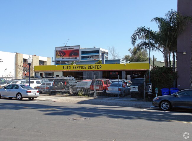
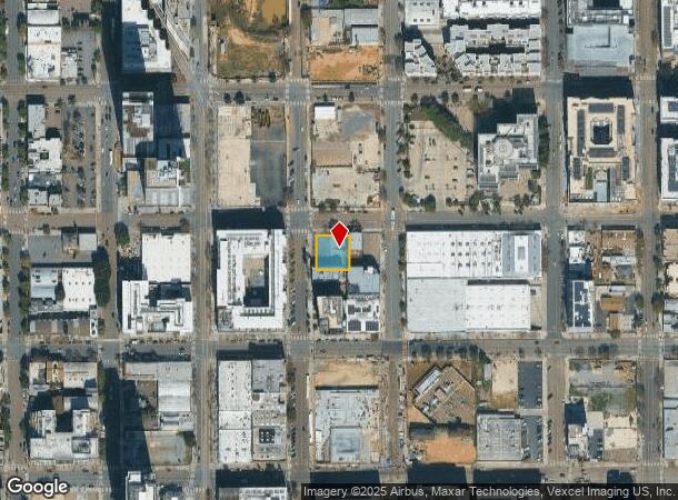
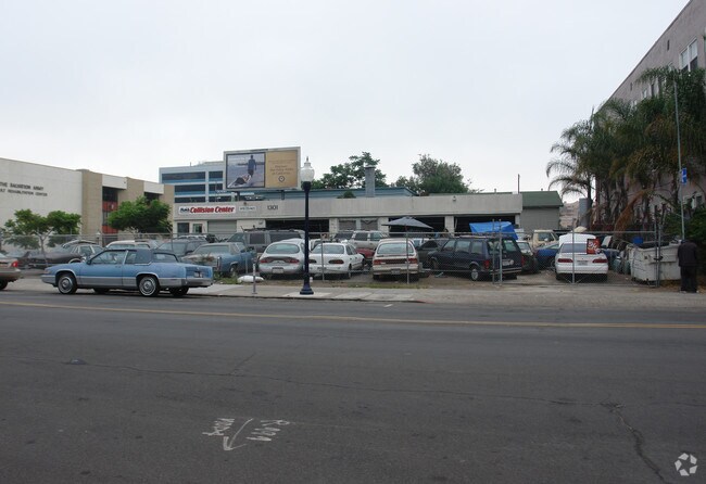
Property Record
865 13Th St, San Diego, CA 92101

NEARBY LISTINGS FOR SALE OR LEASE
Property Detail
865 13Th St
San Diego-Carlsbad, CA
Hortons Add Lockling
534-345-01
BLK 53 LOTS A & B TR DB0013PG522
Autorepair
San Diego
X
California
06073C1884H
a,b
2024
0.23 AC
2025
Central San Diego
005201
San Diego
2,016 SF
DEMOGRAPHICS near 865 13Th St
1 Mile
3 Mile
5 Mile
2024 Total Population
55,748
209,970
495,760
2029 Population
56,347
210,418
494,846
Pop Growth 2024-2029
+ 1.07%
+ 0.21%
(0.18%)
Average Age
41
40
38
2024 Total Households
28,926
94,818
198,487
HH Growth 2024-2029
+ 1.42%
+ 0.38%
(0.06%)
Median Household Inc
$71,261
$80,179
$73,451
Avg Household Size
1.60
2.00
2.30
2024 Avg HH Vehicles
1.00
1.00
2.00
Median Home Value
$737,570
$858,223
$764,235
Median Year Built
2002
1977
1974
Nearby Places
Map Layers
Map Styles
 Street
 Aerial
- Restaurants
- Banks
- Shops
- Fitness
- Groceries
PUBLIC TRANSPORTATION
COMMUTER RAIL
San Diego (Santa Fe Depot) (Coaster - San Diego North County Transit District (Coaster/Sprinter/Breeze))
DRIVE
WALK
Distance
San Diego (Santa Fe Depot) (Coaster - San Diego North County Transit District (Coaster/Sprinter/Breeze))
3 min
1.3 mi
Old Town Transit Center (Coaster - San Diego North County Transit District (Coaster/Sprinter/Breeze))
DRIVE
WALK
Distance
Old Town Transit Center (Coaster - San Diego North County Transit District (Coaster/Sprinter/Breeze))
8 min
4.5 mi
AIRPORT
San Diego International
DRIVE
WALK
Distance
San Diego International
8 min
3.8 mi
Freight Ports
Port of San Diego
DRIVE
WALK
Distance
Port of San Diego
5 min
2.2 mi
Nearby Properties
Address
Land Use
TOTAL SIZE
Lot Size
Zoning
Address
Land Use
TOTAL SIZE
Lot Size
Zoning
8.75 AC
60
Address
Land Use
TOTAL SIZE
Lot Size
Zoning
10.72 AC
M
Address
Land Use
TOTAL SIZE
Lot Size
Zoning
12.79 AC
C
Address
Land Use
TOTAL SIZE
Lot Size
Zoning
5.99 AC
C
Address
Land Use
TOTAL SIZE
Lot Size
Zoning
3.24 AC
C
Address
Land Use
TOTAL SIZE
Lot Size
Zoning
0.33 AC
CCPD-NC
Address
Land Use
TOTAL SIZE
Lot Size
Zoning
1.38 AC
CCPD-R
Address
Land Use
TOTAL SIZE
Lot Size
Zoning
125.69 AC
M
Address
Land Use
TOTAL SIZE
Lot Size
Zoning
7.27 AC
HM
Address
Land Use
TOTAL SIZE
Lot Size
Zoning
1.25 AC
CCPD-BP
Address
Land Use
TOTAL SIZE
Lot Size
Zoning
37.33 AC
C
Address
Land Use
TOTAL SIZE
Lot Size
Zoning
9,999 SF
1.18 AC
C
Address
Land Use
TOTAL SIZE
Lot Size
Zoning
107.28 AC
UNZONED
Address
Land Use
TOTAL SIZE
Lot Size
Zoning
17.25 AC
CCPD-BP
Address
Land Use
TOTAL SIZE
Lot Size
Zoning
1.14 AC
CCPD-NC
Address
Land Use
TOTAL SIZE
Lot Size
Zoning
496,552 SF
27.12 AC
M
Address
Land Use
TOTAL SIZE
Lot Size
Zoning
0.21 AC
CCPD-R
Address
Land Use
TOTAL SIZE
Lot Size
Zoning
10,000 SF
0.21 AC
CCPD-NC
Address
Land Use
TOTAL SIZE
Lot Size
Zoning
1.38 AC
CCPD-CORE
Address
Land Use
TOTAL SIZE
Lot Size
Zoning
12.63 AC
R4
Address
Land Use
TOTAL SIZE
Lot Size
Zoning
18.97 AC
C
Address
Land Use
TOTAL SIZE
Lot Size
Zoning
CCPD-ER
Address
Land Use
TOTAL SIZE
Lot Size
Zoning
1.51 AC
CC-3-9
Address
Land Use
TOTAL SIZE
Lot Size
Zoning
0.57 AC
CCPD-NC
Address
Land Use
TOTAL SIZE
Lot Size
Zoning
0.77 AC
CCPD-NC
Address
Land Use
TOTAL SIZE
Lot Size
Zoning
1.38 AC
CCPD-R
Address
Land Use
TOTAL SIZE
Lot Size
Zoning
1.10 AC
GQPD-GASLA
Address
Land Use
TOTAL SIZE
Lot Size
Zoning
RM-4-10
Address
Land Use
TOTAL SIZE
Lot Size
Zoning
3.17 AC
U
Address
Land Use
TOTAL SIZE
Lot Size
Zoning
15.37 AC
CC-3-8
The World's #1 Commercial Real Estate Marketplace
Connect with us
© 2025 CoStar Group
The information above has been obtained from sources believed reliable. While we do not doubt its accuracy we have not verified it and make no guarantee, warranty or representation about it. It is your responsibility to independently confirm its accuracy and completeness. Any projections, opinions, assumptions, or estimates used are for example only and do not represent the current or future performance of the property. The value of this transaction to you depends on tax and other factors which should be evaluated by your tax, financial, and legal advisors. You and your advisors should conduct a careful, independent investigation of the property to determine to your satisfaction the suitability of the property for your needs.