Property Record
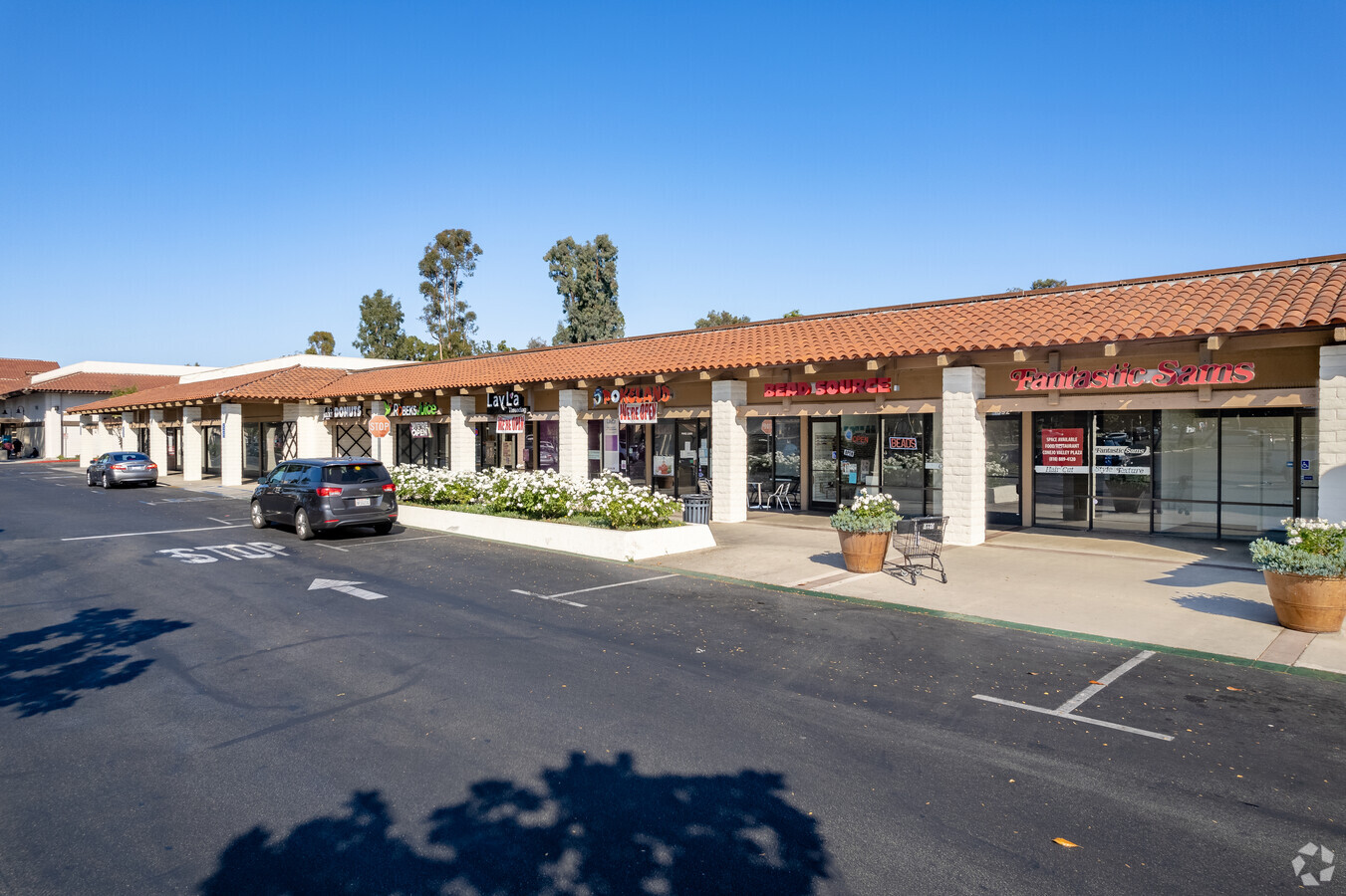
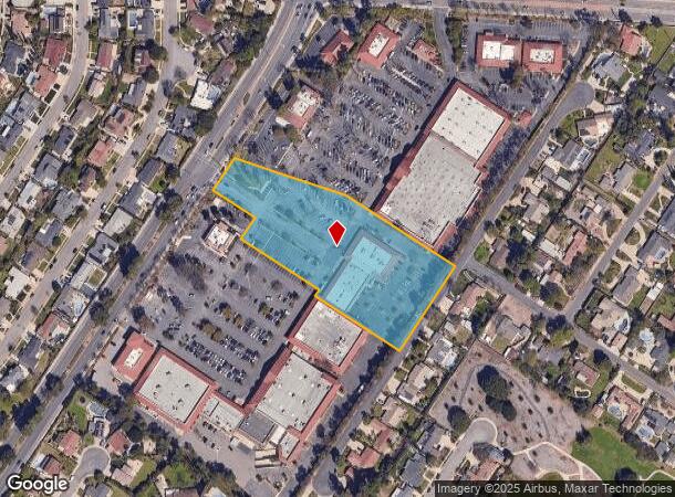
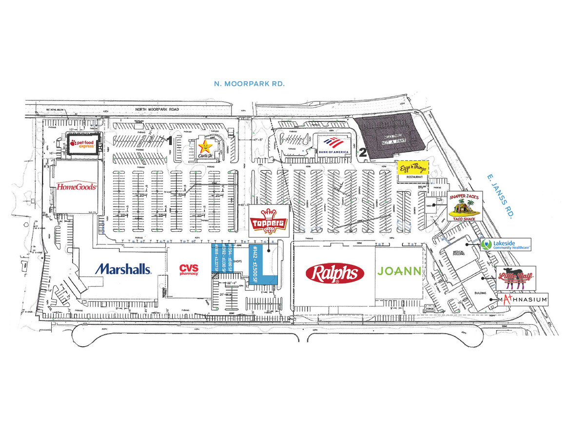
1388 N Moorpark Rd, Thousand Oaks, CA 91360
NEARBY LISTINGS FOR SALE OR LEASE
Property Detail
1388 N Moorpark Rd
677-0-300-075
LOT: 10 REF: 009PM 059
Regionalshoppingcenterormallwithanchorstore
Ventura
X
California
06111C0978E
10
2024
3.57 AC
2024
Thousand Oaks/SE County
006800
Los Angeles
22,100 SF
Oxnard-Thousand Oaks-Ventura, CA
DEMOGRAPHICS near 1388 N Moorpark Rd
1 Mile
3 Mile
5 Mile
2024 Total Population
12,557
81,330
140,657
2029 Population
12,358
80,346
138,704
Pop Growth 2024-2029
(1.58%)
(1.21%)
(1.39%)
Average Age
42
43
44
2024 Total Households
4,506
29,556
51,746
HH Growth 2024-2029
(1.60%)
(1.26%)
(1.47%)
Median Household Inc
$97,635
$110,622
$122,502
Avg Household Size
2.60
2.60
2.60
2024 Avg HH Vehicles
2.00
2.00
2.00
Median Home Value
$766,790
$788,066
$846,252
Median Year Built
1967
1976
1978
Nearby Places
- Restaurants
- Banks
- Shops
- Fitness
- Groceries
PUBLIC TRANSPORTATION
COMMUTER RAIL
Moorpark (Ventura County Line - Southern California Regional Rail Authority (Metrolink))
DRIVE
WALK
Distance
Moorpark (Ventura County Line - Southern California Regional Rail Authority (Metrolink))
13 min
9.0 mi
AIRPORT
Bob Hope
DRIVE
WALK
Distance
Bob Hope
47 min
36.1 mi
Freight Ports
The Port of Hueneme
DRIVE
WALK
Distance
The Port of Hueneme
35 min
23.5 mi
SALE & LEASE HISTORY
LISTING DATE
SALE/LEASE

Sep 25, 2016
For Lease
Sep 11, 2024
For Lease
Oct 03, 2016
For Lease
Nov 13, 2017
For Lease
Apr 07, 2017
For Lease
Nearby Properties
Address
Land Use
TOTAL SIZE
Lot Size
Zoning
Address
Land Use
TOTAL SIZE
Lot Size
Zoning
13.12 AC
PL
Address
Land Use
TOTAL SIZE
Lot Size
Zoning
4,950 SF
50.22 AC
Address
Land Use
TOTAL SIZE
Lot Size
Zoning
Address
Land Use
TOTAL SIZE
Lot Size
Zoning
5.25 AC
Address
Land Use
TOTAL SIZE
Lot Size
Zoning
239,224 SF
11.65 AC
Address
Land Use
TOTAL SIZE
Lot Size
Zoning
Address
Land Use
TOTAL SIZE
Lot Size
Zoning
384,742 SF
19.93 AC
RPD2
Address
Land Use
TOTAL SIZE
Lot Size
Zoning
199,586 SF
8.95 AC
RPD25
Address
Land Use
TOTAL SIZE
Lot Size
Zoning
15,596 SF
3.17 AC
C2
Address
Land Use
TOTAL SIZE
Lot Size
Zoning
182,756 SF
8.88 AC
RPD1
Address
Land Use
TOTAL SIZE
Lot Size
Zoning
10.32 AC
PL
Address
Land Use
TOTAL SIZE
Lot Size
Zoning
27.54 AC
PL
Address
Land Use
TOTAL SIZE
Lot Size
Zoning
135.43 AC
Address
Land Use
TOTAL SIZE
Lot Size
Zoning
1.94 AC
Address
Land Use
TOTAL SIZE
Lot Size
Zoning
5.08 AC
PL
Address
Land Use
TOTAL SIZE
Lot Size
Zoning
11,907 SF
6.11 AC
Address
Land Use
TOTAL SIZE
Lot Size
Zoning
6.93 AC
PL
Address
Land Use
TOTAL SIZE
Lot Size
Zoning
177,503 SF
5.36 AC
Address
Land Use
TOTAL SIZE
Lot Size
Zoning
26,654 SF
17.84 AC
C3
Address
Land Use
TOTAL SIZE
Lot Size
Zoning
127,196 SF
10.18 AC
MULT
Address
Land Use
TOTAL SIZE
Lot Size
Zoning
206,886 SF
12.11 AC
Address
Land Use
TOTAL SIZE
Lot Size
Zoning
90,194 SF
4.12 AC
Address
Land Use
TOTAL SIZE
Lot Size
Zoning
Address
Land Use
TOTAL SIZE
Lot Size
Zoning
89,664 SF
5.03 AC
R-3
Address
Land Use
TOTAL SIZE
Lot Size
Zoning
123,248 SF
8.70 AC
RPD2
Address
Land Use
TOTAL SIZE
Lot Size
Zoning
74,757 SF
9.01 AC
Address
Land Use
TOTAL SIZE
Lot Size
Zoning
73,565 SF
5.27 AC
MULT
Address
Land Use
TOTAL SIZE
Lot Size
Zoning
2.13 AC
M1
Address
Land Use
TOTAL SIZE
Lot Size
Zoning
68,015 SF
1.22 AC
Address
Land Use
TOTAL SIZE
Lot Size
Zoning
The World's #1 Commercial Real Estate Marketplace
Connect with us
© 2025 CoStar Group
The information above has been obtained from sources believed reliable. While we do not doubt its accuracy we have not verified it and make no guarantee, warranty or representation about it. It is your responsibility to independently confirm its accuracy and completeness. Any projections, opinions, assumptions, or estimates used are for example only and do not represent the current or future performance of the property. The value of this transaction to you depends on tax and other factors which should be evaluated by your tax, financial, and legal advisors. You and your advisors should conduct a careful, independent investigation of the property to determine to your satisfaction the suitability of the property for your needs.