Property Record
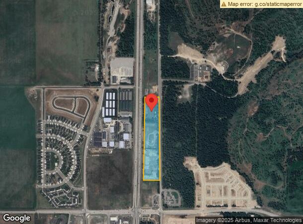
13403 N Government Way, Hayden, ID 83835
NEARBY LISTINGS FOR SALE OR LEASE
-
-
No Photo
-
-
-
-
View all Hayden listings for lease on LoopNet.com
Property Detail
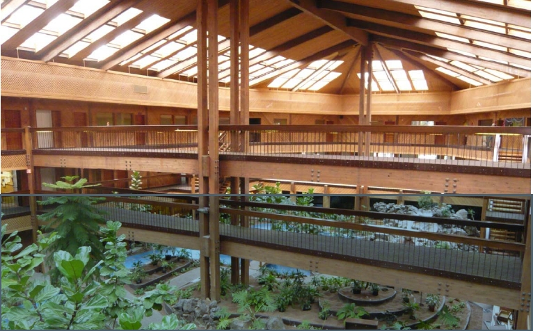
13403 N Government Way
51N04W027300
TAX#26620 [IN E2-SE] 0251N04W
Loftbuilding
Kootenai
X
Idaho
16055C0250E
13.06 AC
2024
Hayden/Dalton Gardens
2023
Coeur D'Alene
000202
Coeur d'Alene, ID
41,836 SF
DEMOGRAPHICS near 13403 N Government Way
1 Mile
3 Mile
5 Mile
2024 Total Population
1,413
17,518
56,688
2029 Population
1,680
20,784
67,406
Pop Growth 2024-2029
+ 18.90%
+ 18.64%
+ 18.91%
Average Age
43
44
41
2024 Total Households
513
6,761
21,135
HH Growth 2024-2029
+ 18.52%
+ 18.27%
+ 18.54%
Median Household Inc
$86,071
$73,191
$76,375
Avg Household Size
2.70
2.50
2.60
2024 Avg HH Vehicles
3.00
2.00
2.00
Median Home Value
$496,153
$489,706
$470,352
Median Year Built
1995
1994
2000
Nearby Places
- Restaurants
- Banks
- Shops
- Fitness
- Groceries
SALE & LEASE HISTORY
LISTING DATE
SALE/LEASE

Sep 25, 2016
For Lease
Nearby Properties
Address
Land Use
TOTAL SIZE
Lot Size
Zoning
Address
Land Use
TOTAL SIZE
Lot Size
Zoning
83,208 SF
7.76 AC
Address
Land Use
TOTAL SIZE
Lot Size
Zoning
60,020 SF
9.52 AC
Address
Land Use
TOTAL SIZE
Lot Size
Zoning
7,003 SF
60.16 AC
LTIND
Address
Land Use
TOTAL SIZE
Lot Size
Zoning
87,176 SF
14.18 AC
Address
Land Use
TOTAL SIZE
Lot Size
Zoning
31,745 SF
1.70 AC
Address
Land Use
TOTAL SIZE
Lot Size
Zoning
45,316 SF
5.79 AC
Address
Land Use
TOTAL SIZE
Lot Size
Zoning
36,000 SF
8.79 AC
Address
Land Use
TOTAL SIZE
Lot Size
Zoning
82,250 SF
8.76 AC
Address
Land Use
TOTAL SIZE
Lot Size
Zoning
67,220 SF
7.21 AC
Address
Land Use
TOTAL SIZE
Lot Size
Zoning
27,885 SF
89.43 AC
Address
Land Use
TOTAL SIZE
Lot Size
Zoning
65,981 SF
5.90 AC
Address
Land Use
TOTAL SIZE
Lot Size
Zoning
58,556 SF
1.24 AC
Address
Land Use
TOTAL SIZE
Lot Size
Zoning
58,000 SF
4.78 AC
Address
Land Use
TOTAL SIZE
Lot Size
Zoning
49,241 SF
2.81 AC
LTIND
Address
Land Use
TOTAL SIZE
Lot Size
Zoning
28,788 SF
9.38 AC
Address
Land Use
TOTAL SIZE
Lot Size
Zoning
50,532 SF
4.70 AC
AGSUB
Address
Land Use
TOTAL SIZE
Lot Size
Zoning
34,236 SF
9.48 AC
Address
Land Use
TOTAL SIZE
Lot Size
Zoning
25,496 SF
5.43 AC
Address
Land Use
TOTAL SIZE
Lot Size
Zoning
47,845 SF
14.85 AC
Address
Land Use
TOTAL SIZE
Lot Size
Zoning
46,560 SF
3.58 AC
Address
Land Use
TOTAL SIZE
Lot Size
Zoning
48,040 SF
10 AC
LTIND
Address
Land Use
TOTAL SIZE
Lot Size
Zoning
15,609 SF
35.15 AC
Address
Land Use
TOTAL SIZE
Lot Size
Zoning
48,950 SF
4.36 AC
Address
Land Use
TOTAL SIZE
Lot Size
Zoning
35,340 SF
4.55 AC
Address
Land Use
TOTAL SIZE
Lot Size
Zoning
6,986 SF
54.55 AC
RESRES
Address
Land Use
TOTAL SIZE
Lot Size
Zoning
7,752 SF
5 AC
Address
Land Use
TOTAL SIZE
Lot Size
Zoning
23,675 SF
9.72 AC
Address
Land Use
TOTAL SIZE
Lot Size
Zoning
5,828 SF
0.82 AC
Address
Land Use
TOTAL SIZE
Lot Size
Zoning
19,114 SF
9.58 AC
Address
Land Use
TOTAL SIZE
Lot Size
Zoning
30,350 SF
4.13 AC
LTIND
The World's #1 Commercial Real Estate Marketplace
Connect with us
© 2025 CoStar Group
The information above has been obtained from sources believed reliable. While we do not doubt its accuracy we have not verified it and make no guarantee, warranty or representation about it. It is your responsibility to independently confirm its accuracy and completeness. Any projections, opinions, assumptions, or estimates used are for example only and do not represent the current or future performance of the property. The value of this transaction to you depends on tax and other factors which should be evaluated by your tax, financial, and legal advisors. You and your advisors should conduct a careful, independent investigation of the property to determine to your satisfaction the suitability of the property for your needs.