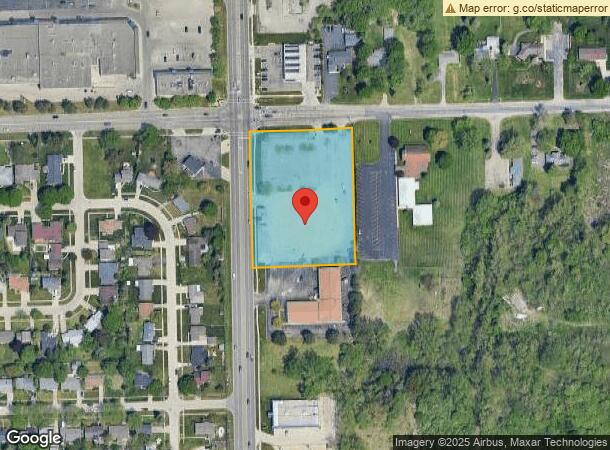
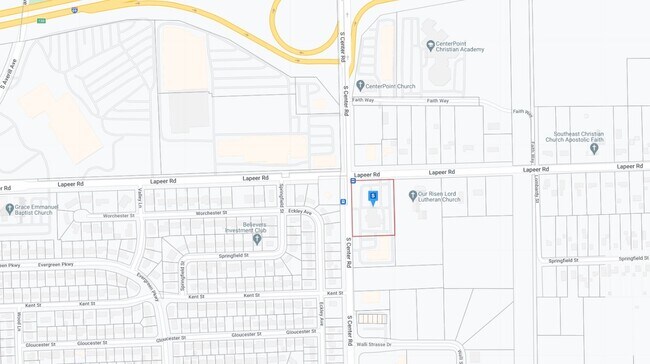
Property Record
1341 S Center Rd, Burton, MI 48509

This Property Is For Sale
NEARBY LISTINGS FOR SALE OR LEASE
Property Detail
1341 S Center Rd
59-15-300-001
A PARCEL OF LAND BEG S 1 DEG 43 MIN E 494.63 FT FROM W 1/4 COR OF SEC, TH S 1 DEG 43 MIN E 420 FT TH N 87 DEG 27 MIN E 330 FT
Commercialacreage
Genesee
X
Michigan
26049C0194D
2.38 AC
2024
Flint
2025
Detroit
011508
Flint, MI
10,444 SF
DEMOGRAPHICS near 1341 S Center Rd
1 Mile
3 Mile
5 Mile
2024 Total Population
4,742
50,164
140,174
2029 Population
4,626
49,990
140,289
Pop Growth 2024-2029
(2.45%)
(0.35%)
+ 0.08%
Average Age
40
40
39
2024 Total Households
2,083
21,025
58,172
HH Growth 2024-2029
(2.30%)
(0.46%)
+ 0.04%
Median Household Inc
$30,895
$40,792
$42,416
Avg Household Size
2.30
2.30
2.30
2024 Avg HH Vehicles
1.00
1.00
2.00
Median Home Value
$82,468
$87,919
$97,009
Median Year Built
1962
1956
1961
Nearby Places
Map Layers
Map Styles
 Street
 Aerial
- Restaurants
- Banks
- Shops
- Fitness
- Groceries
PUBLIC TRANSPORTATION
COMMUTER RAIL
Flint Amtrak Station (Blue Water - Amtrak)
DRIVE
WALK
Distance
Flint Amtrak Station (Blue Water - Amtrak)
4 min
1.6 mi
AIRPORT
Bishop International
DRIVE
WALK
Distance
Bishop International
23 min
11.4 mi
Freight Ports
Port of Toledo
DRIVE
WALK
Distance
Port of Toledo
138 min
117.2 mi
Nearby Properties
Address
Land Use
TOTAL SIZE
Lot Size
Zoning
Address
Land Use
TOTAL SIZE
Lot Size
Zoning
MOBILE
Address
Land Use
TOTAL SIZE
Lot Size
Zoning
290,267 SF
79 AC
PC
Address
Land Use
TOTAL SIZE
Lot Size
Zoning
227,669 SF
25.87 AC
C-2
Address
Land Use
TOTAL SIZE
Lot Size
Zoning
130,291 SF
Address
Land Use
TOTAL SIZE
Lot Size
Zoning
227,755 SF
32.27 AC
C-2
Address
Land Use
TOTAL SIZE
Lot Size
Zoning
354,079 SF
48.41 AC
C-4
Address
Land Use
TOTAL SIZE
Lot Size
Zoning
144,896 SF
0.23 AC
DC
Address
Land Use
TOTAL SIZE
Lot Size
Zoning
115,556 SF
2.50 AC
DE
Address
Land Use
TOTAL SIZE
Lot Size
Zoning
371,636 SF
12.50 AC
M-1
Address
Land Use
TOTAL SIZE
Lot Size
Zoning
60,613 SF
12.91 AC
RO
Address
Land Use
TOTAL SIZE
Lot Size
Zoning
68,571 SF
0.81 AC
DC
Address
Land Use
TOTAL SIZE
Lot Size
Zoning
246,759 SF
19.03 AC
CC
Address
Land Use
TOTAL SIZE
Lot Size
Zoning
24.38 AC
RM
Address
Land Use
TOTAL SIZE
Lot Size
Zoning
111,882 SF
5.36 AC
C-4
Address
Land Use
TOTAL SIZE
Lot Size
Zoning
419,038 SF
57.18 AC
M-2
Address
Land Use
TOTAL SIZE
Lot Size
Zoning
49,582 SF
25.15 AC
HRM
Address
Land Use
TOTAL SIZE
Lot Size
Zoning
364,289 SF
24.80 AC
GN-1
Address
Land Use
TOTAL SIZE
Lot Size
Zoning
136,506 SF
16.54 AC
C-4
Address
Land Use
TOTAL SIZE
Lot Size
Zoning
236,340 SF
25.17 AC
CE
Address
Land Use
TOTAL SIZE
Lot Size
Zoning
2,829 SF
75.78 AC
RMH
Address
Land Use
TOTAL SIZE
Lot Size
Zoning
65,488 SF
0.30 AC
DC
Address
Land Use
TOTAL SIZE
Lot Size
Zoning
320,622 SF
14.93 AC
M-2
Address
Land Use
TOTAL SIZE
Lot Size
Zoning
74,816 SF
Address
Land Use
TOTAL SIZE
Lot Size
Zoning
98,932 SF
6.09 AC
GI-2
Address
Land Use
TOTAL SIZE
Lot Size
Zoning
122,240 SF
3.42 AC
TN-2
Address
Land Use
TOTAL SIZE
Lot Size
Zoning
3.45 AC
MR-3
Address
Land Use
TOTAL SIZE
Lot Size
Zoning
218,229 SF
37.64 AC
CE
Address
Land Use
TOTAL SIZE
Lot Size
Zoning
149,136 SF
9.35 AC
CE
Address
Land Use
TOTAL SIZE
Lot Size
Zoning
107,580 SF
5.18 AC
RETAIL
Address
Land Use
TOTAL SIZE
Lot Size
Zoning
82,240 SF
15.03 AC
C-2
The World's #1 Commercial Real Estate Marketplace
Connect with us
© 2025 CoStar Group
The information above has been obtained from sources believed reliable. While we do not doubt its accuracy we have not verified it and make no guarantee, warranty or representation about it. It is your responsibility to independently confirm its accuracy and completeness. Any projections, opinions, assumptions, or estimates used are for example only and do not represent the current or future performance of the property. The value of this transaction to you depends on tax and other factors which should be evaluated by your tax, financial, and legal advisors. You and your advisors should conduct a careful, independent investigation of the property to determine to your satisfaction the suitability of the property for your needs.