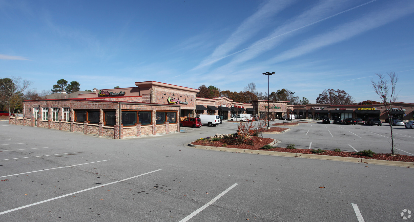
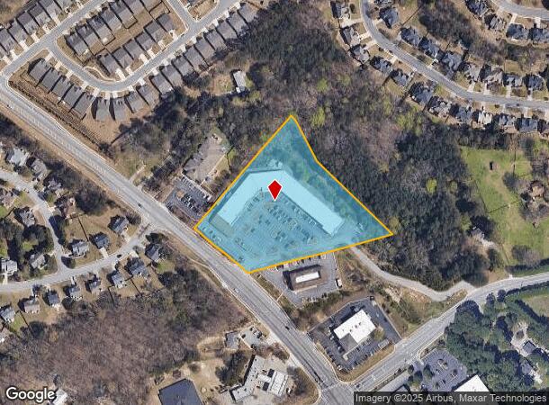
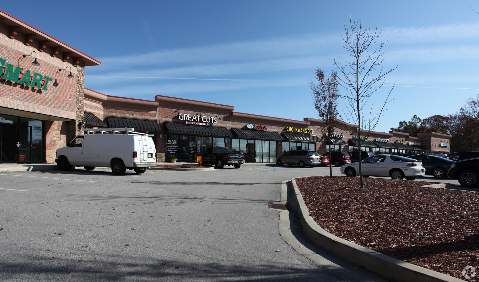
Property Record
1342 Auburn Rd, Dacula, GA 30019
NEARBY LISTINGS FOR SALE OR LEASE
Property Detail
1342 Auburn Rd
Atlanta-Sandy Springs-Roswell, GA
Hog Mtn
2-001-044
HOG MTN DACULA RD
Stripcommercialcenter
Gwinnett
X
Georgia
13135C0048G
0
2023
4.13 AC
2023
Suwanee/Buford
050620
Atlanta
37,436 SF
DEMOGRAPHICS near 1342 Auburn Rd
1 Mile
3 Mile
5 Mile
2024 Total Population
9,574
56,145
129,949
2029 Population
9,971
58,991
138,029
Pop Growth 2024-2029
+ 4.15%
+ 5.07%
+ 6.22%
Average Age
38
38
38
2024 Total Households
2,890
17,245
40,877
HH Growth 2024-2029
+ 4.22%
+ 5.10%
+ 6.42%
Median Household Inc
$108,063
$109,684
$97,662
Avg Household Size
3.30
3.20
3.10
2024 Avg HH Vehicles
3.00
2.00
2.00
Median Home Value
$324,270
$332,428
$324,266
Median Year Built
2002
2002
2002
Nearby Places
- Restaurants
- Banks
- Shops
- Fitness
- Groceries
Nearby Properties
Address
Land Use
TOTAL SIZE
Lot Size
Zoning
Address
Land Use
TOTAL SIZE
Lot Size
Zoning
891.66 AC
R100
Address
Land Use
TOTAL SIZE
Lot Size
Zoning
432,168 SF
85.71 AC
RA200
Address
Land Use
TOTAL SIZE
Lot Size
Zoning
403,129 SF
117.11 AC
RA200
Address
Land Use
TOTAL SIZE
Lot Size
Zoning
327,580 SF
7.80 AC
HRR
Address
Land Use
TOTAL SIZE
Lot Size
Zoning
186,270 SF
17.39 AC
RA200
Address
Land Use
TOTAL SIZE
Lot Size
Zoning
122,983 SF
7.97 AC
OI-OFFICE-
Address
Land Use
TOTAL SIZE
Lot Size
Zoning
284,415 SF
17.55 AC
OI-OFFICE-
Address
Land Use
TOTAL SIZE
Lot Size
Zoning
158,307 SF
26.77 AC
R75
Address
Land Use
TOTAL SIZE
Lot Size
Zoning
101,343 SF
44.33 AC
R1400
Address
Land Use
TOTAL SIZE
Lot Size
Zoning
84.13 AC
R1400-SING
Address
Land Use
TOTAL SIZE
Lot Size
Zoning
134,673 SF
29.74 AC
RA200
Address
Land Use
TOTAL SIZE
Lot Size
Zoning
93,702 SF
5.66 AC
C2
Address
Land Use
TOTAL SIZE
Lot Size
Zoning
124,425 SF
20.73 AC
RA200
Address
Land Use
TOTAL SIZE
Lot Size
Zoning
110,356 SF
20.42 AC
RA200
Address
Land Use
TOTAL SIZE
Lot Size
Zoning
204,235 SF
24.93 AC
C2
Address
Land Use
TOTAL SIZE
Lot Size
Zoning
23,126 SF
88.56 AC
RA200
Address
Land Use
TOTAL SIZE
Lot Size
Zoning
116,332 SF
4.83 AC
OI
Address
Land Use
TOTAL SIZE
Lot Size
Zoning
61,686 SF
10 AC
R1400-SING
Address
Land Use
TOTAL SIZE
Lot Size
Zoning
102,618 SF
18 AC
R1200
Address
Land Use
TOTAL SIZE
Lot Size
Zoning
99,516 SF
10.83 AC
C3
Address
Land Use
TOTAL SIZE
Lot Size
Zoning
21,218 SF
20.02 AC
RA200-AGRI
Address
Land Use
TOTAL SIZE
Lot Size
Zoning
51,084 SF
26.89 AC
R1200-SING
Address
Land Use
TOTAL SIZE
Lot Size
Zoning
69,901 SF
10.01 AC
C2
Address
Land Use
TOTAL SIZE
Lot Size
Zoning
97,824 SF
13.71 AC
M1
Address
Land Use
TOTAL SIZE
Lot Size
Zoning
32,982 SF
25.46 AC
RA200
Address
Land Use
TOTAL SIZE
Lot Size
Zoning
89,487 SF
11.14 AC
C2-GENERAL
Address
Land Use
TOTAL SIZE
Lot Size
Zoning
52,024 SF
8.04 AC
C2
Address
Land Use
TOTAL SIZE
Lot Size
Zoning
327.79 AC
R100
Address
Land Use
TOTAL SIZE
Lot Size
Zoning
117,207 SF
12.97 AC
C2
Address
Land Use
TOTAL SIZE
Lot Size
Zoning
75,160 SF
14.82 AC
C2
The World's #1 Commercial Real Estate Marketplace
Connect with us
© 2025 CoStar Group
The information above has been obtained from sources believed reliable. While we do not doubt its accuracy we have not verified it and make no guarantee, warranty or representation about it. It is your responsibility to independently confirm its accuracy and completeness. Any projections, opinions, assumptions, or estimates used are for example only and do not represent the current or future performance of the property. The value of this transaction to you depends on tax and other factors which should be evaluated by your tax, financial, and legal advisors. You and your advisors should conduct a careful, independent investigation of the property to determine to your satisfaction the suitability of the property for your needs.