Property Record
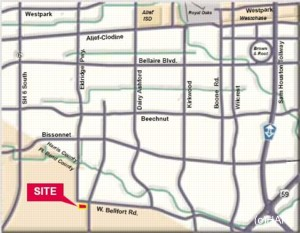
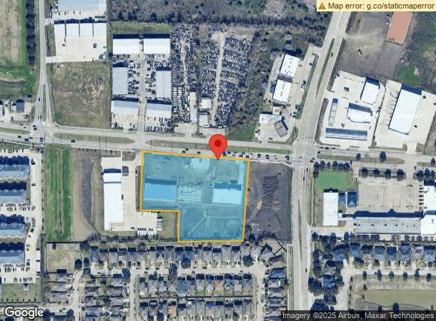
13435 W Bellfort Ave, Sugar Land, TX 77478
NEARBY LISTINGS FOR SALE OR LEASE
Property Detail
13435 W Bellfort Ave
Houston-The Woodlands-Sugar Land, TX
Jas Alston
0101-00-000-2600-907
0101 JAS ALSTON, BLOCK 1, ACRES 4.0708, FAST PASS STATION, UNRESTRICTED RESERVE B
Commercialacreage
Fort Bend
X
Texas
48157C0165L
4.07 AC
2023
E Fort Bend Co/Sugar Land
2023
Houston
672304
DEMOGRAPHICS near 13435 W Bellfort Ave
1 Mile
3 Mile
5 Mile
2024 Total Population
15,158
152,404
389,683
2029 Population
17,907
167,616
426,128
Pop Growth 2024-2029
+ 18.14%
+ 9.98%
+ 9.35%
Average Age
39
38
37
2024 Total Households
4,740
48,930
128,987
HH Growth 2024-2029
+ 18.80%
+ 10.61%
+ 9.57%
Median Household Inc
$73,622
$62,021
$58,406
Avg Household Size
3.10
3.00
2.90
2024 Avg HH Vehicles
2.00
2.00
2.00
Median Home Value
$192,633
$203,077
$222,993
Median Year Built
1989
1987
1987
Nearby Places
- Restaurants
- Banks
- Shops
- Fitness
- Groceries
PUBLIC TRANSPORTATION
AIRPORT
William P Hobby
DRIVE
WALK
Distance
William P Hobby
39 min
25.0 mi
George Bush Intcntl/Houston
DRIVE
WALK
Distance
George Bush Intcntl/Houston
50 min
39.0 mi
Freight Ports
Port of Houston
DRIVE
WALK
Distance
Port of Houston
42 min
27.1 mi
SALE & LEASE HISTORY
LISTING DATE
SALE/LEASE

Sep 24, 2016
For Sale
Jul 25, 2017
For Sale
Nearby Properties
Address
Land Use
TOTAL SIZE
Lot Size
Zoning
Address
Land Use
TOTAL SIZE
Lot Size
Zoning
637,364 SF
11.57 AC
YQ
Address
Land Use
TOTAL SIZE
Lot Size
Zoning
104,287 SF
13.56 AC
M
Address
Land Use
TOTAL SIZE
Lot Size
Zoning
94,547 SF
13.59 AC
Address
Land Use
TOTAL SIZE
Lot Size
Zoning
76,306 SF
15.84 AC
Address
Land Use
TOTAL SIZE
Lot Size
Zoning
218,755 SF
19.69 AC
MQY
Address
Land Use
TOTAL SIZE
Lot Size
Zoning
343,438 SF
54.92 AC
S
Address
Land Use
TOTAL SIZE
Lot Size
Zoning
126,308 SF
16.95 AC
Address
Land Use
TOTAL SIZE
Lot Size
Zoning
291,196 SF
30.06 AC
SXY
Address
Land Use
TOTAL SIZE
Lot Size
Zoning
76,385 SF
17.48 AC
Address
Land Use
TOTAL SIZE
Lot Size
Zoning
183,015 SF
9.91 AC
Address
Land Use
TOTAL SIZE
Lot Size
Zoning
422,123 SF
39.85 AC
Address
Land Use
TOTAL SIZE
Lot Size
Zoning
88,705 SF
17.04 AC
SY
Address
Land Use
TOTAL SIZE
Lot Size
Zoning
355,887 SF
13.89 AC
Address
Land Use
TOTAL SIZE
Lot Size
Zoning
313,484 SF
4.47 AC
XSY
Address
Land Use
TOTAL SIZE
Lot Size
Zoning
61,006 SF
13.16 AC
X
Address
Land Use
TOTAL SIZE
Lot Size
Zoning
Address
Land Use
TOTAL SIZE
Lot Size
Zoning
329,954 SF
15.55 AC
SH
Address
Land Use
TOTAL SIZE
Lot Size
Zoning
84,509 SF
13.06 AC
Y
Address
Land Use
TOTAL SIZE
Lot Size
Zoning
259,117 SF
6.28 AC
YS
Address
Land Use
TOTAL SIZE
Lot Size
Zoning
75,978 SF
10.13 AC
Address
Land Use
TOTAL SIZE
Lot Size
Zoning
45,216 SF
11.92 AC
SY
Address
Land Use
TOTAL SIZE
Lot Size
Zoning
165,146 SF
3.07 AC
XYS
Address
Land Use
TOTAL SIZE
Lot Size
Zoning
226,700 SF
19.14 AC
M
Address
Land Use
TOTAL SIZE
Lot Size
Zoning
280,309 SF
9.98 AC
Address
Land Use
TOTAL SIZE
Lot Size
Zoning
299,622 SF
17.66 AC
MSY
Address
Land Use
TOTAL SIZE
Lot Size
Zoning
330,612 SF
13.41 AC
Address
Land Use
TOTAL SIZE
Lot Size
Zoning
156,259 SF
9.28 AC
IT
Address
Land Use
TOTAL SIZE
Lot Size
Zoning
328,483 SF
15.53 AC
XY
Address
Land Use
TOTAL SIZE
Lot Size
Zoning
406,120 SF
3.35 AC
Address
Land Use
TOTAL SIZE
Lot Size
Zoning
263,303 SF
11.47 AC
YT
The World's #1 Commercial Real Estate Marketplace
Connect with us
© 2025 CoStar Group
The information above has been obtained from sources believed reliable. While we do not doubt its accuracy we have not verified it and make no guarantee, warranty or representation about it. It is your responsibility to independently confirm its accuracy and completeness. Any projections, opinions, assumptions, or estimates used are for example only and do not represent the current or future performance of the property. The value of this transaction to you depends on tax and other factors which should be evaluated by your tax, financial, and legal advisors. You and your advisors should conduct a careful, independent investigation of the property to determine to your satisfaction the suitability of the property for your needs.